
Alaska District Current Coastal Erosion Efforts - PowerPoint PPT Presentation
1 / 43
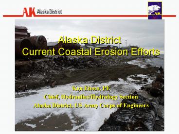
Title: Alaska District Current Coastal Erosion Efforts
1
Alaska District Current Coastal Erosion Efforts
Ken Eisses, PE Chief, Hydraulics/Hydrology
Section Alaska District, US Army Corps of
Engineers
2
EROSION PROTECTION SHISHMAREF, ALASKA
- Shishmaref is located on Sharichef Island, in the
Chukchi Sea, just north of the Bering Strait - In the summer of 2005, USACE constructed 230 feet
of rock revetment in front of the school property
(to combat the extensive erosion
3
Shishmaref Teachers Quarters July 2004 (looking
east)
- Approximately 30 feet of shoreline in front of
the teachers quarters.
NOTE THE LOCATION OF THIS STAIRCASE IN THE
UPCOMING PHOTOS
4
Shishmaref Teachers Quarters October 2004
(looking west)
STAIRCASE
5
USACE Revetment October 2005Shishmaref Teachers
Quarters (looking west)
6
USACE Revetment October 2005(looking west)
7
USACE Revetment October 2005(looking east)
8
THERMISTOR STRINGS
THERMISTOR STRING USACE REVETMENT
THERMISTOR STRING GABION REVETMENT
- Thermistor strings have been placed in both the
USACE revetment and the gabion revetment to
gather data about the interaction of the
revetment with the in-situ material and how that
corresponds to temperature. - Data for the gabion revetment is not yet available
9
Rock Revetment Thermistor Locations
1
2
Thermistor 16-11 may have been effected by water
inflitration Thermistors 1-4 are above
ground Thermistors 5-10 have been consistent
3
5
4
9
8
6
7
10
11
12
16
13
14
15
10
October 2005
January 2007
11
Thermistors
- Data spans from October of 2005 until January of
2007 - The ground is staying relatively cool
- Maximum temperature is approximately 9C (48 F)
- This warming is happens for a fairly small period
of time (summer months) - Minimum temperature is approximately -15C (5 F)
- Over time we hope to see cooling trends continue
and the entire graph begin to shift downward.
12
Future USACE Work at Shishmaref
EXISTING PROTECTION
FUTURE CONSTRUCTION
FUTURE CONSTRUCTION
USACE PROPOSED REVETMENT (300)
13
Barter Island Gravel Bag Revetment
- Protects existing Air Force Radar Site landfill
from wave induced erosion - Temporary solution until Radar Site landfill is
removed as planned - Design wave Hs 7.8 T 5.2 sec based on
50-year wind data for the airport. Wave height
likely depth limited, however no offshore
bathymetry was obtained
14
Barter IslandGravel Bag Revetment looking west
- Bags are 2 CY capacity filled to 80
- Bag dimensions 9 x 3.5 x 2.5
- Revetment crest elevation 21 MLLW
- Side slope 2H1V
- Bag overlap of 60
- Project length 215 lineal feet
15
Barter IslandStorm from NW, 4 to 6 waves
- Project constructed in 2000 by the Air Force
- Local gravel source used for filling bags
- Bags filled with forklift and loader, placed with
an excavator and sling - Filter fabric placed by hand
16
Bluff 1995
Bluff 2000
2 Cy Sand Bag Revetment Constructed 1999
Bluff 2005
Barter Island Landfill Erosion Protection
Barter Island, July 2003
17
Nome SeawallRock Revetment
- Project constructed in 1951 by the Corps
- Project length approximately 3,350 lineal feet
18
Nome SeawallRock Revetment looking east
- Class A Armor stone approximately 8 Ton
- Sea-side side slope 2H1V
19
KotzebueGravel Filled Barrel Revetment Plan
- Project constructed in the summers of 1978 and
1979 by the Corps - Local source of empty 55-gallon fuel barrels and
gravel
20
Kotzebue Gravel Filled Barrel Revetment
Construction
- Performance was initially acceptable
- Wave driven ice flow damage occurred at the
seaward end of the structure - Gravel retention not 100 without concrete cap
- Corrosion of barrels has occurred
21
Barrow Shore Protection Ice Study
- Deirdre Ginter
- Kenneth Eisses
- Alaska District
- Dr. Steven F. Daly
- Leonard Zabilansky
- Dr. Jon Zufelt
- Kevin Bjella
- USACE ERDC/CRREL
22
Barrow Shore Protection Background
- AK District has proposed coastal protection
structures at Barrow, AK to protect the shoreline
from open-water wave action - Constructed of 8 ton armor stone with specified
geometry
23
Ice Shoves at Barrow, Ivus
- Ice shoves originating from the Arctic Ocean have
long been observed to occur along the shoreline
at Barrow, Alaska. - The objective of the model tests is to assess the
integrity of the proposed structures under the
impact of the ice shoves by determining the
stability of the stones.
Known Dates
- July 22 1892
- 1913
- 1919
- Jun-43
- 1953
- 1960
- 1961
- 1968
- 1970
- 1975
- Jul-75
- Jun-76
- 19-Oct-78
- Jan. 2 1978
- 1978
- Jun-01
- Dec-06
- Jan. 26, 2006
- Dec. 2006
24
Ice Shoves Around the US
Green Bay, WI
Buffalo NY Harbor Breakwater
25
Laboratory Tests Guidance on Design of Rip Rap
Structures (Sodhi et al, 1996, 1999)
26
TEST SERIES
- Four tests are planned
- Generic dike section developed by Alaska District
- Impact on stones by ice
- Questions water level, sand condition (frozen,
unfrozen), toe details, etc
27
Kodiak Breakwater Construction Option
28
(No Transcript)
29
- ARMOR STONE - Average stone weight 3200 lbs
- CORE-LOC - Unit size 3000 lbs
30
(No Transcript)
31
(No Transcript)
32
Expedient Shore ProtectionLocal Materials and
Geotextiles
33
Sandbag Revetment, West Dock Causeway Prudhoe
Bay, Alaska
Photo courtesy of BP Exploration (Alaska), Inc
34
Sand Bag Revetment Projects in Alaska
Proposed
35
Northslope Revetment Design
2-4 Cubic Yard Sand Bags (50 Overlap)
1
Extra Layer For Toe Protection
3
Sand/Gravel Fill
Natural Shoreline
Filter Fabric
36
European Sandbag Revetment Design
1 Cubic Yard Sand Bags (ltlt 50 Overlap)
1
1.5
Sand/Gravel Fill
Natural Shoreline
37
Runup Coefficient 0.5 to 0.6 (3H1V) (Gadd, 1988)
Stability Kd 3.0 (3H1V 50 Overlap) (Gadd,
1988)
Reflection Coefficient 0.5 to 0.7 (1H1V
) (Oumeraci, 2002)
Extra Bag Layer for Toe Scour (Liedersdorf, 2006)
1
3
Sand/Gravel Fill
Bag Filling Ratio 80 (Oumeraci, 2002)
Extra Layer for Ice Scour
Max 3H1V (Gadd, 1988)
Available Design Information
38
Advantages to Sandbag Revetments
- Lower cost (not necessarily Low Cost)
- Materials can be transported by airplane
- Utilize local construction equipment
- Simple construction no specialized equipment
39
Disadvantages to Sandbag Revetments
- Lack of design guidance
- Data and knowledge base is proprietary
- Semi-permanent revetments REQUIRE annual
maintenance - Susceptible to vandalism, ice and woody debris
punctures - Durable engineered sandbags are expensive (100
each)
40
2007 COE Hydraulic Model Study
- Objectives
- Confirm Sandbag Stability (Kd3.0)
- Evaluate different sand bag aspect ratios 11,
12 13 (length to width sewn flat) - Qualitative Toe Scour Observations
- Compare European vs Northslope Designs
Photo Courtesy of Pioneer Resources
41
Long-Term Alaska Wind, Wave and Surge Climatology
- Purchased continuous wind/ pressure and ice
fields from 1985 through 2005 - Future plans to run WAM cycle 4.5 with multiple
nested loops
42
Extreme Storm Event Analysis Domains
- Storm surge generation using ADCIRC using
approximately 90 storm events - If funds become available point source
measurements will be taken to verify model
results
43
Questions?
Recommended
CrystalGraphics Presentations


