
Using Maps and Globes - PowerPoint PPT Presentation
Title:
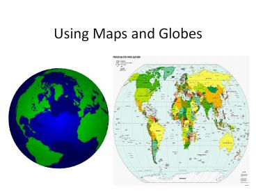
Using Maps and Globes
Description:
Using Maps and Globes Elements of Maps and Globes Title Symbols Labels Color Latitude Lines Longitude Line Compass Rose Scale Legend or key Locator Globe Title ... – PowerPoint PPT presentation
Number of Views:654
Avg rating:3.0/5.0
Title: Using Maps and Globes
1
Using Maps and Globes
2
Elements of Maps and Globes
- Title
- Symbols
- Labels
- Color
- Latitude Lines
- Longitude Line
- Compass Rose
- Scale
- Legend or key
- Locator Globe
3
Title
4
Symbols
5
Labels
6
Color
7
Latitude and Longitude Lines
8
Compass Rose
9
Scale
10
Key or Legend
11
Globe Locator
12
Hemispheres
- Geographers use a system of an imaginary lines
that crisscross the globe. - The equator circles the middle of the earth like
a belt from East to West. Dividing it into two
half spheres, the Northern and Southern
Hemispheres. - The Prime Meridian circles the earth from North
to South. Dividing it into two half spheres, the
Eastern and Western Hemispheres.
13
(No Transcript)
14
(No Transcript)
15
Understanding Latitude and Longitude
- Lines on globes and maps provide information that
can help us locate places on the Earth.
16
Latitude or Parallels
- Circle the earth parallel to the equator.
- This measures distance north or south of the
equator in degrees. - The equator is zero degrees latitude.
- The North Pole is 90N
17
Longitude or Meridians
- Circle the Earth from pole to pole.
- This measures distance from east or west of the
prime meridian. - The prime meridian is zero degrees longitude.
18
Absolute Location
- The grid system formed by lines of latitude and
longitude makes it possible to find an absolute
location of a place.