
Cartography PowerPoint PPT Presentations
All Time
Recommended

Cartographie de lInformation, Cartographie Gographique, Web 2'0 et si lon brassait les cartes
| PowerPoint PPT presentation | free to view

FANTASIA: The Musical Maps Project. Objectives and Methodology. Coding System ... FANTASIA: The Musical Maps Project. The journey so far . Musical Maps ...
| PowerPoint PPT presentation | free to view

Cartography has seen dramatic technological changes in the ... Land-Form PANORAMA Contour (1:50,000, NTF or DXF) Land-Form PANORAMA DTM (1:50,000, NTF or DXF) ...
| PowerPoint PPT presentation | free to view

Cartographie Quelques types de projections Projections sur un plan Projections sur un cylindre Projections sur un c ne Dans chaque cas, la surface de projection peut ...
| PowerPoint PPT presentation | free to download
They also conduct map research and ... Tools of Cartography. Salary ... The way that cartography applies to the park, is that next year we'll be mapping ...
| PowerPoint PPT presentation | free to download

Information comes from aerial photography, using survey ... Hydrography. rivers. streams. lakes. coastline. Vegetation. mangroves. forest. Culture. roads ...
| PowerPoint PPT presentation | free to view
Cartographie d un r seau d experts Visualisation de l information dans ISICIL Les veilleurs font-ils de la science sans le savoir ? Veille Recherche ?
| PowerPoint PPT presentation | free to download

ph notypes contrast s qui permettent d' valuer les effets g n tiques pour les locus impliqu s dans l'expression des caract res d'int r t agronomique ...
| PowerPoint PPT presentation | free to view

United Nations Regional Workshop on Census Cartography and Management ... Field work mapping EA maps in digital format Dissemination maps ...
| PowerPoint PPT presentation | free to download

Cartography 101 The art and science of map making. World Map Mercator Projection How is this map unique? Why? What is different about this map?
| PowerPoint PPT presentation | free to view
Cartographie des processus ...
| PowerPoint PPT presentation | free to download

Come with Maps and some Data. Spreadsheets, Statistical ... 5 - Can easily overlay and visually compare Geocoded maps to one another. Advantages (cont. ...
| PowerPoint PPT presentation | free to view
At the simplest, they offer a means of keeping and updating maps and diagrams of a work area. ... We record the 6000 data points in raw form in a spreadsheet, ...
| PowerPoint PPT presentation | free to download

Universal Transverse Mercator (UTM)Projection. zone, easting, northing, altitude ... The same lat/long/alt numbers in two different datums refer to two different ...
| PowerPoint PPT presentation | free to view
8 minutes ago - DOWNLOAD HERE : .softebook.net/show/1426219725 PDF/READ All Over the Map: A Cartographic Odyssey | Created for map lovers by map lovers, this rich book explores the intriguing stories behind maps across history and illuminates how the art of cartography thrives today. In this visually stunning book, award-winning journalists Betsy Mason and Greg Miller--authors of the National Geographic cartography blog "All Over the Map"--explore the int
| PowerPoint PPT presentation | free to download

seldom used for Cartography. Vector: Computer Aided Drafting (CAD) ... over Hand Cartography. 1 - Easy to Modify existing digital base maps to create new maps ...
| PowerPoint PPT presentation | free to view

PROCESSUS - ISO 9000 :2000 :
| PowerPoint PPT presentation | free to download
Joint ICA Seminar, Madrid, 6-8 July 2005. ... different dictionaries, handbooks, encyclopedias (e.g. Microsoft Bookshelf, 1987) ...
| PowerPoint PPT presentation | free to download

The History of Cartography
| PowerPoint PPT presentation | free to view

Introduction to Cartography Maps vs. Globes General Types of Maps Standard Map Features Map Projections GIS GPS Remote Sensing Representation in Maps or How to Lie ...
| PowerPoint PPT presentation | free to view

De la cartographie dynamique l interop rabilit de service le portail InfoTerre du BRGM Jean Marc Trouillard
| PowerPoint PPT presentation | free to download
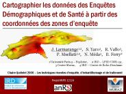
Cartographier les donn es des Enqu tes D mographiques et de Sant partir des coordonn es des zones d enqu te J. Larmarange1,2, S. Yaro3, R. Vallo3,
| PowerPoint PPT presentation | free to download

The Global Electronic Cartography System Market witnessed a rapid growth in the historic period from 2016 to 2019 and is anticipated to witness significant growth during the forecast period.
| PowerPoint PPT presentation | free to download
Every land parcel (LOT) on the island would be uniquely identified and digitally ... number, the Land Survey (LS) Number, and via a lot shown on the digital ...
| PowerPoint PPT presentation | free to download

The World through Maps: A History of Cartography (2003) ... Cartography is the making and study of maps in all their aspects. Cartography is an efficient way of ...
| PowerPoint PPT presentation | free to view

'The art, science & technology of making maps, together with the study as ... Development of Maps. National Censuses & Resources ...
| PowerPoint PPT presentation | free to view

Dynamic Links eye dropper tool. Printing and Exporting Options. Questions to ask ... http://www.amazon.co.uk/Designing-Better-Maps-Guide-Users/dp/1589480899 ...
| PowerPoint PPT presentation | free to view

Electronic Cartography Market by Application, Components (Systems, Charts), Marine Electronic Navigation Systems (ECDIS, ECS), Aviation Electronic Navigation Systems, Marine Electronic Charts Licensing Mode & Geography. http://www.marketsandmarkets.com/Market-Reports/electronic-cartographic-marine-market-227404996.html
| PowerPoint PPT presentation | free to download

Le programme de cessions est arr t annuellement apr s consultation des services locaux (Pr fets, services locaux du Domaine, services gestionnaires) ...
| PowerPoint PPT presentation | free to view

Hydrography. Elevation. Roads and Railroads. Cadastral ... Hydrography / Hydrology / drainage network/ River and lake basins. Hydrogeology. Coastlines ...
| PowerPoint PPT presentation | free to download

History of Cartography. Earliest Maps. Predate writing (ca 4000s BCE) Seemingly of the stars, not the world. Babylonian Map Making ...
| PowerPoint PPT presentation | free to view

Courbes de r ponse des 4 canaux du capteur ' v g tation ' embarqu bord des ... 4 et 5, ainsi que des courbes typiques de r ponses spectrales de la v g tation et d'un sol nu. ...
| PowerPoint PPT presentation | free to view

Analytical and Computer Cartography
| PowerPoint PPT presentation | free to view

A drawing or other representation of the earth's surface or a part of it made on ... Portolan Map of the Mediterranean, 1559 (Majorca) ...
| PowerPoint PPT presentation | free to view

Cartographier les controverses
| PowerPoint PPT presentation | free to view

Topo map from USGS. City maps. AAA map. Mapquest.com. Thematic map. Maps showing spatial distribution of one or more variables. ...
| PowerPoint PPT presentation | free to view

Cartography === Spatial Information. Transition in technology. Current. technology. Experimental ... LESS experienced. users. More. MORE experienced. users ...
| PowerPoint PPT presentation | free to view

History of Cartography/GIS 1.2 Historical Foundations Evidence of early maps: Babylonians- earth as flat circular disk on clay tablets Pre-Columbian maps in MX ...
| PowerPoint PPT presentation | free to view
Geography 360 Principles of Cartography May 15~17, 2006 Outlines: Isarithmic map Two kinds of isarithmic map Isometric map from the true point data (continuous fields ...
| PowerPoint PPT presentation | free to download

Cartographic Abstraction. The production of a map requires ... A small scale map shows only large features, fraction is small, e.g., 1/1,000,000 ...
| PowerPoint PPT presentation | free to view

Atelier Cartographie des risques Retour d Exp rience du Groupe Al Omrane Projet Management des Risques Said EL BOUKHARI, Directeur de l Audit et du Risk Management
| PowerPoint PPT presentation | free to view

Cartography, Map Production and GeoVisualization Geog 176B Lecture 10: Longley Chapters 12,13 Visual Variables: Bertin Map Types: Point Data Reference Topographic Dot ...
| PowerPoint PPT presentation | free to download

Started in 1978. Now composed of at least 24 satellites ... 12 hour orbit. Sends signals at two wavelengths, L1 and L2 to compensate for ionospheric error. ...
| PowerPoint PPT presentation | free to view
Title: Aucun titre de diapositive Author: Isambert Aur lie Last modified by: sofy Created Date: 5/27/2003 12:56:56 PM Document presentation format
| PowerPoint PPT presentation | free to download

Understanding the way maps are encoded to be used in GIS requires knowledge of cartography. ... A GIS is scaleless because maps can be enlarged and reduced and ...
| PowerPoint PPT presentation | free to view

Cartography, Map Production and GeoVisualization. Geog 176B ... 2.75D Anaglyphic stereo. Map Types: Time. Multiple views. Animation. Moving map. Fly thru ...
| PowerPoint PPT presentation | free to download

In the last three censuses Kenya has been able to carry out cartographic census ... to culminate into a fully fledged Kenya Census Geographic Information System ...
| PowerPoint PPT presentation | free to download

If you make the same kind of map over and over again you can save your ... Don't over do it with symbology. Legend. Descriptive title. Projection information ...
| PowerPoint PPT presentation | free to view

Include a table in a layout (improved) PDF file new layer capabilities ... Convert existing symbology to rules. Build new representation rules ...
| PowerPoint PPT presentation | free to view
Data structure for representation stored in the computer. Three commonly ... Grid (most of time considered equivalent to DEM) Phenomenon, data, map ... photogrammetry ...
| PowerPoint PPT presentation | free to download

GIS's Roots in Cartography. Getting Started With ... Cartography and GIS ... Cartography is the science that deals with the construction, use, and principles ...
| PowerPoint PPT presentation | free to view

Module: Cartography and Geovisualization By: Omirzhan Taukebayev o.taukebaev@gmail.com Department of Cartography and Geoinformatics Al-Farabi Kazakh National University
| PowerPoint PPT presentation | free to view

Leonardo da Vinci. The Virgin of the Rocks. Leonardo da Vinci. The Last Supper. Raphael of Urbino. Marriage of the Virgin. Ansidei Madonna ...
| PowerPoint PPT presentation | free to view

IETR/GIT : Institut d'Electronique et de T l communication de Rennes- groupe Image et T l d tection ... ARIANA (processus ponctuels marqu s, contours actifs) ...
| PowerPoint PPT presentation | free to view

For example, It is two blocks from the E-5? ... Everyone is an amateur cartographer. However, this class will help you on the way to be a professional cartographer ...
| PowerPoint PPT presentation | free to view

... Objets mobiles dans la sc ne Auto-calibrage pour la St r o L'algorithme du Partage F d ratif de l Information (PFI) ...
| PowerPoint PPT presentation | free to download