
Mississippi River PowerPoint PPT Presentations
All Time
Recommended

Mississippi River NMGK-8 Program What do you know about the Mississippi River? Who was the first European to explore the Mississippi River? In what year did he first ...
| PowerPoint PPT presentation | free to view

The largest in North America, and among the largest in the world. ... It is an angiosperm from the pineapple family. ????? ????? ????? ??? ?????? ...
| PowerPoint PPT presentation | free to view

The Mississippi River Old Man River Background By 1800 1 million people lived between the Appalachian Mts. and the Mississippi River Most were farmers Grain Wheat ...
| PowerPoint PPT presentation | free to download

eagle. WILDLIFE(PG2) fox. duck. eagles. Wildlife(PG3) FISHERY. dinner. PICTURES. FUNNY PHOTOS. WHAT'STHAT! THE END. BY KATIE AND GEORGE ...
| PowerPoint PPT presentation | free to view
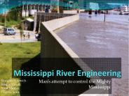
Mississippi River Engineering. Man s attempt to control the Mighty Mississippi. Brandon Horwich. Megan Ginelli. Scott Murray. DeserieSoliz
| PowerPoint PPT presentation | free to download
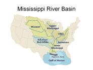
Mississippi River Basin NC River Basins Map Water Resources Aquifer Depletion NOAA: Water Cycle Water Cycle The Water Cycle The water moving along the outside of a ...
| PowerPoint PPT presentation | free to download

The Mississippi River starts at Lake Itasca and empties into the Gulf of Mexico ... they were helped by a she-wolf on Palatine Hill, where Rome was established. ...
| PowerPoint PPT presentation | free to view

Goals: provide secure resting and feeding areas for waterfowl; enhance hunting ... Provide equitable hunting experience. Admin changes made in 2006 ...
| PowerPoint PPT presentation | free to view

Since 1948 there have been striking changes in many meteorological variables. ... Dimming has led some researchers to deduce that evapotranspiration ET may have ...
| PowerPoint PPT presentation | free to view

Wisconsin Mississippi River Parkway Commission The Great River Road Corridor
| PowerPoint PPT presentation | free to download

upper mississippi river source water protection project ...
| PowerPoint PPT presentation | free to download

Current Vision, Mission, Objectives and Goals of the National MRPC ... Facilitate the development of highways and amenities along the ... funds expired. ...
| PowerPoint PPT presentation | free to download

New Mississippi River Bridge Project Overview
| PowerPoint PPT presentation | free to view

Mississippi River Water Quality: Implications for Freshwater Diversions
| PowerPoint PPT presentation | free to download

ROCK ISLAND DISTRICT Mississippi River Maintenance Spare Miter Gates Mississippi River Project Location Map / Field Sites Mississippi River Project Office Location ...
| PowerPoint PPT presentation | free to view

New Mississippi River Bridge Expert Panel Meeting
| PowerPoint PPT presentation | free to view

Flooding in the Upper Mississippi Basin began in early June and continued through mid August ... Missouri, Kansas, Illinois, Des Moines and Wisconsin Rivers, flooded ...
| PowerPoint PPT presentation | free to view

Wonders of the Water: Thematic Learning with the Mississippi River Heath E. Capello University of Mississippi January 27, 2006 So you have Questions
| PowerPoint PPT presentation | free to view

Just to its right is the older 10th Avenue Bridge, and at the far right is the ... US Army Corps of Engineers lowered rivel level 2 ft downriver at Fort Dam to ...
| PowerPoint PPT presentation | free to view

Upper Mississippi River Locks and Dams
| PowerPoint PPT presentation | free to download

New York, Pennsylvania, West Virginia, Kentucky, Tennessee, Virginia, North Carolina, South Carolina, Georgia, Alabama, Mississippi ...
| PowerPoint PPT presentation | free to view

Sediment-laden Mississippi River water spreading over clear Gulf of Mexico water ... of Mt. Pinitubo (Phillipines) spreads west on trade winds across Indiana Ocean ...
| PowerPoint PPT presentation | free to view

Ecohydraulics in the Mississippi River: Freshwater Mussels Modeling Joseph A. Daraio Larry J. Weber IIHR Hydroscience and Engineering Teresa Newton
| PowerPoint PPT presentation | free to view

The Problem Surges from Hurricanes. Sea, Lake, and Overland Surge Heights ... Hurricanes can cause the Mississippi River to rise rapidly due to Storm Surge ...
| PowerPoint PPT presentation | free to view

... 33 3f3f33ff3f 3f3f 3 3 33 f3 3 3 3333f3 33 3 3 33 f3 3 3 ff3fff ff ... f 3f ff f f 3 f 3 33 3f 3 3 3 f f3 ff f f f 3 f 3 f ...
| PowerPoint PPT presentation | free to view

UPPER MISSISSIPPI RIVER FOREST PARTNERSHIP ORGANIZATION CHART ... ST. PAUL FIELD OFFICE WORKING GROUP. TECHNICAL TEAM. FEDERAL, STATE, and. NONGOVERNMENTAL ...
| PowerPoint PPT presentation | free to download

Synopsis of on-going work. Upper Midwest Environmental Sciences Center ... NWHC lead. Upper Midwest Environmental Sciences Center. Prevalence of Infection. Overall ...
| PowerPoint PPT presentation | free to view

Exotic Species Threat to the Mississippi River Basin
| PowerPoint PPT presentation | free to view

Nicknamed Ol’ Man River, the Mississippi got its name from the Native American Ojibwe words meaning ‘Great River’ and rightly so. The largest river system in North America, the Mississippi flows through 10 states and is the world’s fourth longest river.
| PowerPoint PPT presentation | free to download

... 11th It also should be pointed out that there exists a difference in sampling depths between the optical and L-band sensors. ... Root Mean Squared ... zone of the ...
| PowerPoint PPT presentation | free to download

The Upper Mississippi River Basin Congressional Task Force. Ben Proctor. Legislative Assistant ... Constituents and regional, political, and personal interests ...
| PowerPoint PPT presentation | free to view

Hypoxia, Water Quality, and LandUse in the Mississippi River Watershed
| PowerPoint PPT presentation | free to view

Biophysical Control of Nitrogen Cycling in the Upper Mississippi River
| PowerPoint PPT presentation | free to download

The Long Term Ecological Research (LTER) Network is a collaborative effort ... scientists and students investigating ecological processes over long temporal ...
| PowerPoint PPT presentation | free to view

Gulf of Mexico Hypoxia and Mississippi River Basin Nutrient Losses
| PowerPoint PPT presentation | free to view

'Hypoxia in the Northern Gulf of Mexico is caused primarily by excess N ... Riparian Forest Buffers. Fertilizer Management. Farm N Management. Reducing. Nutrient ...
| PowerPoint PPT presentation | free to download

CE 397 Statistics of Water Resources Yao You Key Points Sediment concentration to water discharge ratio decreases downstream; Sediment concentration does not reach ...
| PowerPoint PPT presentation | free to download

Steve Morse, Senior Fellow, Minnesota Institute for Sustainable Agriculture ... migratory waterfowl and neo-tropical songbird populations at the watershed level ...
| PowerPoint PPT presentation | free to view

The Mississippi and Nile Rivers are two of the most powerful natural wonders of the world. The Nile is the longest river in the world, located in northwest Africa. ...
| PowerPoint PPT presentation | free to view

Reason: Balize delta thicker at approximately 100-120 meters. Other lobes ... Cause: Balize delta has built up so much that it now requires more energy for ...
| PowerPoint PPT presentation | free to view

Census Data on the Interior Least Tern (Sterna antillarum athalassos) Lower Mississippi River Valley 1985-2003 Census Techniques Aerial (discontinued in 1998) Towboat ...
| PowerPoint PPT presentation | free to download

Visions of a Sustainable Mississippi River. Matt Rota. August 11, ... Clint Guidry. Potential ecological 'Regime Shift' The Dead Zone. History of the Dead Zone ...
| PowerPoint PPT presentation | free to view

Hypoxia, Water Quality, and LandUse in the Mississippi River Watershed
| PowerPoint PPT presentation | free to view

... by clicking your mouse. ... is a cue to click your mouse, when you are ready, to proceed ... entering 'Mississippi River' in the Search Station Name field. ...
| PowerPoint PPT presentation | free to view

... Higgins eye pearlymussel. COE, 2004. Lures to entice host fish species 'Free Lunch' Lampsilis reeveiana. Chris Barnhart, SMSU ...
| PowerPoint PPT presentation | free to view

Image courtesy of NASA/GSFC. Potential Climate Change Impacts on Flow and Water ... Fugitive nitrates and sediment from the landscape are both carried by overland ...
| PowerPoint PPT presentation | free to view

SPARROW modeling approach: ... SPARROW SPAtially Referenced Regressions On ... SPARROW Modeling in the Mississippi and Great Lakes Basins. Captain Jack Sparrow ...
| PowerPoint PPT presentation | free to view

Opportunities for Collaboration on Water- Quality Issues in the ... Lock & Dam. Management. Diversions to. Coastal Wetlands. Davis Pond Diversion Structure ...
| PowerPoint PPT presentation | free to download

Optical Ages Spanning Two GlacialInterglacial Cycles from Deposits of the Ancient Mississippi River,
| PowerPoint PPT presentation | free to download

Simulation of stream discharge and transport of nitrate and selected herbicides ... One-dimensional, unsteady discharge. Calibration to WY 1996 hydrographs ...
| PowerPoint PPT presentation | free to view

Longer-Term Forecasting of Commodity Flows on the Mississippi River: Application to Grains and World Trade Project report to the ACE Penultimate for discussion and ...
| PowerPoint PPT presentation | free to view

(mm/yr) Period. Source. Subsidence Mechanisms. Penland & Ramsey, 1990; Roberts et al., 1994; ... 5 mm/yr. Compaction Holocene sediments. Morton et al., 2006; ...
| PowerPoint PPT presentation | free to view

... Strickland River System in Papua New Guinea has been profoundly influenced by ... SOME CALCULATIONS APPLIED TO THE FLY-STRICKLAND RIVER SYSTEM, PAPUA NEW GUINEA ...
| PowerPoint PPT presentation | free to download

Some browsers and monitors will distort the text image of this presentation. ... Literature sources (Moody, 1995; Pereira et al., 1995; Coupe et al., 1995) ...
| PowerPoint PPT presentation | free to view

Department of Civil & Environmental Engineering. Dr. Chunyan Li ... 'Traditional' Civil and Coastal Engineering. Oceanography and Coastal Sciences ...
| PowerPoint PPT presentation | free to view

Earth Scan Laboratory Satellite Surveillance of Mississippi River Diversions and Gulf of Mexico Nan
| PowerPoint PPT presentation | free to view