
Stream Channels in Watersheds - PowerPoint PPT Presentation
1 / 54
Title:
Stream Channels in Watersheds
Description:
Problems of habitat (previous lecture and lab exercise) and water quality ... D. Rosgen, Applied River Morphology, Wildland Hydrology, 1996 ... – PowerPoint PPT presentation
Number of Views:81
Avg rating:3.0/5.0
Title: Stream Channels in Watersheds
1
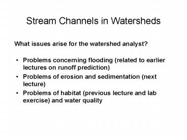
Stream Channels in Watersheds
What issues arise for the watershed analyst?
- Problems concerning flooding (related to earlier
lectures on runoff prediction) - Problems of erosion and sedimentation (next
lecture) - Problems of habitat (previous lecture and lab
exercise) and water quality
2
Problems concerning flooding
- Is the channel conveyance capacity being
overtaxed too frequently, especially in reaches
where it decreases rapidly? - Lower reaches of creeks running through Santa
Barbara, leading from debris-flow fans to coastal
plain and lagoons. - Where there is some constriction, natural or
engineered (mouth of Mission Creek). - Where the runoff potential (CN) of the upper
watershed has been increased by urbanization
(Honolulu, Barcelona), logging (Oregon,
Freshwater Creek, CA), etc. - Question of whether to control, convey, or adjust
to flooding.
3
Problems of erosion and sedimentation
- Where there is a high turbidity problem.
- Where larger amounts of sediment are being
supplied than the stream can transport through a
reach, leading to aggradation and/or bar
formation. - Where aggradation and bar formation increase
channel movement (instability). - Where reduction of sediment supply or increase of
streamflow leads to bed scour. - Conversions of channel morphology (widening, pool
filling) and bed state (sediment infilling,
embedding, armoring, scour). - Management of the harvesting of bed material.
4
Problems of habitat and water quality
- High water temperatures (low flow and low shade,
aggravated by channel widening) - High dissolved contaminant concentration or low
dissolved oxygen - Separation of channel from floodplain (diking,
incision) - Low organic debris loading, leading to scouring
of sediment and channel simplification
5
River channels
- Concentrations of flow and sediment transport
between distinct banks - Concentration of flow increases the efficiency of
sediment transport and therefore the tendency for
the flow to scour its bed to create the channel,
or extend it headward - Discontinuous channels (gullies)
6
Channels are formed by runoff processes
- Infiltration excess (Horton) overland flow
causing concentrated shearing of surface and
sediment transport - Deep percolation and exfiltration of groundwater
causing seepage erosion - Shallow subsurface flow (interflow, throughflow)
causing landslides and scouring by debris flows - Saturation excess overland flow causing slow,
concentrated shearing and sediment transport - Subsurface flow through fractured, dispersible
soils causing tunnel erosion
7
Channels formed through convergence of
HOF/sheetwash
8
Channel formation by seepage erosion due to deep
groundwater flow
9
Channel formation by landsliding and debris-flow
scour triggered by interflow
10
Channel formation by tunnel erosion, Central
California coast
11
Discontinuous gully, Sierra Nevada meadow.
Continuous gully, breached through cattle grazing
pressure
12
River channel networks
- As channels extend upstream or downstream, they
coalesce, in more-or-less random patterns, to
form networks - Therefore drainage area, flow, and sediment
discharge increase downstream
13
Drainage network structure - vocabulary
(Strahler order) - arithmetic
(magnitude)From J. Mount, California Rivers
and Streams, UC Press, 1995
14
General pattern of channel morphology in
networks Caveat there are many variations
imposed by tectonics and glacial history, but .
15
Upland zone High sedimentsupply and low
storage.Alluvial transport zone sediment
transport rate sediment supply rate.
Significant transient sediment storage in valley
floors and tributary fans. Multi-threaded
channels in upper, steeper reaches
single-thread, meandering channels on lower
gradients. Free alluvial landforms.Alluvial
accumulation zone sediment transport capacity
decreasing downstream floodplain
aggrading.Outlet fans deltas, estuaries.
Length scale Amazon to Atascadero. Depends on
plate tectonics,. Again and always! ESM 203
16
Network context of river channel characteristics
- Upstream bed and banks may consist of bedrock
- Further downstream, banks may consist of sediment
(alluvium, adjustable by the river) while bed is
rocky - Further downstream, progression to deeper
alluvium beneath and along channel margins, so
that channel is molded in its own alluvium by the
river flow
17
Bedrock channelsSierra Nevada
Bolivian Andes
18
(No Transcript)
19
(No Transcript)
20
(No Transcript)
21
(No Transcript)
22
(No Transcript)
23
Network context of river channel characteristics
- Upstream bed and banks may consist of bedrock
- Further downstream, banks may consist of sediment
(alluvium, adjustable by the river) while bed is
rocky - Further downstream, progression to deeper
alluvium beneath and along channel margins, so
that channel is molded in its own alluvium by the
river flow - Not a universal generalization
- e.g alternation of alluvial and bedrock reaches
through bands of softer and harder rock in
Transverse Ranges - some Oregon Coast Range rivers (e.g Siuslaw) are
sediment-starved and flowing on bedrock near the
ocean, while rivers that cut through the OCR
(e.g. Umquah) bring higher loads of harder gravel
from glaciated Cascades to coast, and are
sediment-rich.
24
Upland Zone
- High sediment supply (steep undercut hillslopes)
- Low valley-floor storage (steep, narrow channels
and valleys) - But not all mountain ranges are now eroding
rapidly e.g. In N and central Sierra Nevada
hillslopes scraped to bedrock by glaciers and
debris flows
25
Upland Zone
- Channels on bedrock or thin alluvial cover
- Ephemeral sediment stores, --- gravel bars and
fans supplied by episodic mass wasting, and
stabilized partly by large woody debris and
rooted trees - Importance of Large Woody Debris depends on
regional ecology (production and types of woody
spp., channel size and gradient --- compare PNW
with S. Is. NZ with steeper channels, wetter
climate, and weaker trees) - Where channels are formed in alluvium, their
morphology (pools, bars, bends) is forced by
LWD and bedrock constraints
26
Alluvial ZoneGeneral principle of fluvial
geomorphologyRiver channel morphology and
behavior are controlled by
- The probability distribution of flows (often said
to be represented by a dominant discharge) - The magnitude and texture of sediment supply
(including organic debris). Linkage to the basin
sediment budget (see earlier lecture notes) - Nature of bank materials
- All are subject to management (conscious and
inadvertent)
27
Factors that control channel morphology and its
response to environmental change (incl. land
management)
D.R. Montgomery and J.M.Buffington, Channel
processes, classification, and response. InRiver
Ecology and Management (Eds. R.J. Naiman and R.E.
Bilby), Springer Verlag, 1998.
28
Dimensions of channels are roughly scaled by
flows and therefore drainage areaDownstream
changes of channel characteristics with bankfull
discharge, Green R. basin, WY
29
Downstream increase in bankfull channel
dimensions with drainage area for several regions
What would you expect to happen to channel
dimensions if the sizes of flood peaks are
reduced by dams or increased by water diversions
into a channel?
30
Channel classification
- Development of shorthand labels for
- rapid characterization of channels for planning
or regulation - organizing information
- making comparisons
- communicating with non-technical people
(landscape architects and river planners love
them for visualization) - transferring physical or biological information
between sites - judging response to management actions (based on
the principle that current form indicates future
behavior. Mmm!)
31
Montgomery-Buffington channel classification
scheme (derived in Pacific Northwest mountains)
D.R. Montgomery and J.M.Buffington, Channel
processes, classification, and response. In
River Ecology and Management (Eds. R.J. Naiman
and R.E. Bilby), Springer Verlag, 1998.
32
Bedrock channel
33
Colluvial channel
D.R. Montgomery and J.M.Buffington, Channel
processes, classification, and response. InRiver
Ecology and Management (Eds. R.J. Naiman and R.E.
Bilby), Springer Verlag, 1998.
34
(Boulder) Cascade
35
Step-pool channel
D.R. Montgomery and J.M.Buffington, Channel
processes, classification, and response. In
River Ecology and Management (Eds. R.J. Naiman
and R.E. Bilby), Springer Verlag, 1998.
36
Plane-bed channel
D.R. Montgomery and J.M.Buffington, Channel
processes, classification, and response. In
River Ecology and Management (Eds. R.J. Naiman
and R.E. Bilby), Springer Verlag, 1998.
37
Sediment beginning to accumulate in lateral bars
38
Pool-riffle channel
D.R. Montgomery and J.M.Buffington, Channel
processes, classification, and response. InRiver
Ecology and Management (Eds. R.J. Naiman and R.E.
Bilby), Springer Verlag, 1998.
39
Pool-riffle reach forced by woody debris LWD
D.R. Montgomery and J.M.Buffington, Channel
processes, classification, and response. InRiver
Ecology and Management (Eds. R.J. Naiman and R.E.
Bilby), Springer Verlag, 1998.
40
Dune-ripple channel
D.R. Montgomery and J.M.Buffington, Channel
processes, classification, and response. InRiver
Ecology and Management (Eds. R.J. Naiman and R.E.
Bilby), Springer Verlag, 1998.
41
Bed profiles of channel types
D.R. Montgomery and J.M.Buffington, Channel
processes, classification, and response. In
River Ecology and Management (Eds. R.J. Naiman
and R.E. Bilby), Springer Verlag, 1998.
42
D.R. Montgomery and J.M.Buffington, Channel
processes, classification, and response. In
River Ecology and Management (Eds. R.J. Naiman
and R.E. Bilby), Springer Verlag, 1998.
43
(No Transcript)
44
(No Transcript)
45
Distribution of channel classes in a watershed
D.R. Montgomery and J.M.Buffington, Channel
processes, classification, and response. In
River Ecology and Management (Eds. R.J. Naiman
and R.E. Bilby), Springer Verlag, 1998.
46
Effects of rare debris flows on channels
47
Effects of debris flows and LWD
48
Rosgen Stream Classification Scheme1996
- Predict a river's behavior from its appearance
- Develop specific hydraulic and sediment
relationships for a given stream type and its
state - Provide a mechanism to extrapolate site-specific
data to stream reaches having similar
characteristics and - Provide a consistent frame of reference for
communicating stream morphology and condition
among a variety of disciplines
49
Rosgens Hierarchical System
Level 1 Geomorphic Characterization Level 2
Morphological Description Level 3 Stream
Condition Level 4 Validation and Monitoring
- Level 1 includes
- Number of channels
- Bank-full depth and width
- Entrenchment ratio
- Width/depth ratio
- Sinuosity
- Slope
- Channel material
50
Hierarchical System
- Level 1 includes
- Number of channels
- Bank-full depth and width
- Entrenchment ratio
- Width/depth ratio
- Sinuosity
- Slope
- Channel material
51
(No Transcript)
52
Rosgen channel classification scheme
D. Rosgen, Applied River Morphology, Wildland
Hydrology, 1996
53
Rosgen channel classification scheme
D. Rosgen, Applied River Morphology, Wildland
Hydrology, 1996
54
Channel classification
- Development of shorthand labels for
- rapid characterization of channels for planning
or regulation - organizing information
- making comparisons
- communicating with non-technical people
(landscape architects and river planners love
them for visualization) - transferring physical or biological information
between sites - judging response to management actions (based on
the principle that current form indicates future
behavior under restoration, for example. Mmm!)