
SINGLE-TREE FOREST INVENTORY USING LIDAR AND AERIAL IMAGES FOR 3D TREETOP POSITIONING, SPECIES RECOGNITION, HEIGHT AND CROWN WIDTH ESTIMATION - PowerPoint PPT Presentation
Title:
SINGLE-TREE FOREST INVENTORY USING LIDAR AND AERIAL IMAGES FOR 3D TREETOP POSITIONING, SPECIES RECOGNITION, HEIGHT AND CROWN WIDTH ESTIMATION
Description:
SPECIES RECOGNITION, HEIGHT AND CROWN WIDTH ESTIMATION. Ilkka Korpela. University of Helsinki ... occlusion and shading, interlaced crowns ILL-POSED ... – PowerPoint PPT presentation
Number of Views:181
Avg rating:3.0/5.0
Title: SINGLE-TREE FOREST INVENTORY USING LIDAR AND AERIAL IMAGES FOR 3D TREETOP POSITIONING, SPECIES RECOGNITION, HEIGHT AND CROWN WIDTH ESTIMATION
1
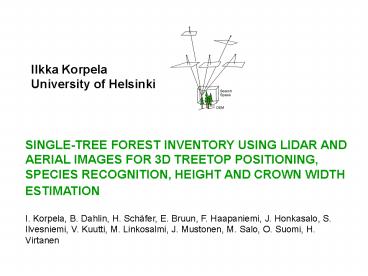
Ilkka KorpelaUniversity of Helsinki
SINGLE-TREE FOREST INVENTORY USING LIDAR AND
AERIAL IMAGES FOR 3D TREETOP POSITIONING,
SPECIES RECOGNITION, HEIGHT AND CROWN WIDTH
ESTIMATION
I. Korpela, B. Dahlin, H. Schäfer, E. Bruun, F.
Haapaniemi, J. Honkasalo, S. Ilvesniemi, V.
Kuutti, M. Linkosalmi, J. Mustonen, M. Salo, O.
Suomi, H. Virtanen
2
Contents Study objectivesMethods the STRS
systemExperimental STRS-based forest Inventory
Data, Field work, Results Conclusions
3
Study objectives Method development and testing
in Single-Tree Remote Sensing, STRS
Rationales Forest inventory, 3D models,
Landscape planning
STRS-tasks- 2D/3D positioning- Species
recognition- Height estimation- Crown
dimensions? Stem diameter, volume, bucking
4
- Single-Tree Remote Sensing, STRS - Revised
- Airborne, active and passive instruments, 2D or
3D - Direct estimation indirect an allometric
estimation phase - Restrictions tree discernibility, detectable
object size, occlusion and shading, interlaced
crowns ? ILL-POSED - Alternative or complement to field methods and
area-based methods - Accuracy restricted by allometric noise ?
tree and stand- level allometric bias, and
tree-level imprecision, dbh 10. - Measurements are subject to bias and imprecision
- Timber quality remains unsolved, only quantity
- Unsolved issues Species recognition?
5
Methods the STRS system we used
- Solves all of the STRS tasks
- Semi-automatic solutions combined with operator
intervention - Optional input 1) images DTM 2) images
LiDAR DTM - Assumptions large-scale images, semi-dense
LiDAR, accurate DTM - Combine use of images and LiDAR for optimal
results - Constrain and filter using allometric regularities
6
Methods 1 Multi-scale template matching in 3D
treetop positioning
Assume that the optical properties and the shape
of trees are invariant to their size.
7
Maxima at different scales, take global ? (X,Y,Z)
Treetop
8
Methods 2 Multi-scale Template matching Crown
width estimation in images
Near-nadir views have been found best for the
manual measurement of crown width in aerial images
9
Methods 3 Species recognition
Variation in - Phenology- Tree age and vigor-
Image-object-sun geometrygt reliable automation
problematic gt bottleneck in STRS
Spectral valuesTexture
10
Methods 4 LS-adjustment of a crown model with
LiDAR points
Assume that 1) Photogrammetric 3D treetop
position is accurate 2) Trees have no slant 3)
Crowns are rotation symmetric 4) We know tree
height and species ? approximation of crown size
and shape ? LiDAR hits are observations of
crown radius at a certain height below the
apex Assume a rather large crown and
collectLiDAR hits in the vicinity of the 3D
treetop position. Use LS-adjustment to find a
crown model.
11
LiDAR hits are observations of crown radius at a
certain height below the apex?
12
Example - a 22-m high birch Solution in six
iterations. Final RMSE 0.47 m RMSEs have been
larger for birch in comparison to pine and spruce.
13
Methods 5 Allometric estimation of stem
diameterand saw/pulp log volumes stem bucking
Species-specific regression equations that map
maximal crown width (dcrm) and tree height (h)
into dbh (Kallio virta and Tokola, 2005)
Species-specific polynomial regression equations
that model the tapering of stem diameter
(Laasasenaho 1982)
14
Experimental forest inventory STRS measurements
- 56.8-ha forest. 25-70 and 100-130-yr-old.
- CIR and PAN-RGBIR images with 12 cm and 9 cm GSD
- ALTM3100 LiDAR with 6-9 pulses per m2
- A LiDAR-based DTM
- 5294 STRS-trees in 59 0.04-ha plots. 165
trees/hour with variables - Treetop position in
XYZ - h, photogrammetric - h, LiDAR-based -
Sp, photogrammetric - dcrm, photogrammetric -
dcrm LiDAR-based
15
Experimental forest Inventory FIELD measurements
Before going to the field, process the STRS
measurements into maps and tree labels
16
Experimental forest Inventory FIELD measurements
1. Find the plot center using satellite
positioning and the tree map 2. Find and
label the STRS-trees using triangulation with
a compass (solve commission errors) 3. Label the
unseen trees in the circular 0.04-ha plot (you
are left with omission errors) 4. Position in XY
the unseen trees with trilateration and
triangulation (ref. Silva Fennica 3/07), 0.3
m. 5. Measure the trees for reference values of
Sp, dbh and height
17
RESULTS Which trees could we observe and
position?
Tree discernibility proportion () of
detected trees as a function of relative tree
height.
- Omission errors 38.8 in stem number (dbh gt 50
mm)- Commission errors 1-2- Dominating trees
were measurable, but not those with fused
crowns- Less than 50 of the trees with a
relative height of below 0.7 were detectable
18
RESULTS Visual tree species recognition
Overall Sp-recognition accuracy was 95, which
is at an acceptable level.
19
RESULTS Height estimation accuracy
Residual plot
- Multi-scale TM LiDAR DTM 0.71 m RMSE,
14-cm underestimation- Highest LiDAR hits
LiDAR DTM 0.82 m RMSE, 58-cm underestimation Ac
curacy varied between species. DTM-errors were
meaningless.
20
RESULTS DBH estimation accuracy
- Photogrammetric height, species and dcrm ?
28.7 RMSE with a 20- underestimation -
Photogrammetric height, species and LiDAR-based
dcrm ? 19.6 RMSE with a 6- underestimation
Tests were not performed, where the
dcrm-measurements had not been used.
21
RESULTS Volume estimation accuracy
With the use of images alone, an RMSE of 60 was
observed for the single-tree stem volume
estimates. By using LiDAR-based measurements of
crown width (dcrm), the RMSE was 46.
22
RESULTS Forest inventory
Omission errors ? 10 of total volume missedDBH
underestimation by 1 cm ? underest. of total and
saw wood volumeDBH-estimates were averaged ?
skew in saw/pulp wood proportions
23
Conclusions
The system worked partly well, and it solved all
of the STRS-tasks, and provided results per
species and timber sortiment, but - Results of
timber resources were contaminated by large
systematic errors and noise due to measurement
errors and model errors (averaging) ?
Calibration of measurements and model estimates
is needed, also a better allometric
DBH-estimation phase - Many of the tasks need a
more automatic solution, especially the
Sp-recognition task.
Recommended
CrystalGraphics Presentations


