
Putting Time in Its Place Putting Place in Its Time: - PowerPoint PPT Presentation
1 / 1
Title:
Putting Time in Its Place Putting Place in Its Time:
Description:
GIS is used as an analytical tool to model climate change, study demographic ... CGIA: Alec Bethune, Zsolt Nagy. Wake Co: Anne Payne. State Archives: Kelly Eubank ... – PowerPoint PPT presentation
Number of Views:53
Avg rating:3.0/5.0
Title: Putting Time in Its Place Putting Place in Its Time:
1
Putting Time in Its Place Putting Place in Its
Time Collaborating on Best Strategies to
Preserve Geospatial Content
GeoMAPP http//www.geomapp.net/
- NC Geospatial Data
- Archiving Project
- (NCGDAP)
- http//www.lib.ncsu.edu/ncgdap
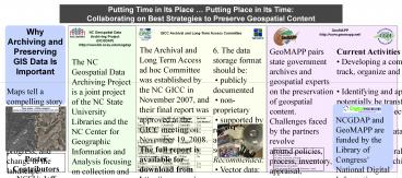
- The NC Geospatial Data Archiving Project is a
joint project of the NC State University
Libraries and the NC Center for Geographic
Information and Analysis focusing on collection
and preservation of digital geospatial data
resources from state and local government
agencies. - Key outcomes
- Acquisition and archiving of key state and local
agency geospatial data resources - Application of emerging digital repository
technologies to preservation of geospatial data - Initiation of discussions within the state's
data producer community about data archiving
practices - Completion of surveys of current archiving
practice in state and local agencies in NC - Outreach and engagement to the commercial
software and service provider community on the
topic of data preservation - In collaboration with national partners,
formation of a Data Preservation Working Group
within the Open Geospatial Consortium
international standards organization - Contribution to Library of Congress efforts to
cultivate a national digital preservation
infrastructure
GICC Archival and Long-Term Access Committee
- The Archival and Long Term Access ad hoc
Committee was established by the NC GICC in
November 2007, and their final report was
approved at the GICC meeting on November 19,
2008. The full report is available for download
from http//www.ncgicc.org. - The committee was composed of county, municipal,
state, federal, regional, and academic
representatives. Both GIS professionals and
archivists were included. - Listed here are 8 General Best Practices for
Geospatial Data Preservation recommended by the
Committee. - Annually review policies and data integrity.
- Develop and maintain fully compliant FGDC
metadata. - On-line network storage of archival data
- Make archived data readily available to other
agencies - and the public.
- 5. Frequency of Capture
6. The data storage format should be publicly
documented non-proprietary supported by
readily accessible software Recommended
Vector data non-compressed shapefiles
Raster data GeoTIFF or TIFF with world
files Naming Consistent scheme, using
jurisdiction theme keywords, and date.
Example WAKE_PARCELS_2008_01 7. Participate
in NC OneMap GIS Inventory 8. Publicize Agency
Retention and archival schedules/practices
GeoMAPP pairs state government archives
and geospatial experts on the preservation of
geospatial content. Challenges faced by the
partners revolve around policies, process,
inventory, appraisal, technical infrastructure,
storage capacity, funding, and ensuring long
term access. Project Objectives GeoMAPP partners
aim to demonstrate, learn, and report on project
activities to meet the following objectives
Identify and inventory at risk or temporally
significant geospatial data Determine criteria
and appraisal process for data assessment
Identify system and capacity requirements
for ensuring long term access to data
Determine best practices for data transfer
and movement to state archives and among
states Document the benefits of
geopreservation Engage stakeholder
organizations and industry in problem solving and
outreach
Current Activities Developing a common
inventory tool to track, organize and compare
data between states Identifying and
appraising datasets to potentially be
transferred to State Archives and between
project partners Documenting data transfer
and ingest processes Creating a general
business plan to detail the benefits of
archiving geospatial content Publishing a
project pamphlet
State Partners NC Center for Geographic
Information and Analysis NC State Archives NC
State University Libraries Kentucky Department
for Libraries and Archives Kentucky Division of
Geographic Information Utah Division of
Archives Utah Automated Geographic Reference
Center
Poster Contributors NCSU Jeff Essic, Steve
Morris, Matt Sumner CGIA Alec Bethune, Zsolt
Nagy Wake Co Anne Payne State Archives Kelly
Eubank
Recommended
CrystalGraphics Presentations


