
Canadian Geospatial Data Infrastructure - PowerPoint PPT Presentation
1 / 23
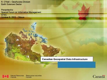
Title:
Canadian Geospatial Data Infrastructure
Description:
European. Inspire. Australian. SDI. Other. SDI. Global. SDI. U.S.. NSDI. CGDI ... Application - The Atlas of Canada. Some questions that needed to be asked ... – PowerPoint PPT presentation
Number of Views:120
Avg rating:3.0/5.0
Title: Canadian Geospatial Data Infrastructure
1
Canadian Geospatial Data Infrastructure
2
Geospatial data
- observations with geographic coordinates
(lat/long or some secondary reference system) as
attributes. - structured, assembled into data bases.
- integrated with other information.
- often represented graphically as maps.
- manipulated in a Geographic Information System
(GIS).
3
Canadian Geospatial Data Infrastructure
- CGDI - being built by the GeoConnections Program
(putting Canadas geographical information on the
Internet) - a national partnership of federal government
departments and provincial agencies, - implemented by partners private sector and NGOs.
4
GeoConnections Program primary mission
- to make Canadas geographic information
accessible on the Internet. - by developing Canadian Geospatial Data
Infrastructure (CGDI) -- an enabling
infrastructure to support the management of
national economic and social priorities - enabling applications in domains such as --
environment, health, sustainable development,
disaster management, community management,
services delivery, transportation, business
development and many others
5
GeoConnections principles
- Partnerships
- collect and manage data closest to source.
- Standards
- adoption/implementation of international
standards. - Consistency
- framework data sets.
- facilitate data collection, management,
processing, integration, analysis, interpretation
and reporting. - Access
- Internet national, electronic.
- Policy
- supportive, enabling, consistent across all
participants.
6
Activities
- Standard services
- discovery portal, gazetteer, we mapping, web
features. - Framework data sets
- facilitate data collection, management,
processing, integration, analysis, interpretation
and reporting. - The Atlas of Canada
- model implementation of a geospatial
infrastructure (visualization, services,
authoritative data) - places information in its geographic context.
- reaches Canadian public.
- GeoInnovations
- support for technology development in private
sector.
7
Activities (cont.)
- Support for connection of information to CGDI by
- applications themes.
- Communities of Practice.
- federal and provincial government agencies (and
some NGOs) - Sustainable Communities Initiative
- capacity building within rural and remote
communities. - GeoSkills
- capacity building among geomatics professionals
8
Enabling Applications
e.g. Sustainable Development Transportation
Planning Climate Change Monitoring Disaster
Response Site Assessment Infrastructure
Portal ...
CGDI
e.g. Features Coverages Projects, Studies,
Activities Events, Situations ...
e.g. Discovery Gazetteer Visualization
Location-based ...
.
9
Global Participation
.
10
Services Architecture
For Example
Applications e.g., Transportation Planning,
Climate Change Monitoring, Site Assessment
A trip planning web site that calculates the best
route between two cities
Users
uses Gazetteer service, Road network server, Web
mapping service
Services e.g., metadata server, gazetteer
service, map server
Other Applications
based on Geographical Names, Road network
features Base maps
Information e.g., base map data, thematic
overlays, text geographic names, metadata
11
Service - data discovery
Provider
Find
Discovery
Advertising
Advertising
Discovery
Publish
Update with Search Server Address
Evaluate
Organizations
Services
Data
Configure
Results
Query
Manage
Search
Search
Bind
12
Service distributed gazetteer
13
Service - Web Mapping an Open GIS Standard
14
Service - cartographic styling of Web Map layers
15
Application - GeoBase Portal
16
Application - The Atlas of Canada
17
Some questions that needed to be asked
18
Information sharing . do you want to?
- most information in government is collected in
support of (internal) operations - very specific audiences.
- few agencies have been set up specifically to
collect and share information - Statistics Canada
- Geomatics Canada (NRCan)
- the Canadian Hydrographic Service (DFO)
- parts of the Meteorological Service of Canada
(EC) - (archives and libraries a service)
- (science organizations would like to develop and
share knowledge)
19
What do you mean by sharing?
- mutual benefit
- of course maybe but
- revenue, cost recovery
- controls (permissions, MOUs, licences)
- applications
- what will the 2nd party use it for.
- suitability for task misrepresentation,
liability. - distribution ?? value-adding
- who else will use it.
- who else might use it.
20
What are you willing to share?
- a peek (e.g. the metadata).
- the data, the observations.
- the information, the context, the structure.
- the analysis, the tools, the methodology.
- the interpretation, the conclusions, the
decisions. - the clients.
21
With whom are you willing to share?
- your colleagues.
- other government operations.
- an international organization.
- an NGO with assumed oversight activities.
- Canadians.
- the World.
22
What are your clients expectations?
- What do they think they see on (American) TV?
- How far are you willing/able to go in meeting
these expectations?
23
Some observations
Provide for graduated buy-in commitment of
suppliers and consumers function of readiness,
capacity,
Early adopters need money, middle adopters need
a business case, the last adopters need an
incentive.
- Information infrastructures are extremely
demanding of the accessible data - clients assume that data is suitable for purpose,
high quality, and can be integrated easily with
other data sets. - do not underestimate diversity or complexity of
applications or resourcefulness of the clients.
24
The future
- interoperable meta-data services to permit
discovery of data between disciplines and
information management communities (e.g.
geospatial, bibliographic, government). - new strategies for dealing effectively across the
data, information and knowledge domains. - Digital Earth - a vision.
25
- http//geoconnections.org
R. ONeil GeoAccess Division, Earth Sciences
Sector Natural Resources Canada email
oneil_at_nrcan.gc.ca http//atlas.gc.ca http//geogra
tis.gc.ca
Recommended
CrystalGraphics Presentations


