
GLOBAL POSITIONING SYSTEM - PowerPoint PPT Presentation
1 / 30
Title:
GLOBAL POSITIONING SYSTEM
Description:
GPS receivers. Passive devices that record and analyze satellite signals for positioning ... Avoid multi-path conditions near the GPS antenna ... – PowerPoint PPT presentation
Number of Views:130
Avg rating:3.0/5.0
Title: GLOBAL POSITIONING SYSTEM
1
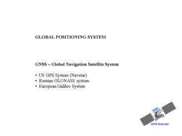
GLOBAL POSITIONING SYSTEM
- GNSS Global Navigation Satellite System
- US GPS System (Navstar)
- Russian GLONASS system
- European Galileo System
2
GPS SYSTEM COMPONENTS
- (Fully operational since 1993)
- The Space Segment
- 24 satellites in six near circular orbits orbits
- 24 hour coverage anywhere on earths surface
between Lat. 80N and 80S - Altitude approx. 20 200km
- Orbital period approx. 12hrs (speed of satellites
about 14000km/hr) - Satellites equipped with very precise (and
expensive!) atomic clocks - Satellites transmit signals with extremely stable
frequencies - The Control Segment
- Five monitoring stations (Col. Springs, Hawaii,
Ascension, Diego Garcia, Kwajaleni) - Satellites monitored and tracked at control
stations - Data relayed to Master Control Station (Colorado
Springs) - Orbital parameters and clock corrections computed
and uploaded to satellites for transmission to
system users (broadcast vs rapid (24 hrs) vs
precise ephemeris (2wks)) - The User Segment
- GPS receivers
- Passive devices that record and analyze satellite
signals for positioning
3
WGS 84
4
CORE IGS TRACKING NETWORK late 1998
Source http//www.gmat.unsw.edu.au/snap/gps/gps_s
urvey/chap12/1224.htmfig1
5
THE GPS MEASUREMENT PRINCIPLE Based
on the basic physical relationship distance
velocity time Observations (pseudo-ranges)
from 4 satellites provide 3 dimensional position
(3 positional and 1 time unknown) Coordinate
system realized by the satellite orbits
(ephemeris data) and by the coordinates and
physical locations of the control and tracking
stations
Trilateration
6
GPS TECHNOLOGY CLASSIFICATION
geodetic
mapping
navigation/
100 m
civilian (SPS)
grade
grade
recreational
(prior to 05/02/00)
grade
20 m
civilian (SPS) post 05/02/00
APPROXIMATE ACCURACY
10 m
military (PPS)
5 m
1 m
0.5 m
dm
cm
mm
E
A
B
C
D
RELATIVE
POINT (ABSOLUTE)
POSITIONING
POSITIONING
Selective Availability switched off see
http//geography.about.com/library/weekly/aa050400
a.htm
7
The Geocentric Cartesian Coordinate System
Z
Satellite P
Greenwich Meridian
N
ZP
A
Y
XP
YP
Equator
S
X
AP v(XP-XA)2 (YP-YA)2 (ZP-ZA)2
8
THE GPS SIGNALS Each Satellite transmits two
carrier waves L1 - frequency of 1575.42 MHz
and a wavelength of approx 19cm L2 - frequency
of 1227.60 MHz and a wavelength of approx
24cm The following satellite-specific signals,
called the pseudo random noise (PRN) codes are
modulated on the carrier waves On L1 C/A
(Coarse/Acquisition) code ? approx 300m -
Accessible to civilian users - Consists of a
series of 1023 binary digits (called chips) that
are unique to each satellite. - The chip
pattern is repeated every millisecond P
(precise) code ? approx. 30m - Accessible only
to military equipment On L2 P code only
Coming on-line L2C and L5
9
Code Signal Positioning
Subframe of message
Receiver Signal
Time Delay
Matching Subframe
Delayed Satellite Signal
The mis-match between the code patterns is a
measure of the time the signal has taken to
travel from satellite to receiver.
10
Geometric Dilution of Precision - Measures the
effect of geometry on the precision of the
observations - Multiply GDOP by the Std Error
to get actual uncertainty - Also HDOP,
VDOP Position Dilution of Precision (PDOP) -
This is positional part of GDOP
11
COMMON MISTAKES
- Logistical weaknesses
- battery power, memory overruns, no inter-party
communications, no - contingencies in observation schedule
- Operator mistakes
- incorrect antenna heights, careless centering,
incorrect receiver settings - (epoch interval), accidental deletion of
raw observations, inadequate field - records, careless handling of antenna and
power cables - Processing mistakes
- insufficient or incorrect datum definition
(e.g. incorrect base station - coords), no checks on centering and antenna
heights, inclusion of trivial - base lines, insufficient redundancy and
quality checks
12
- Precautions to minimize errors
- Schedule your survey to fall within periods of
good satellite geometry (i.e. low PDOP) - Eliminate satellites at low elevation to reduce
the length of the signal path through the
atmosphere - Avoid multi-path conditions near the GPS antenna
- For precise positioning use differential
corrections and/or phase observations of the
carrier waves
15 (Mask Angle)
Earth
Atmosphere
Multipathing
13
GPS POSITIONING ERROR CLASSIFICATION
14
(No Transcript)
15
Post-processing vs Real Time Correction
16
Base Stations
Connected via cable
Tirana, Albania
Antenna on Tripod
Receiver and Laptop logging base station
measurements
Base Station over Known Point Cajamarca, Peru
17
Differential GPS (Static)
Single Differencing One satellite observed from
two receivers Satellite clock error is eliminated
Double Differencing Two satellites observed from
two receivers Receiver clock error is eliminated
Triple Differencing Two satellites observed from
two receivers at two different epochs. Eliminates
integer cycle ambiguity
Epoch 2
Epoch 1
18
Real Time Kinematic (RTK)
Differential corrections are broadcast via radio
Base station over free point
Base station over known point
Data latency 0.05 1.0 secs Radio limits range
between base and rover
19
THIRD PARTY DIFFERENTIAL CORRECTION SERVICE
- Service available commercially (e.g. Omnistar)
- Sub-meter accuracies possible when used in
combination with L1 - User needs only one receiver
GPS satellites
Geostationary Communication Satellite
Differential Base Station
Rover
Footprint of Communication Satellite coverage
See http//www.omnistar.com/
20
Eccentric Points
Geostationary Communication Satellite
Useful when Canopy prevents direct occupation of
point or when Communication Satellite is blocked
21
STATIC SURVEYS FOR CONTROL NETWORK IN NAMIBIA
Source Walter Volkmann
22
(No Transcript)
23
Fiducial Points for defining GPS datum in the
country
24
Surveying river boundaries with GPS Belize
River, Belize
25
Cadastral survey using handheld GPS - Ecuador
26
Field testing rapid GPS cadastral surveying
methodology - Peru
27
Calibrating sub-meter GPS receiver Tirana,
Albania
28
Testing GPS methodology for surveying rural
properties - Nicaragua
29
Measuring Control Points - Zaire
30
(No Transcript)
Recommended
CrystalGraphics Presentations


