
12.221 Field Geophysics - PowerPoint PPT Presentation
Title:
12.221 Field Geophysics
Description:
12.221 Field Geophysics Lecture 2 Brief introduction to earthquakes in ECSZ Introduction to gravity measurement and interpretation Reading: Chapter 2 of 12 ... – PowerPoint PPT presentation
Number of Views:126
Avg rating:3.0/5.0
Title: 12.221 Field Geophysics
1
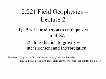
12.221 Field Geophysics Lecture 2
- Brief introduction to earthquakes in ECSZ
- Introduction to gravity measurement and
interpretation
Reading Chapter 2 of 12.501 lecture notes (Rob
van der Hilst) (may be heavy going in places -
skim global part, focus on gravity anomalies
2
Magnitude
5
3
7
6
4
3
Gravity simple physics
M
m
r
- Force f GmM/r2
- G 6.67 10-11 m3kg-1s-2
- Vector directed along r
- Acceleration of test mass g GM/r2
- Potential energy U -GmM/r
- Gravitational potential V GM/r
4
Gravity distributed density ?(x,y,z)
- potential
- acceleration
Recall Gauss theorem
Measuring g places constraints on
?(x,y,z) Measuring g does not constrain ?
directly (sphere? point mass) ?(x,y,z) can be
complicated ? simple physics, complicated
interpretation Interpretation (and effort
justified) depend on accuracy of measurements -
consider the trade-off judiciously!
5
Measuring absolute g?Measuring variations in g
- f mg ku
- g 9.8 m/s2
- g 980 cm/ s2 (980 gals - Galileo)
- ?g 1 mgal (10-6) interesting
- Need good instrument, good theory!
6
(No Transcript)
7
Observed Gravity
8
What causes these variations?
Spinning Earth -gt centrifugal force, equatorial
bulge centrifugal force gt less g at equator, no
effect at poles equatorial bulge
(elliptical) more mass near equator gt g
increases r larger at equator gt g
decreases Dependence of g on latitude
(?) g(?) 978032(1 0.0052789 sin2 ?
0.00000235sin4?) mgal Elevation change r -gt r
h gt g decreases (free air effect) Free air
correction g(rh) g(r) (dg/dr) h dg/dr
-2g/r -0.307 mgal/m
9
Gravity anomalies
In general ?g gobserved gtheory Free Air
theory gFree Air g(?,h) g(?) 0.307
h Free air anomaly ?gfaa gobserved - gFree
Air
10
(No Transcript)
11
Bouguer gravity anomalyMountains are not hollow!
Approximate as a sheet mass gBouguergFree Air
2??Gh for ? 2.67, 2??G 0.112 mgal/m
12
(No Transcript)
13
Terrain has an effect
h in feet!
14
Isostacy Mass in each column assumed to be equal
15
Tides?
www.astro.oma.be/SEISMO/TSOFT/tsoft.html
16
Step in basement topography
g2G(??)t?/2tan-1(x/d)
How big a step makes 0.1 mgal?
x
d
?s
t
?b
17
(No Transcript)
18
(No Transcript)
19
Example real-world problems
- Are the mountains isostatically compensated?
- How deep is basin fill in Mesquite basin?
- How steep is the basin boundary?
- Is Table Mountain a plug or a flow?
- Is Black Butte autochthonous?
- . . . . . . . . . . . ?
20
Vidal DEM
DEM of Vidal Quadrangle http//data.geocomm.com/de
m Rendered using http//www.treeswallow.com/macdem
//
21
Computation of terrain root using DEM a new
solution to a classic problem
Apply Gauss theorem dot product
See http//www.geo-online.org/manuscript/singh9906
3.pdf for Matlab scripts for carrying out
calculations
22
Gravity data www.scec.org on web page
Southern California Gravity Data (point
measurements)
Contributed to the Southern California Earthquake
Center by Dr.
Shawn Biehler of University of California at
Riverside on December
14, 1998.
Notes
0) Stations name used by Shawn
Biehler.
1) Latitude and longitude were given to
1/100 minute. Here they are given in
decimal degrees.
2) Elevation is
given in meters above sea level. Original was in
feet. The column 'E' denotes the
method of determining elevation
T gt orginal in tenths of feet
(method unspeficied)
M gt map contour (accuracy 1 foot)
B gt bench
mark (acurracy 1 foot)
U gt useful (accuracy and
method unspecified)
3) Raw gravity - 978000.00 mgals (original
accuracy 0.01 mgals) 4)
Predicted gravity - 978000.00 mgals, from XXXXX
5) inT -gt
inner terraine correction, 0 - 1km box.
outT -gt outer
terrane correction, 1 - 20 km box.
T -gt method of inner
terrane correction.
6) FAA - Free Air Anomaly (mgals)
(original accuracy 0.01 mgals).
7) BOUG -Bouger Anomaly (mgals) (original
accuracy 0.01 mgals) 8)
map - quadrangle map location of stations - first
3 letters denote map, digits
indicate site marked on map.
stat lat long elev E
Raw g Pred g inT outT T faa boug
map ..... ........ .......... ....... .
........ ........ ..... ..... . ....... .......
...... RO2050 34.96100 -119.44650 889.07 T
1494.47 1742.24 0.32 0.97 G 26.59 828.43
BLC_11 RO2048 34.96667 -119.44000 848.84 T
1498.36 1742.72 0.64 1.08 G 17.59 824.35
BLC_12 RO2020 34.95800 -119.43800 922.29 T
1485.64 1741.98 0.32 1.07 G 28.27 826.49
BLC_10
Recommended
CrystalGraphics Presentations


![NOTE: To appreciate this presentation [and insure that it is not a mess], you need Microsoft fonts: PowerPoint PPT Presentation](https://s3.amazonaws.com/images.powershow.com/7012918.th0.jpg?_=20201123045)

![NOTE:%20To%20appreciate%20this%20presentation%20[and%20insure%20that%20it%20is%20not%20a%20mess],%20you%20need%20Microsoft%20fonts:%20%20 PowerPoint PPT Presentation](https://s3.amazonaws.com/images.powershow.com/P1251328625QzGDe.th0.jpg?_=201805240711)

