
Digital Elevation Models and Erosion Potential Mapping - PowerPoint PPT Presentation
1 / 17
Title:
Digital Elevation Models and Erosion Potential Mapping
Description:
... random sample of points is taken from the large scale map (one point ... from the USGS Middle East Oil Resources Survey geologic map of the Arabian Pennisula. ... – PowerPoint PPT presentation
Number of Views:327
Avg rating:3.0/5.0
Title: Digital Elevation Models and Erosion Potential Mapping
1
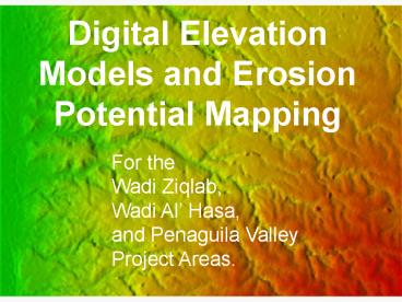
Digital Elevation Models and Erosion Potential
Mapping
For the Wadi Ziqlab, Wadi Al Hasa, and Penaguila
Valley Project Areas.
2
Reinterpolation of large scale digital elevation
maps
- Aster DEMs are available at 30 meter resolution
only. - Erosion processes occur at a smaller scale.
- In order to model these processes, we need finer
scale maps than we can obtain from outside
sources. - We must reinterpolat these 30 meter DEMs to
higher resolution.
3
Reinterpolation of large scale digital elevation
maps
- First, we zoom in on the project area.
- A random sample of points is taken from the large
scale map (one point for every two pixels). - The desired resolution is set (10 meters).
- SplineTension interpolation fills the gaps
between the sampled points at the new resolution.
4
Reinterpolated Maps
Penaguila Valley
5
Reinterpolated Maps
Wadi Ziqlab
6
Reinterpolated Maps
Wadi Al Hasa . Archaeological sites
7
Erosion Modeling
- RUSLE the Universal Soil Loss Equation
- Erosion Potential RKLSCP
- Rrainfall factor, Ksoil factor, LSlength slope
factor, Cland cover factor, Pprevention factor
(not necessary for our purposes) - LS factor can be made directly from the DEM
8
Erosion Modeling
- Eventually, we will recode vegetation maps with
the C factor for each plant type. - We will also recode soil maps and rainfall maps.
- For now, rainfall, soil, and land cover are held
constant, and land cover is adjusted to represent
bare soil, agricultural fields, and forest to
produce some example maps.
9
Erosion Potential Maps
Penaguila Valley
Bare land
Forest
Agriculture
10
Erosion Potential Maps
Wadi Ziqlab
Forest
Bare land
Agriculture
11
Other Maps
- Some other maps of interest include watersheds,
satellite photos, slope maps, and geology
(examples to follow). - Other available maps (of which I have no examples
of today) include, aspect, shaded elevation maps,
basins, curvature, and flow accumulation maps.
12
Watershed Maps
Penaguila Valley
Wadi Ziqlab
13
Satellite Maps
Wadi Ziqlab SPOT image draped on the DEM and
visualized in NVIS
14
Slope Maps
Wadi Ziqlab Slope map draped on the DEM and
visualized in NVIS
15
Geologic Maps
Wadi Ziqlab Major Geologic Strata in Wadi
Ziqlabfrom the USGS Middle East Oil Resources
Survey geologic map of the Arabian Pennisula.
16
What Next?
- Create digital R, C, and K factor maps for the
project areas. - Create finalized erosion potential maps from
these data using RUSLE and USPED (Unit Stream
Power - based Erosion Deposition) . - Finish archaeological sites databases for project
areas (Completed for Wadi Al Hasa). - Create point vector maps of these site databases
(Completed for Wadi Al Hasa). - Start dynamic simulation of erosion processes.
17
Where are the maps?
- All the preceding and following maps are
available on the Sagunto server in the
/home/share/transfer/isaac_ullah_export
directory. - All maps on the server have associated metadata
and are available in ready to use GRASS
locations, and some as ASCII GRID files. - Export of rasters to GEOTiff format coming soon.
- Wadi AlHasa archaeological survey site data is
available in .dbf, .mdb, ESRI shapefile, and
GRASS format.
Recommended
CrystalGraphics Presentations


