
The Chicago Metro HighResolution Land Cover Mapping Project: - PowerPoint PPT Presentation
1 / 49
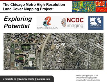
Title: The Chicago Metro HighResolution Land Cover Mapping Project:
1
The Chicago Metro High-Resolution Land Cover
Mapping Project
Exploring Potential
2
Todays Path
- Introductions
- Geospatial Technology
- The Chicago Metro
- Project
- Case Studies
- Discussion / QA
3
Introductions
- RFP Mapping, LLC
- Extensive aerial photography, GIS, economic
development, public relations environmental
background - Evolved out of a specific need from municipal
clients for interpretative vertical imagery - Licensed DigitalGlobe reseller, strategic NCDC
Imaging partner - Based in McHenry, Illinois
4
The Three Tenets
- Understand
- Become students and subject matter experts
- within our vertical markets to uncover the full
- scope of the problem
- Communicate
- Use best available GIS and Remote Sensing
technology resources and innovations to visualize
an effective solution - Collaborate
- Harness the power of participatory GIS and
- open source systems to support collaborative
- decision-making
5
TODAYS HOT BUTTONS
Storm Water Runoff
Climate Change
Green Space Planning
Water Conservation
Air Quality
Water Quality
Renewable Energy Resources
Forest Health
Invasive Species
6
COMPANY OVERVIEW
NCDC Imaging Mapping
UNIQUE CAPABILITIES
INNOVATIVE SOLUTIONS
7
NCDC Background
- Established in 2000 as Native Communities
Development Corporation - Native American-Owned, Non-Tribal, Small Business
(USA) - DigitalGlobe, GeoEye and ESRI Partner
- Growing List of Partners and Affiliates
- Specialize in the use of high resolution imagery
and advanced remote sensing and GIS technology
for action-oriented land cover mapping
applications - Natural Resource Management
- Urban Green Planning and Conservation
- Food, Energy and Environment
8
Southwestern U.S. Projects
9
GREEN INFRASTRUCTURE MAPPING PROJECTS
10
Geospatial Technology
11
Imagery
- Imagery is the basis of our analysis procedures.
- As opposed to a traditional GIS approach to
resource management, which focuses on
field-collected samples and some aerial imagery,
we use a combination of high-resolution satellite
and aerial imagery captured in several formats.
12
Imagery Sources
- Fixed-Wing Aerial
- High resolution (up to 6-inch) color photography
- Hyperspectral, 250-band data sets
- Digital Globe's Quickbird Satellite
- 60 cm pan-sharpened resolution
- 4-band, multispectral imaging
13
Imagery Applications
Multispectral (Satellite)
Hyperspectral (Aerial)
- Stormwater planning, monitoring and management
- Urban tree canopy assessment and valuation
- Watershed planning, monitoring, and management
- Change detection and monitoring
- Planning for Green Infrastructure
- EPA guideline compliance
- Invasive species host detection
- Vegetation catalog creation, including speciation
- Water quality assessment
- Any application that requires the identification
of a specific target within a large geographic
area.
14
Imagery Comparison
15
Automated Feature Extraction (AFE)
- Manual collection of impervious surfaces took
substantially longer...automated feature
extraction provided big time savings. - ---Frank Obusek, North Carolina Center
for Geographic Information and Analysis
16
The AFE Process
- For every project, it is important to use known
ground samples to check accuracy
- When ground samples are compared to first run
data, the software is adjusted accordingly,
yielding greater accuracy
17
Cost Benefit
18
Accuracy
- Automated feature extraction yields results that
accurately reflect nuance that may otherwise be
missed by manual digitization while shrinking
project timeframes
19
What is a Land Cover Map?
Color-Infrared Imagery
Tree Canopy
Impervious Area
Low-Lying Vegetation
Scrub/Shrub
Bare Soil
Water
20
The Chicago Project
21
The Chicago Metro High-Resolution Land Cover
Mapping Project
- Bringing Information to the Region
- Over 3,000 mi2 over two phases.
- Phase 1 - 1800 square miles based on recent
archival imagery - Phase 2 - 1200 square miles based on planned
custom imagery acquisition - First-of-its-kind Project
- Regional projects mean data consistency across
municipal boundaries - Large-scale image acquisition and data
processing means significantly lower unit costs
to users
October 20 2007
PHASE 1
PHASE 2
22
Possible Phase 3 Area of Interest
- Pending further input, a third acquisition phase
covering the following counties may be tasked - Winnebago
- Boone
- Ogle
- DeKalb
- Lee
- La Salle
PHASE 1 PHASE 2 PHASE 3
23
Phase 1 Project Specifications
- IMAGERY
- 14,800, multispectral, 2-ft resolution QuickBird
satellite imagery - 2006 2007 leaf-on acquisition
- LAND COVER CLASSIFICATION
- 6-class, Anderson Level-1
- Includes impervious, tree cover, healthy grass,
unhealthy grass, bare soil water bodies - 85-95 accuracy (area and point-based assessment)
- Tiled (3x3mi grid system)
- ESRI GIS-ready shapefiles
- Easily adaptable to USGS Historical Land Use and
Land Cover (LULC) data
24
Chicago Land Cover Products
Color Infrared Imagery
6 Classes
7 Classes
Pervious / Impervious
Vegetation vs. Non-Vegetation
25
Change Analysis Over Time
Applications / Benefits Establish
benchmark Measure and model land use and land
cover conversion Monitor effectiveness and
compliance of policy programs Forecast supply
demand
26
Case Studies
WATER RESOURCES
GREEN INFRASTRUCTURE
Chicago Wilderness Magazine
Chicago Wilderness Magazine
27
City of San Francisco, CASFDPW - 2007
28
San Francisco Stormwater Runoff Modeling
Purpose Help city address problems of drainage,
flood control and pollution caused by stormwater
runoff and meet EPA regulations
29
San Francisco Stormwater Runoff Modeling
Scope of Work Use High Resolution imagery to
create a comprehensive land cover map for
Stormwater Management Modeling Benefits Fast
turnaround of a critical, comprehensive dataset
with seamless integration into other applications
within Department of Public Works and similar
groups Area 72 sq mi Timeline 6 weeks
30
Web2.0, Open Source GIS Community-Based
Tree Inventory
31
City of Denver, CODPR WMD - 2006
Purpose Support Million Tree Planting
Initiative planning, urban forest management and
stormwater modeling
32
Green Infrastructure, Denver, CO
- Features / Scope of Work
- Use high resolution imagery to create detailed
urban tree canopy by neighborhood, conifer vs.
deciduous composition, CITYgreen reports for
urban forest value and GoogleEarth .kml online
mapping interface - Benefits
- First green data layer in Citys GIS database,
easily communicable tool to engage the public
participation and education process - Area 120 sq mi
- Timeline 12 weeks
33
Analyzing Existing and Possible Urban
Tree Canopy by Land Use
34
Castle Rock Utilities, CO
- Purpose
- Provide parcel-level land cover statistics for
water budget rate structure development and
support erosion control mitigation efforts - Area 45 sq mi
- Timeline 15 weeks
35
Castle Rock Utilities Water Budget Development
Irrigated Area (H-M-L)
Impervious Area
Tree Shrub Cover
Non-Irrigated
Landscaped Area
36
Castle Rock Stormwater Erosion Control
Mitigation
Purpose Prioritize on-the-ground mitigation and
monitoring efforts for stormwater and erosion
control along 54 miles of drainages
Project Benefits cost-share / collaboration
involving utilities, stormwater, conservation,
parks, planning, and wildfire risk assessment
Grass
Shrub/Scrub
Trees
Non-Vegetation
37
Mecklenburg County, NC American Forests
Purpose Paint a complete picture for planning,
management and conservation to improve or protect
water quality Area 80 sq mi Timeline 3 weeks
2-ft QuickBird Satellite Image, Mountain Island
Lake Watershed, NC
Mountain Island Lake Watershed, NC
38
Protecting Water Quality Supply
- Features / Scope of Work
- Comprehensive land cover map to model the benefit
of strategic tree plantings on water quality
stream buffer restoration
- Benefits
- Quick turnaround with an accurate, comprehensive
view of area resources that serves as a visual,
communicable tool for education and training
39
Arkansas River Invasive Species Mapping
Purpose maintain and protect riparian habitats
water supply
Features / Scope of Work to identify and map
Tamarisk density and distribution (aka
Salt-Cedar) in Colorado and Kansas
40
Tamarisk Mapping Results
Benefits highly accurate, spatially specific
assessment that reduces expensive, time-consuming
traditional survey work
41
Utility Vegetation Mapping (UVM)
Huntsville, Alabama
2-ft Resolution, QuickBird
Purpose Identify utility vegetation management
(UVM) strategies and budgetary needs based on
GIS-based assessment of transmission line
corridors Features / Scope of Work Map trees,
briar/shrub and low-lying grass vegetation and
provide area statistics by management unit
(span) Area 10 linear miles Timeline 2 weeks
42
Encroachments Hazard Assessment Prioritize
strategize vegetation management Budgetary,
planning bidding purposes Vegetation
Composition by Span or Mgmt Unit
Trees (12 and up) Scrub/Briar (7-15) Shrub
(3-8) Grass (0-5)
43
GIS Analysis Data Integration
Benefits Fast, accurate, new information and
cost-effective over large project areas
- Results
- Management Unit (Span) 34
- Tree cover 0.12 acres
- Scrub/Briar/Shrub cover 0.67 acres
- Grass/Low-Lying cover .014 acres
34
44
Environmental Benefits Analysis Keep
Indianapolis Beautiful
- Purpose
- Use CITYgreen software to calculate current
urban forest value vs. at higher canopy cover
after planting efforts - Scope of Work
- Compile existing land cover GIS data and run
CITYgreen reports for 8 Hot Spot areas in
Indianapolis - Benefits
- Marketable, visual tool for education and public
awareness - Area 8 Hot Spots
- Timeline 4 weeks
45
Albuquerque, New Mexico Urban Ecosystem Analysis
- Purpose
- Help city address effects of rapid climate
change, heat island reduction, GHG emission
reduction programs and water harvesting - Features / Scope of Work
- Use High and Medium Resolution imagery to create
a comprehensive land cover and change map for an
Urban Ecosystem Analysis - Area 188 sq mi
- Timeline 15 weeks
46
Sacramento Air Quality Modeling Study
Purpose Model air quality benefits provided by
trees to justify inclusion in the California
State Implementation Plan (SIP) Features / Scope
of Work Comprehensive land use / land cover
(LULC) assessment including LiDAR analysis for
above ground feature mapping (needed for air
quality models) Area 500 sq mi Timeline
summer 2008
47
Salt Lake City Urban Forestry Research Pilot
Project
Purpose To collaborate, implement and test the
efficacy and costs of remote sensing technology
as it relates to benchmarking, analyzing,
managing and monitoring the urban forest and
related resources. Bill Rutherford, City
Forester Features / Scope of Work Land use /
land cover (LULC) and LiDAR analysis,
environmental benefits tradeoffs spreadsheet, LAI
and other vegetation indices, research
reporting Area 10 sq mi Timeline spring 2008
48
City of Aurora, COWater Reuse Litigation Study
Colorado Water Court Case No. 02CW341
49
Case Study GIS Campinas - 2008
- Location
- County of Campinas, SP, Brazil
- Purpose
- Support Mayoral taxation initiative by providing
updated map of parcel edifications (impervious
area) - Project Area
- 800 sq km
- 400,000 parcels
50
GIS Campinas Savings
- AFE vs. Manual
- Cost
- Manual 750,000
- AFE 150,000
- 80 SAVINGS
- Time
- Manual 9 months
- 10 Technicians
- AFE 2 months
- 5 Technicians
- 80 SAVINGS
51
Road Map Whats Next?
RFP Partners
Marketing Collaborations
Webinars
Resource Presentations
Workshops
- Conferences
- 2008 Targets
- Solution Mash-up
- Joint Training
- Roll-Up
- Projects
- Outreach
- Education
NCDC Partners
52
Contact Information
Office Information
Dan Swick Vice President, GIS
IT dswick_at_rfpmappingllc.com (815) 477-3480 (815)
382-3447 (mobile)
RFP Mapping LLC PO Box 775 McHenry, IL
60051 USA Office (815) 477-3480 Fax (815)
477-3498
Bill Peel Partner bpeel_at_rfpmappingllc.com (847)
309-1611
www.rfpmappingllc.com
Ian S. Hanou Business Development
Manager ihanou_at_ncdcimaging.com (719)
579-9276 (303) 503-4846 (mobile)
NCDC Imaging Mapping 1235 Lake Plaza Drive, Ste
127 Colorado Springs, CO 80906 USA Office (719)
579-9276 Fax (719) 632-5614
www.ncdcimaging.com
ian.hanou
Recommended
CrystalGraphics Presentations


