
Predicting Hurricanes and Improving Climate Models using Ensemble Data Assimilation Jeffrey Anderson - PowerPoint PPT Presentation
1 / 75
Title:
Predicting Hurricanes and Improving Climate Models using Ensemble Data Assimilation Jeffrey Anderson
Description:
Predicting Hurricanes and Improving Climate Models using Ensemble Data Assimilation Jeffrey Anderson – PowerPoint PPT presentation
Number of Views:75
Avg rating:3.0/5.0
Title: Predicting Hurricanes and Improving Climate Models using Ensemble Data Assimilation Jeffrey Anderson
1
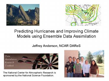
Predicting Hurricanes and Improving Climate
Models using Ensemble Data AssimilationJeffrey
Anderson, NCAR DAReS
The National Center for Atmospheric Research is
sponsored by the National Science Foundation.
2
How an Ensemble Filter Works for Geophysical Data
Assimilation
1. Use model to advance ensemble (3 members here)
to time at which next observation becomes
available.
Ensemble state estimate after using previous
observation (analysis)
Ensemble state at time of next observation (prior)
3
How an Ensemble Filter Works for Geophysical Data
Assimilation
2. Get prior ensemble sample of observation, y
h(x), by applying forward operator h to each
ensemble member.
Theory observations from instruments with
uncorrelated errors can be done sequentially.
4
How an Ensemble Filter Works for Geophysical Data
Assimilation
3. Get observed value and observational error
distribution from observing system.
5
How an Ensemble Filter Works for Geophysical Data
Assimilation
4. Find the increments for the prior observation
ensemble (this is a scalar
problem for uncorrelated observation errors).
Note Difference between various ensemble filter
methods is primarily in observation increment
calculation.
6
How an Ensemble Filter Works for Geophysical Data
Assimilation
5. Use ensemble samples of y and each state
variable to linearly regress observation
increments onto state variable increments.
Theory impact of observation increments on each
state variable can be handled independently!
7
How an Ensemble Filter Works for Geophysical Data
Assimilation
6. When all ensemble members for each state
variable are updated, there is a new analysis.
Integrate to time of next observation
8
Research with DART
- Public domain software for Data Assimilation
- Well-tested, portable, extensible, free!
- Models
- Toy to HUGE
- Observations
- Real, synthetic, novel
- An extensive Tutorial
- With examples, exercises, explanations
- People
- You dont have to go it alone!
used at -
and many more
9
DART is
- Education
- Exploration
- Research
- Operations
10
Basic Capability Ensemble Analyses and Forecasts
in Large Geophysical Models
6-hour forecast 500 hPa height 18Z 14 Jan
2007
20 of 80 members
Forecast from CAM (Community Atmosphere Model)
11
Diagnosis of Noise in the CAM Finite Volume core
using DART
- Kevin Raeder
- Jeff Anderson
- Peter Lauritzen
- Tim Hoar
NCAR/CISL/IMAGe/DAReS NCAR/ESSL/CGD/AMPS
The National Center for Atmospheric Research is
sponsored by the National Science Foundation.
12
CAM DART
- CAM 3.5.xx, Finite Volume core, 1.9x2.5, 30
min ?t. - DART Data Assimilation Research Testbed, an
ensemble Kalman filter data assimilation system. - Assimilate observations used in operational
forecasting - U, V, and T from radiosondes, ACARS, and
aircraft, - U and V from satellite cloud drift winds,
- every 6 hours to bring CAM as close to the
atmosphere as possible, balancing the obs and
model errors. - This system is competitive with operational
weather centers data assimilation systems.
13
Houston, we have a Problem.
CAM FV core - 80 member mean - 00Z 25 September
2006
14
Suspicions turned to the polar filter (DPF)
CAM FV core - 80 member mean - 00Z 25 September
2006
15
Using a continuous polar filter(alt-pft) does
not show this effect.
Ensemble Mean V _at_ 266hPa - 00Z 25 Sep 2006 - CAM
FV core
16
The differences are minimal except at the
transition region of the default polar filter.
Ensemble Mean V _at_ 266hPa - 00Z 25 Sep 2006 - CAM
FV core
17
Three adjacent E-W cross-sections from the region
of the discontinuity reveal more detail.
m/s
m/s
m/s
East Longitude
Ensemble Mean V _at_ 266hPa - 00Z 25 Sep 2006 - CAM
FV core
18
That wasnt so bad!
- The use of DART diagnosed a problem that had been
unrecognized (or at least undocumented). - The problem can be seen in free runs - it is
not a data assimilation artifact. - Without assimilation, cant get reproducing
occurrences to diagnose. - Could have an important effect on any physics in
which meridional mixing is important. - The alternate polar filter fixes this problem,
but . . .
19
2 ?y noise in ensemble average V
More suspicious patterns, not fixed by ALT_PFT
Ensemble Mean V _at_ 266hPa CAM FV core 00Z 25
September 2006
20
North-South cross sections
46º East
206º East
Polar filter noise (fixed)
Residual Noise
Residual Noise
Ensemble Mean V _at_ 266hPa CAM FV core 00Z 25
September 2006
21
Another instance of noise from real-time use of
DART-CAM in a chemistry field campaign (ARCTAS)
6 hour forecast of a single ensemble member
Ensemble Member 10 V _at_ 266hPa CAM FV core 06Z 13
April 2008
22
Noise not restricted to V winds
suspicious
Ensemble Member 10 T _at_ 266hPa CAM FV core 06Z 13
April 2008
23
suspicious
Ensemble Member 10 U _at_ 266hPa CAM FV core 06Z 13
April 2008
24
Doubling the dynamical time splitting reduced the
noiseimplicates model as opposed to
assimilation.
Ensemble Mean V _at_ 266hPa CAM FV core 00Z 25
September 2006
25
Notes and Conclusions
The noise here may seem small and transient, but
since it had not been recognized by any of the
labs which are using this FV core, the effects
on climate runs had not been explored.
- Spurious mixing is happening.
- Parameterizations may have been mistuned.
- More time may need to be spent fixing the
remaining noise and looking at other unexamined
pieces of the code.
26
Evaluating the atmospheric forcing on recent
Arctic sea ice loss
- Jennifer E. Kay
- National Center for Atmospheric Research (NCAR)
- Colorado State University (CSU)
- Collaborators Julienne Stroeve (NSIDC),
- Andrew Gettelman, Kevin Raeder, Jeff Anderson
(NCAR), - Graeme Stephens, Tristan LEcuyer, Chris ODell
(CSU) - Special Thanks Cecile Hannay (NCAR)
March 10, 2008 MODIS image of the Alaska coastline
27
New Tool Data AssimilationDART Data
Assimilation Research Testbed
Fig. 1 from Rodwell and Palmer (2007)
- Lots of science and model assessment can be done!
- Do climate models capture observed atmospheric
processes? - Do analysis increments reveal the underlying
mechanisms for persistent model biases?
28
- New observations and tools
- Mechanisms for recent sea ice loss
- Arctic CAM-DART project
The 2007 record minimum extent was 4.13 million
km2.
The 2008 minimum extent was 4.52 million km2.
29
DART-CAM Assimilations
- Research Questions
- Does CAM capture changes in atmospheric forcing
important for sea ice loss? - Does the surface affect the atmospheric forcing
on sea ice loss in CAM?
30
From CAM forecasts to monthly averages
Average all 12-hour forecasts.
31
CAM monthly mean SLPJuly06 vs. July07
CAM forecasts show large differences in mean sea
level pressure fields.
32
CAM-forecasted clouds
July 2007 had cloud decreases under high SLP, but
cloud increases over the ice-free ocean.
33
CAM-forecasted shortwave radiation
CAM downwelling and net surface solar radiation
responded to cloud changes and surface albedo
decreases.
34
CAM-forecasted longwave radiation
Surface downwelling LW radiation changes related
to low cloud changes.
35
CAM-forecasted clouds and radiationJuly07 minus
July06
Overall, July 2007 had fewer clouds, more
downwelling and absorbed shortwave radiation, and
less downwelling longwave radiation.
Over open water, 2007 had more clouds, less
downwelling shortwave radiation, more absorbed
shortwave radiation, and more downwelling
longwave radiation.
36
Modeled vs. observed cloud changesJuly 2007
minus July 2006
Unlike CAM, MODIS shows variability in the cloud
response over open water.
37
Summary
- New satellite data and model-observation
comparison tools are improving our understanding
of atmospheric processes. - While 2007 was a perfect storm for ice loss,
2008 had the 2nd lowest ice extent with
relatively normal atmospheric forcing. - The timing of ice loss matters, and can be used
to understand ice loss forcing mechanisms. - Comparing CAM forecasts from July 2006 and July
2007 revealed ubiquitous low cloud increases over
open water. This negative feedback on sea ice
loss was not seen in observations.
38
Application of Radio Occultation Data in Analyses
and Forecasts of Tropical Cyclones Using an
Ensemble Assimilation System
Hui Liu, Jeff Anderson, and Bill Kuo
Joint Statistical Meeting August 2008
An Example of using assimilation to evaluate the
impact of novel observations.
39
GPS Radio Occultation (RO)
Basic measurement principle Deduce atmospheric
water vapor and temperature based on measurement
of GPS signal phase delay.
40
Limb sounding of atmosphere as LEO satellite
receivers rise or set with respect to GPS
satellites
Global observations are related
to Temperature, Humidity, Ionospheric stuff.
41
COSMIC GPS RO Research Mission (2006 - 2011)
15 April 2006 Vandenberg AFB
A set of six mini-satellites in Low Earth Orbit
(LEOs) with GPS receivers were launched on 15
April 2006.
COSMIC launch picture provided by Orbital
Sciences Corporation
42
Global coverage including oceans and polar areas!
7 Dec 2007 1878 soundings
43
GPS Radio Occultation Refractivity
- Has accurate measurements of both water vapor and
temperature with high vertical resolution - Minimally affected by clouds and precipitation
- Has great potential to improve weather analyses
and forecasts over data-sparse and cloudy areas
like tropical oceans
So, RO is especially useful for tropical cyclone
forecasts
44
Challenges for Assimilation of RO Refractivity
- RO refractivity is a function of both water vapor
and temperature - Retrieval of water vapor and temperature requires
accurate estimate of covariance between RO data,
temperature, and moisture - These covariances are highly time-varying and not
well known
45
Ensemble Kalman Filter Assimilation
- Covariance of RO refractivity with water vapor
and temperature is computed from online ensemble
forecasts - The error covariance is time-varying, related to
weather patterns
46
Typhoon Shanshan (Sep 10-17, 2006)
Operational forecasts using variational
assimilation failed to predict the curving of the
typhoon.
Central SLP pressure
47
COSMIC RO soundings
RO soundings, randomly distributed over the
domain, provide large-scale information.
101 profiles on 13 September 2006
48
Assimilation experiments
- WRF/DART ensemble assimilation at 45km resolution
- 8-14 September 2006 (typhoon develops on the
10th) - 32 ensemble members.
- Control/NoGPS run
- Assimilate operational datasets including
radiosonde, cloud winds, land and ocean surface
observations, SATEM thickness, and QuikSCAT
surface winds. - GPS run
- Assimilate the above observations RO
refractivity.
49
Typhoon central pressure in analyses
Sep 10
Sep 14
Intensity of the typhoon is enhanced with RO data.
50
Typhoon Maximum surface wind in analyses
Sep 10
Sep 14
Intensity of the typhoon is enhanced with RO data.
51
ensemble mean analysis Typhoon Track
Sep 14
Ensemble mean
Observed
Sep 8
GPS
NOGPS
Typhoon track with GPS data is closer to
observations.
52
Impact of RO refractivity on Ensemble forecasts
(16 members, with a finer nested grid of 15km)
initialized at 00UTC 13 and 14 Sept 2006.
53
Forecast from 00UTC 13 Sep 2006
54
Ensemble Forecasts of central sea level pressure
Ensemble Mean
Observed
Ensemble mean
Observed
with RO data
Sep 13
Sep 13
Sep 16
Sep 16
Intensity of the typhoon is increased with RO data
55
Ensemble Forecasts of maximum surface wind
Ensemble Mean
Observed
Ensemble mean
Observed
with RO data
Intensity of the typhoon is increased with RO data
56
Forecast Probability of Rainfall gt60mm/24h, 12Z
14-15 Sep
Ensemble mean
Observed
OBS
with RO data
Probability Rainy members/total members
Rainfall probability is increased with RO data
57
Ensemble Forecasts of Typhoon Track
Ensemble mean
Ensemble mean
Observed
Observed
with RO data
GPS
NOGPS
Curving of the Typhoon is well predicted in both
cases.
58
Ensemble Forecasts of Typhoon Track Error
Ensemble mean
Curving of the Typhoon is well predicted in both
cases.
59
Summary
- Forecasts of the typhoon intensity and rainfall
probability are improved by using RO refractivity
observations with the WRF/DART ensemble system. - The curving path of the typhoon is well predicted.
60
Mesoscale WRF Surface-Data Assimilation Spring
2007 Experiments at theNational Severe Storms
Laboratory
David Dowell NCAR, Boulder, CO
David Stensrud NSSL, Norman, OK
Nusrat Yussouf CIMMS, Norman, OK
Mike Coniglio NSSL, Norman, OK
Jeff Anderson NCAR, Boulder, CO
Chris Snyder NCAR, Boulder, CO
Acknowledgments Nancy Collins, Tim Hoar, Greg
Carbin
61
Motivation
- Investigate the value of assimilating surface
observations for mesoscale NWP - predictions of surface boundaries, convective
storm environments - probabilistic precipitation forecasts
- Using surface obs to update the model state can
be difficult - strong gradients near the surface
- situation-dependent background-error covariances
needed - Recent work provides encouragement
- Hacker and Snyder 2005 -- significant
correlations between state variables at sfc and
those at heights up to several km AGL, even at
night - Fujita et al. 2007 -- improvement in 6-12 hour
MM5 ensemble forecasts through assimilating
surface obs for only 6 hours
62
Mesoscale Ensemble Forecasting (WRF-ARW 2.1)
- CONUS grid
- 30-km horizontal grid spacing, 31 vertical levels
- Mean initial and boundary conditions from NAM
- 30-member ensemble
- Initial and boundary condition perturbations
(from WRF-Var) - Parameterization diversity
- Microphysics Lin et al. (6 class), WSM (3
class) - Shortwave radiation Dudhia, Goddard
- PBL YSU, Mellor-Yamada-Janjic, NCEP GFS
- Surface layer MM5 similarity, Eta similarity
(Janjic) - Cumulus Kain-Fritsch, Betts-Miller-Janjic,
Grell-Devenyi
63
Observations
- Hourly observations from approximately 1500 sites
over USA, Mexico, and Canada - Horizontal wind components (u and v) at 10 m AGL
(2.0 m s-1 error) - Potential temp. (?) and dewpoint (Td) at 2 m AGL
(2.0 K error) - All model state variables updated
- 300-km (20-level) localization radius around each
observation - Observations in model diagnosed through PBL and
surface-layer schemes (U10, V10, T2, Q2)
64
Daily Experiments (March-June 2007)
- Hourly mesoanalyses
- Ensemble forecasts with surface-data assimilation
- Ensemble forecasts without surface-data-assimilati
on - NAM 18Z analysis i.c. and b.c. perturbations
parameterization diversity
12Z 18Z
0Z 6Z
hourly assimilation
12Z 18Z
0Z 6Z
assimilation
forecast
18Z
0Z 6Z
forecast
65
March 28 Tornado Outbreak
May 4 (Greensburg, KS) Tornado Case
66
Impact of Surface-Data Assimilation on
ForecastsRMS Difference between Obs and
Ensemble Mean
v wind component
temperature
67
Probability (1-hr convective precip. gt 1 mm)0300
UTC 5 May 2007
9-hr forecast without assimilation (18Z
initialization)
9-hr forecast with assimilation (12Z
initialization 6 hr assimilation)
68
Future Work
- More analysis of spring 2007 cases
- Verification at Oklahoma Mesonet sites
- Sounding verification
- Statistics stratified by ensemble-member
characteristics (e.g., PBL scheme) - Higher-resolution ensemble forecasting
- Longer assimilation windows
69
Projects making use of ensemble statistics
70
Hurricane Katrina Sensitivity Analysis Ryan Torn,
SUNY Albany
Contours are ensemble mean 48h forecast of
deep-layer mean wind.
Color indicates change in the longitude of
Katrina.
71
MOPITT CO assimilation prototype(CAM/CHEM
model)Ave Arellano, NCAR/ACD
Support for ARCTAS field experiment
72
Other ongoing projects
- Doppler radial velocity assimilation
- Radar reflectivity assimilation
- WRF column model for boundary layer using ARM
intensive obs. - Mesoscale reanalysis for T-Parc typhoons
- Prediction with AM2, GFS, COAMPS
73
Other ongoing projects
- OSSEs for chemical remote sensing in CAM/chem and
WRF/chem - Assimilation of cloud -moisture, -ice,
-fraction - Gulf of Mexico mesoscale eddies with MIT ocean
GCM - Quasi-operational ensemble prediction for Taiwan
74
Other ongoing projects
- Space weather, ionosphere, magnetosphere
prediction - Solar cycle prediction using helioseismology
- Martian OSSEs and assimilation with WRF/MARS
75
Maintaining Ensemble Diversity
Adaptive Inflation in DART can nearly eliminate
tuning!
76
Were looking for interesting partnerships. Conta
ct jla_at_ucar.edu Or see the DART web-site
at www.image.ucar.edu/DAReS/DART
Recommended
CrystalGraphics Presentations


