
2005 GIS User Group Meeting - PowerPoint PPT Presentation
1 / 98
Title:
2005 GIS User Group Meeting
Description:
DRS sites in every networked office and in many offices with DSL/VPN internet ... Shows lands acquired by DNR Fisheries through purchase, donation and easement ... – PowerPoint PPT presentation
Number of Views:146
Avg rating:3.0/5.0
Title: 2005 GIS User Group Meeting
1
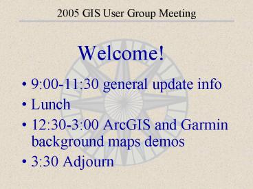
2005 GIS User Group Meeting
- Welcome!
- 900-1130 general update info
- Lunch
- 1230-300 ArcGIS and Garmin background maps
demos - 330 Adjourn
2
2005 GIS User Group Meeting DRS Updates
- DRS sites in every networked office and in many
offices with DSL/VPN internet connections - Automated updates to network/VPN sites occur
weekly or twice weekly amount updated size of
data files to update linespeed - Many people creating stand-alone DRSs for their
laptops/portable hard drives
3
2005 GIS User Group Meeting DRS Updates
- Biggest change to DRS sites is addition of FSA
imagery - Some sites had to have 3 meter DOQs removed to
make enough room - Can view FSA status at
4
2005 GIS User Group Meeting New Data
- PRIM
- Natural Heritage database Biotics
- Lake basin morphology
- Lake basin fetch and maximum length/width
- Lake basin littoral zone
- DNR 100k lakes rivers, wetlands, hydrology
- Restorable depressional wetlands
- Fisheries acquisitions
- Conservation Officer boundaries
- Administrative Area Unit boundaries
- DOT railroads and runways
- WMAs, WMA cover types, wildlife admin boundaries
- 2003-2004 FSA imagery
5
2005 GIS User Group Meeting New Data
Public Recreation Information Maps (PRIM) 15
maps have been updated - 10/2004
See QUICK THEMES SCANNED MAPS DNR PRIM Maps
6
2005 GIS User Group Meeting New Data
Rare and Natural Features Basics
- The Natural Heritage Nongame Research Program
(NHNRP) has a new database system called Biotics - Data are now maintained as polygons rather than
points - Allows depiction of the actual shape of rare
feature occurrences on the landscape. - Incorporates locational uncertainty (i.e. any
uncertainty as to where the actual observation
occurred)
7
2005 GIS User Group Meeting New Data
Rare and Natural Features
See QUICK THEMES EVENTS AND SIGHTINGS Rare
Natural Features - Polygons
8
2005 GIS User Group Meeting New Data
New Lake Data Lake Basin Morphology - Lake
polygons with an attribute table of morphometric
indices which describe the physical form and
structure (morphology) of a lake
See QUICK THEMES HYDROGRAPHY
9
2005 GIS User Group Meeting New Data
Lake Basin Fetch and Maximum Length/Width Linear
features representing the Fetch, Maximum Length
and Maximum Width of a lake basin
See QUICK THEMES HYDROGRAPHY
10
2005 GIS User Group Meeting New Data
- Lake Basin Littoral Zone - Observed
Polygons showing the estimated littoral zone of a
lake
Lake Basin Littoral Zone Shoreline to 15-ft
depth contour
Calculated littoral zone based on the area of a
lake from shore to the 15-ft depth contour
See QUICK THEMES HYDROGRAPHY
11
2005 GIS User Group Meeting New Data
- DNR 100k Lakes and Rivers - "lake_dnrpy2".
- DNR 100k Hydrography - "watr_dnrpy2"
- DNR 100k Wetlands - "wetl_dnrpy2"
- Datasets went through a major revision
- Data have been converted into ArcView and the
attribute tables restructured and enhanced to
better support DNR business practices - DNR Division of Waters Lake Numbers were added
and many outlines were redigitized
12
2005 GIS User Group Meeting New Data
- Restorable Depressional Wetland Inventory Basics
- Created by USFWS
- Represents drained, potentially restorable
wetlands in agricultural landscapes - Created primarily through photo-interpretation
of 140,000 scale color infrared photographs
acquired in April and May, 1991 and 1992
See QUICK THEMES HYDROGRAPHY Restorable
Wetland Inventory
13
2005 GIS User Group Meeting New Data
Restorable Depressional Wetland Inventory
Spatial Extent Big Stone, Carver, Douglas,
Faribault, Freeborn, Grant, Jackson, Kandiyohi,
Polk, Pope, Rice, Scott, Stevens, Swift,
Stearns, and Traverse counties
See QUICK THEMES HYDROGRAPHY Restorable
Wetland Inventory
14
2005 GIS User Group Meeting New Data
- Fisheries Acquisitions Basics
- Shows lands acquired by DNR Fisheries through
purchase, donation and easement - As of March 15, 2004, 98 of NE and SE Minnesota
trout stream acquisitions are complete and
digitizing continues statewide - Fisheries Acquisitions hotlinked to scanned deed
documents that describe the acquired parcel - See QUICK THEMES OWNERSHIP State Land Admin -
Division of Fisheries (Sub 40)
15
2005 GIS User Group Meeting New Data
Enforcement Officer Patrol Areas Basics
- Updated to include changes made to the officer
patrol area boundaries as of 10/20/2004 - Additional attributes have been added including
Station name, Officer Name and Contact phone - Will be updated on a regular basis
- See QUICK THEMES ADMINISTRATIVE FEATURES DNR
Division of Enforcement Officer Patrol Areas
16
2005 GIS User Group Meeting New Data
- Administrative Unit Area Boundaries Basics
- Administrative boundaries files for Fisheries,
Forestry, Trails and Waterways, Waters and
Wildlife have had their attributes standardized - Managed and kept up-to-date by division GIS staff
- Tables now include the following attributes
- SQMI - Administrative Area, area in square miles
- AREA_ID - Administrative Area Identification
number - AREA_NAME - Administrative Area Name
- ADDRESS - Address of Contact person
- CITY - City of Contact person
- STATE - State of contact person
- ZIP - Post Office Zip Code
- PHONE - Phone number of contact person
- FAX - Fax number of contact person
- FACILITY_S - Site ID of Contact
17
2005 GIS User Group Meeting New Data
DOT Basemap Airport Runways / Railroads Basics
- Updated versions of these layers were downloaded
from the DOT website - Metadata was also updated
- See QUICK THEMES TRANSPORTATION Airport
Runways or Railroads
18
2005 GIS User Group Meeting New Data
Wildlife Administrative Areas Basics
- Wildlife Management Areas
- WMA Cover Types
- Wildlife Administrative Areas
19
2005 GIS User Group Meeting New Data
- 2003-04 FSA Photos Most anticipated data layer
in recent memory - Original delivery from FSA
- Quarter-quad tiles 12 square miles
- 125 MB per image 6591
images - 855 GB total storage volume
- Final Product on DRS
- 4 quadrangle tiles 204
square miles - 70 mb per image 475 images
- 28.4 GB total storage volume
20
2005 GIS User Group Meeting New Data
21
2005 GIS User Group Meeting New Data
2003-04 FSA Photos
- Compression saves lots of disk space
- Fewer tiles improves draw speed and reduces
overhead - Less data maintenance
22
2005 GIS User Group Meeting New Data
- Imagery collected during the summer months
- June 2276 (light green)
- July 2324 (dark green)
- August 1364 (tan)
- September 19 (brown)
- White areas were not collected. These areas were
acquired in 2004
23
2005 GIS User Group Meeting New Data
New Data 2003-04 FSA Photos
- Early summer imagery tends to look better than
late summer imagery - More contrast in the early images because there
are more shades of green in the image - Late summer images are more of a solid green with
less contrast
24
2005 GIS User Group Meeting New Data
New Data 2003-04 FSA Photos
- Some imagery is missing!
- These areas have been re-done and will be
available some time in 2005 - Preliminary products have been produced but are
not yet available. - We should get delivery spring of 2005
- Data is available to non-DNR staff via the Data
Deli
25
2005 GIS User Group Meeting Landview
- Current version is 3.9.1 released 12/12/04
- New features include
- Import table
- Allows user to
import table file
of
coordinates and
save as a
shapefile
26
2005 GIS User Group Meeting Landview
27
2005 GIS User Group Meeting Landview
28
2005 GIS User Group Meeting Landview
- Can also create new or edit existing tables
(Access from the Display Window)
29
2005 GIS User Group Meeting Landview
- Basic ArcView table management functions become
available - Add field
- Delete Field(s)
- Add record
- Delete record(s)
- Refresh
30
2005 GIS User Group Meeting Landview
- Give/modify field definitions
- Assign values
- (one value at a time)
- Get statistics
- (numeric data)
- Works with data you have access to alter/write to
. . .
31
2005 GIS User Group Meeting ArcView
- Current department standard remains ArcView
3.2/3.3 - QuickThemes has been expanded
- Additional extensions and improvements to
existing extensions - Additional symbolsets
32
2005 GIS User Group Meeting DNR Toolbox
- DNR Toolbox extension continues to be updated
see the dictionary document - DNRTOOLBOX_DIC.DOC
33
2005 GIS User Group Meeting Symbolsets
- In the past year a couple of new symbol sets for
ArcView have been developed - Available on DRS in the ArcView Symbols folder
- \drs\apps\arcview\symbols
- These can be loaded into ArcViews Palette
Manager and saved
34
2005 GIS User Group Meeting Symbolsets
- MNDNRLINESYM a set of line symbols originally
developed for fire response map symbology - Cannot change the color of these lines!
35
2005 GIS User Group Meeting Symbolsets
- STIPPLEFILL this set of symbols contains a
number of commonly available fill styles not
previously available in ArcView - Note the swamp symbol!
36
2005 GIS User Group Meeting Symbolsets
- WEBPAL This is a set of Colors designed for WEB
production - Non-dithering colors result in pure symbols
- Not a new set but many dont know of it
37
2005 GIS User Group Meeting Symbolsets
- ARTIST
- A set of gradient colors
- Several thousand colors available
- Not a new set but many dont know of it
38
2005 GIS User Group Meeting Symbolsets
- PANTONE
- A set of pantone compatible colors
- Several thousand colors available
- Unfortunately, no number associations listed
- Not new but many dont know of it
39
2005 GIS User Group Meeting Symbolsets
- You can load symbol sets using the Symbol Window,
Palette manager - Select the symbol type
- Load loads a symbol set
- Save Saves a symbol set
- Clear clears the symbols
- Make Default sets the current symbols as
default. - Creates a file called default.avp in the temp
folder. - Reset resets the symbol set to the original one
provided with ArcView
40
2005 GIS User Group Meeting DNR Garmin
- Current version is 4.4.2 released 09/27/04
- New features include
- Real-Time Collection
- Specify Tolerances (Time and Distance)
- Mark Point tool in Arcview
- Point, line or polygon shapefile created
- Enhanced functionality with Landview
41
2005 GIS User Group Meeting DNR Garmin
- Waypoint Symbol Lookup (Double-click
in Symbol field) - USB Connection
- Sort Waypoint Table
- (Click on field heading)
- New symbols appear in Garmins list of waypoints
42
2005 GIS User Group Meeting Bugzilla
Go Go BugZilla!
- MIS has recently implemented a software program
for reporting and tracking software bugs - Called BugZilla, this program is a Web Based tool
that can be used submit bug reports for software - Once a bug is reported, the person who manages
the software is e-mailed - The software bug archives can be searched to see
if this bug has already been reported and also to
check on the status of bug fixes or workarounds - All through a Web Browser interface
43
2005 GIS User Group Meeting Bugzilla
- BugZilla can be found at
- http//mini-me.dnr.state.mn.us/bugzilla
- Several program options
- Search Existing Bug Reports,
- Enter a new bug report
- Summary reports and charts
44
2005 GIS User Group Meeting Bugzilla
2005 GIS User Group Meeting Bugzilla
45
2005 GIS User Group Meeting Bugzilla
- The Enter Bug option shows a list of registered
software - Select the software to report the bug for
46
2005 GIS User Group Meeting Bugzilla
- Record the Bug Specifics here!
- Not only bugs but also enhancements
- Submit the bugs using the Commit Button
47
2005 GIS User Group Meeting DRS Manager
- The DRS Manager program was designed to
- help assist GIS administrators and field users
- to build and keep current remote Data
- Resource Sites. Some key features include
- Build stand-alone Data Resource Site
- Update data and applications
- Delete Data
48
2005 GIS User Group Meeting DRS Manager
- Pros of a stand-alone Data Resource Site
- Access to Landview and Arcview (Quick Themes) in
a non-networked location - Easy to switch back and forth between Networked
and Stand-Alone DRS - Arcview projects read DRS data regardless of
drive. (Set DRS_LOC appropriately) - Smaller, local datasets draw quicker
49
2005 GIS User Group Meeting DRS Manager
- Cons of a stand-alone Data Resource Site
- Dynamic data/programs go out of date
- Located in an editable location possible
corruption of data - Updating a stand-alone DRS requires access to a
networked DRS
50
2005 GIS User Group Meeting DRS Manager
- The DRSmanager can be found at
- \DRS\apps\drsmanager\drsmanager.exe
- Follow the five numbered steps, and
- remember, if you go back a step, you must
- redo the steps after it.
51
2005 GIS User Group Meeting Data Deli II
- The Data Deli II includes more data and a more
sophisticated interface for selecting and serving
data - Intended for external (non-DNR clientele)
- Data shipped in zip format via an email notice
and FTP link link remains valid for 48 hours - Unzipping data does NOT create a DRS site
52
2005 GIS User Group Meeting The Joy of Imagery
- 2003 FSA Air photos have been one of the most
anticipated new GIS datasets in recent memory - Generally, imagery requires large volumes of disk
space - FSA, USGS, Met Council and Resource Assessment
imagery make up over 60 of the volume in the
DNRs GIS Database - And we anticipate that we will be getting more of
it in the future! - This presents a challenge for data storage,
distribution, backup and access
53
2005 GIS User Group Meeting The Joy of Imagery
- One option that is emerging is a centralized
image service that can distribute imagery via the
network - Web Mapping Services or WMS
- A WMS provides imagery via a standard request
- Give me this image for this area at this
resolution
54
2005 GIS User Group Meeting The Joy of Imagery
- This type of service provides an image that is
optimized for web downloads - All processing is done on the Server.
- Only one file/image to deal with
- Multiple tiles are mosaiced, resampled and
delivered - The image is only as big as the viewing area in
this case the size of the view on your screen - You never see things draw tile-by-tile
- The popular TerraServer is an example of a WMS
55
2005 GIS User Group Meeting The Joy of Imagery
6 tiles
Notice that as the area displayed gets larger,
the draw times for the WMS layer are pretty
consistent while the draw time for the DRS layers
increases rapidly.
56
2005 GIS User Group Meeting The Joy of Imagery
- Overall, the larger the area viewed, the better
WMS services become
57
2005 GIS User Group Meeting The Joy of Imagery
- The DNR developed a WMS Client for ArcView
- Called the DNR WMS Client
- Reads OGC files to learn about WMS services
- OGC Files are found in V\DRS\APPS\WMSCLIENT
- Works just like a normal ArcView theme
- Each time you zoom, pan or change your window a
new image is requested from the WMS
58
2005 GIS User Group Meeting The Joy of Imagery
Add WMS Theme Button
WMS Client Menu
59
2005 GIS User Group Meeting The Joy of Imagery
- Add WMS Image
- Add an image specifying the OGC file
- Download WMS Tiles
- Downloads imagery at a specific cell size clipped
to a rectangle as a series of tiled images - This can be used by folks who want to go off-line
and still have high resolution data - Save WMS Image to Disk
- Saves the current image to disk
60
2005 GIS User Group Meeting The Joy of Imagery
- Whats Next?
- Integrate into QuickThemes
- Refine printing process
- Develop WMS Capabilities in-house
- Already exists for some data, just not FSA images
we hope to have this soon and are waiting on a
vendor to produce! - LMIC currently has a WMS that is serving FSA data
61
2005 GIS User Group Meeting The Joy of Imagery
- WMS Positives
- Fast Access
- Reduced costs for overhead and delivery
- More efficient management of data
- More and more WMSs are available
- Iowa, LMIC, Data Deli
- WMS Negatives
- Need relatively speedy internet access
- Dont control your own imagery
- Doesnt work when WMS is down
- Have to download lots of imagery for printing
62
2005 GIS User Group Meeting Internet Links
- Collection of DNR links
- Your Internet favorites folder is located under
DOCUMENTS AND SETTINGS \USERNAME\FAVORITES - Added by network folks when updating computers,
but you can also copy it into your FAVORITES
folder - Coming to network W\ drives soon
63
2005 GIS User Group Meeting Intranet Pages
- Intranet GIS/GPS resources can be found at
http//dnr.state.mn.us/mis/gis
64
2005 GIS User Group Meeting Training
- Training and special events can be found at
http//dnrnet.state.mn.us/mis/gis/events.html - Spring 2005 training includes
- Introduction to GPS
- Division-specific training (forestry, fisheries)
- Contact your Regional GIS Coordinator with
training requests youll be added to a waiting
list and be the first notified when a new class
is offered
65
2005 GIS User Group Meeting File Management
- Do you know what is on your hard drive?
- When you save a file, do you know
- where you saved it
- what the file name is
- File management especially important for GIS and
GPS users (number of files and versions of those
files) - Use MY COMPUTER or Windows Explorer to manage
your files regularly
66
2005 GIS User Group Meeting File Management
Right click
67
2005 GIS User Group Meeting File Management
- Dont compress
drives to save space - Try to save data on drive other than C, as if
Windows goes bad, the C drive must sometimes be
reformatted . . . - Reminder NAS drives are NOT backed up
68
2005 GIS User Group Meeting File Management
- Create a folder hierarchy to contain
files - PROJECTS\REDLK
- \OHV
- \WMAs
- \data
- \maps
- \reports
69
Transitioning to ArcGIS
- The DNR is using ArcView 3.x as it desktop GIS
- Many organizations we work with are moving to the
latest versions of ArcView - 8 and more recently 9
- Should you change?
- Its not an easy question to answer
70
Transitioning to ArcGIS
- DNR GIS Software Policy
- Governed by the department GIS Policy and
Planning Committee - unanimous in its opinion that Arcview 8 offers
few functional advantages over Arcview 3, and
that on a cost-benefit basis, there has been very
little incentive to promote the change - ButArcView 3 will not be supported forever
- Should be around for 3-4 years
71
Transitioning to ArcGIS
- To date there has been a lack of support from the
GIS section. - This is changing
- Training course development is planned
- Tools are being migrated (QuickThemes)
- Some organizations are forcing users to upgrade
- the DNR is not following that path
- No new major software development will be done in
ArcView 3.x
72
Transitioning to ArcGIS
- Some Advantages
- Arcview 9 has the look and feel of a typical
Microsoft Windows program. - It has improved map symbol control and a more
flexible mapping environment. - The ArcCatalog application has nice features for
managing your personal data. - You can use data supplied directly from the
Internet - Geodatabases are a new form of storing spatial
data. - On the fly projections
- DNR Quick Themes for Arcview 9 has some nice
enhancements over the Arcview 3 version.
73
Transitioning to ArcGIS
- Some Disadvantages
- Arcview 9 is slower than Arcview 3 and requires
more computing power. - You may have to buy a new computer
- Many users consider Arcview 9 to be less stable
than Arcview 3 (freezes or locks up more) - A lot of the custom DNR tools will be unavailable
for the foreseeable future. - Large tiled, non-image data sets may not work
very well in Arcview 9 (slow draw times). - You will be limited to one layout document per
Arcview project. - You will be required to pay year maintenance fees
74
Transitioning to ArcGIS
- Technical Requirements
Operating the software below the minimum
specifications will result in a desktop that
crashes or locks up more than usual.
75
Transitioning to ArcGIS
- Cost Considerations
- 225 to convert an ArcView 3.x License to 9
- 225 Annual Maintenance fee
- Maintenance entitles you to free upgrades
- If you dont pay now, you pay later.
- Unconfirmed reports of the maintenance rising to
350.00 in 2005 - Requires you to stop using ArcView 3.x after one
year
76
Transitioning to ArcGIS
- ArcGIS has three levels of software
- Arc/Info Full software implementation
- ArcEditor Edit and Create Geodatabases
- ArcView -
- Costs go down as you move from Arc/Info to
ArcView and so does cost - Extensions are available at extra cost
- Spatial Analyst
- 3D Analyst
- Network analyst
- Others.
77
Transitioning to ArcGIS
- ArcView 9 purchases should be coordinated through
MIS/GIS - At this time, budgeting for on-going maintenance
will be through your division - For more information contact
- Robert Maki
- Tim Loesch
- Regional or Division GIS Coordinators
78
Transitioning to ArcGIS
- ArcGIS consists of three modules
- ArcCatalog To manage spatial Data and
attributes - ArcMap Interactive map display and cartographic
output. - ArcToolBox Geoprocessing tools
79
2005 GIS User Group Meeting Field Data Collection
- See the Powerpoint presentation entitled
HANDHELD_COMPUTERS.PPT
80
2005 GIS User Group Meeting GPS Background Maps
You can use DNR GIS data to create background
maps for your Garmin Map GPS
81
2005 GIS User Group Meeting GPS Background Maps
- The uploading capability DNRGarmin provides
allows some mapping capabilities in all Garmins,
but there are drawbacks for storing reference
data as waypoints or tracks - Limited amount of storage, especially for
detailed line and polygon data - Little control of the display in GPS, especially
when adding numerous types of data to reference - Uploaded waypoint and track data takes up space
that may be needed for data collection - Constantly uploading and downloading data used
for reference in the field can take up a lot of
time
82
2005 GIS User Group Meeting GPS Background Maps
- MapSource background maps can be purchased/used,
but they dont provide the detail that DNR data
can - Tim Loesch researched a background map solution
-- a set of shareware programs on the internet - Cgpsmapper
- GPSMapEdit
- GPSSendMap
83
2005 GIS User Group Meeting GPS Background Maps
- GPSMapEdit program creates Garmin background maps
from ArcView shapefiles - Background maps have several advantages over GIS
data that is uploaded as waypoint or tracks - Store larger, more detailed GIS data sets (i.e.
FIM Inventory) as rather than generalizing
(smoothing) track data - Load as many background layers as you wish up to
GPS storage limits - Turn display of map layers on and off in GPS
- Use different point, line or polygon symbology
for background maps and create labels that can be
turned on and off in GPS - Still cant load raster data into GPS (i.e. FSA
photos and PRIM maps)
84
2005 GIS User Group Meeting GPS Background Maps
Compatible GPSs below (also the GPSIII Plus, GPS
12 map)
85
2005 GIS User Group Meeting GPS Background Maps
- Uploading smaller GIS datasets as waypoints or
tracks through DNRGarmin for navigation is
easier, especially for GIS data that is updated
more frequently - Background maps only work with Garmin Map GPS
models - If you need to load large GIS datasets to
reference on the GPS in the field, use background
maps - If wanting to view background map photos, youll
need to spend some more money to get a tablet PC,
or some kind of handheld computer with GIS and
GPS capabilities
86
2005 GIS User Group Meeting GPS Background Maps
- Documentation for the GPSMapEdit software is
currently not up to par for most GIS users - GPSMapEdit is cumbersome easier to get input
from you, the user, then hand off the development
of background maps to MIS and Division GIS
specialists - Creating background maps as standard layers to be
shared among DNR users needs some coordination
were addressing that soon
87
2005 GIS User Group Meeting GPS Background Maps
- A single background map can be made up of a
combination of point, line, and polygon features
along with labels and symbology for each feature
type (resulting map can resemble a PRIM map) - Keeping feature types as separate background maps
may be best -- it gives the user more options for
displaying certain features, just as if they were
turning on/off GIS layers and labels in ArcView
or Landview
88
2005 GIS User Group Meeting GPS Background Maps
- Two flaws have been encountered when creating
background maps from polygon features - Outlines of polygon features seem to disappear
when displaying the background maps in the GPS - Island or holes in polygon features seem to cause
problems when creating polygon backgrounds - To resolve missing polygon boundaries, outlines
are turned into line features, then lines can be
labeled - Using polygon features in background maps is
still useful to display interactive labels for
features - Holes that fill when importing polygon features
into the MapEdit program can be refreshed so
they no longer appear as part of the polygon
89
2005 GIS User Group Meeting GPS Background Maps
- Labels can obscure the view of features in
background maps, especially if they long - Labels can be turned off or set to appear
interactively within the Map Setup options - To create maps that will be used as label
background maps by using point and/or polygon
features - Create centroid points to be used as labels for
line features such as roads or trails if their
density prohibits viewing of other features
90
2005 GIS User Group Meeting GPS Background Maps
- Depending on the GPS model and background map
detail, display of background maps in a GPS may
be painful to view at small scales - Can set to display at specified zoom levels so
the most general background layers will display
at small scales and more detailed background
layers will display as the user zooms in to the
map page - Can modify when point and polygon background maps
start displaying at certain zoom scales within
the Garmins Map Setup options
91
2005 GIS User Group Meeting GPS Background Maps
- Requirements to load background maps
- Sendmap.exe loaded on computer c\gpssendmap\sendm
ap.exe (Setup file located V\drs\apps\gps\gpssend
mapsetup.exe) - Background maps with .img file extension stored
in a folder location without spaces (i.e.
C\GarminMaps) - The standard Garmin download cable with a COM
Port connection. A USB version of sendmap exists
but it has not been fully tested yet . . .
92
2005 GIS User Group Meeting GPS Background Maps
- Options when loading Background Maps
- Doesnt seem to be a limit to the number of .img
files that can be loaded (other than the overall
map memory space) For instance, the Garmin Map 76
has 8 MB map space - Existing background maps including MapSource
maps will be erased from GPS map memory when
loading new maps (does not include the basemap
that is included in all Garmin Map units)
93
2005 GIS User Group Meeting GPS Background Maps
- There are different menus and terminology used
among the Garmin Map units to set up Background
maps, but options include - Display only the background maps that you select
- Adjust the map detail (adjusts the scale at which
each zoom level will start displaying) - Display point and polygon labels
- Display point and polygon features depending on
Zoom Level
94
2005 GIS User Group Meeting GPS Background Maps
Setting a background map in a Garmin Map76
Turn on Backgrounds
Background Map Detail
Map Setup
95
2005 GIS User Group Meeting GPS Background Maps
Setting a background map in a Garmin Map76
Turn off Polygon Labels
Polygons display at 300 Ft.
Turn off Point Labels
96
2005 GIS User Group Meeting GPS Background Maps
Background map examples in a Garmin Map76
Interactive Label Display
Point Feature Off, Interactive Polygon Label
Display
97
2005 GIS User Group Meeting GPS Background Maps
Interactive Label Display
Label Display
Interactive Label Display
98
2005 GIS User Group Meeting
- Thanks for attending!
- Go to http//dnrnet.state.mn.us/mis/gis to access
this slideshow
Recommended
CrystalGraphics Presentations


