
Advanced Land Administration Systems and Solutions - PowerPoint PPT Presentation
Title:
Advanced Land Administration Systems and Solutions
Description:
AIOS is one of the most experienced providers in efficient and effective land administration and management solutions designed to uncomplicate various processes related to the proper management of land parcels across a jurisdiction, including their taxation, security of tenure, and other regulations and procedures implemented by the governing agencies of a particular region. – PowerPoint PPT presentation
Number of Views:70
Title: Advanced Land Administration Systems and Solutions
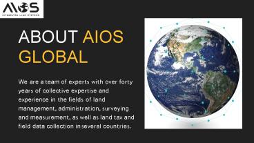
1
ABOUT AIOS GLOBAL
We are a team of experts with over forty years
of collective expertise and experience in the
fields of land management, administration,
surveying and measurement, as well as land tax
and field data collection in several countries.
2
Land Administration Systems for Agencies
We offer land administration systems and
solutions for efficient land management and to
speed up various land related processes. The
goal here is to simplify the tasks of the users
and increase productivity.
3
AIOS' Receivers, Using Global Navigation
Satellite Systems
GNSS is a blanket term used for a group of
satellites designed to provide precise
coordinates corresponding to a location. Our
receivers have been created to take advantage of
the Global Navigation Satellite Systems in the
field of land surveying.
4
Land Management
Solutions for Enabling Security of Tenure
With our state of the art solutions, your agency
can ascertain fair security of tenure for all
regions. In fact, we can help you cultivate a
positive relationship between authorities and
land owners through the effective implementation
of the necessary practices and our systems.
5
Systematic Land Registry Via AIOS Land
Management Systems
Field data collection and related tasks are made
extremely convenient with our services. Ensure
systematic land registry with features like
movable properties and titles registry, land
records management, and GIS, which will help you
create and store records safely and in an easily
procurable manner.
6
Enhanced Precision with Europea Global Navigation
Satellite System Devices
- AIOS offers satellite receivers that relay
signals to and from the European Global
Navigation Satellite System, a constellation of
satellites also known as Galileo. Called the AIOS
GNSS, these come with a Star Fire license for a
lifetime to ensure centimetre-level precision at
all times.
7
SATELLITE BASED NAVIGATION SYSTEM - ACCURACY AND
PRECISION
In a satellite based navigation system, there are
multiple satellites known together as a
constellation, that transmit signals to pinpoint
locations and timing. AIOS uses the power of the
European GNSS in its land measurement and
surveying equipment for excellent accuracy.
8
Phone Number 41 78 644 14 90 385 99 520 9444
Contact Us
Email Address
kuzo_at_aios.global
Website https//aios.global/
Recommended
CrystalGraphics Presentations


