
Steps To Perform Bathymetric Surveys - PowerPoint PPT Presentation
Title:
Steps To Perform Bathymetric Surveys
Description:
Bathymetry is the study of the bed of a waterbody, including mapping of showcases on charts to deliver information on water depth. To help navigation and inform scouring activities, bathymetric Surveys are used. – PowerPoint PPT presentation
Number of Views:168
Title: Steps To Perform Bathymetric Surveys
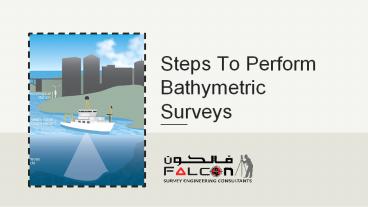
1
Steps To Perform Bathymetric Surveys
2
What is Bathymetric Survey?
- Bathymetric is the study of the floor of a
waterbody, which includes mapping of features on
charts to offer details on water depth. These
charts are usually made to help navigation and
inform dredging activities. For instance, during
maintenance of navigational channels. It is used
as an echosounder attached to the survey board.
They also analyze and define the tides,
surroundings, currents, and shorelines to make a
better model of the area features overall.
3
HOW TO PERFORM A BATHYMETRIC SURVEY?
Equipment Inspections and Calibration
Mobilize Each Equipment
01
02
Deployment and Equipment System
Sound Casting
03
04
Begin the Survey
Check the Data Before Demobilization
05
06
Demobilize
Process the Data
07
08
4
1. Equipment Inspections and Calibration
2. Mobilize Each Equipment
- In the survey area, mobilization of all equipment
can involve transporting the survey boat and
launching it. This is only transport of equipment
which can then be used on a local hire boat as
that can be more cost-effective in some cases.
- When appearing on site, this is crucial to make
sure equipment is in the main condition.
5
3. Deployment and Equipment System
- This contains the setting up of a bespoke frame
which is applied to add all the equipment tightly
to the boat. When the boat is moving to make sure
high-quality data, this keeps it firmly in place.
The transducer is involved in the underwater
portion of this frame and the GNSS (GPS)
transmitters are affixed at the top of the frame
to have as great a view of the sky as potential.
The control hardware the echosounder and the
GNSS controllers are then linked via marine
cables to all additional equipment and the
control computer. The software is then placed up
with details about the survey noted in its
records.
6
4. Sound Casting
- Measurement of the speed of sound at a Width site
to calibrate the transducer. This is because the
speed differs with salinity and temperature it
can considerably affect the reading of depth.
7
5. Begin the Survey
6. Check the Data Before Demobilization
- Whilst monitoring the depth data over the whole
area to be surveyed, this includes driving the
boat. This is done by following subsequent lines.
These lines will be very close together in narrow
waters and where the accuracy needed is high.
- This is a fast look at overall data gathered to
see whether any apparent areas require additional
data collection.
8
7. Demobilize
8. Process the Data
- Power down all equipment, detach, and clean with
fresh water.
- Utilizing specialized software, the data must be
handled with a powerful workstation computer. Any
inaccurate data is eliminated, and the final map
is created.
9
- Bathymetric surveys will be beneficial if all the
steps are performed effectively. The above
information can be helpful to know more about
these steps. These steps will guide how to make
surveys and how to use data collected through
them.
10
Contact
- 209, 2nd Floor - Apricot Tower
- P.O. Box 238544, Dubai Silicon Oasis
- Dubai - United Arab Emirates
- Tel 971 4 3271414
- Email info_at_falconsurveyme.com
- https//www.falconsurveyme.com/contact-us/