
Geospatial Technologies - PowerPoint PPT Presentation
1 / 28
Title: Geospatial Technologies
1
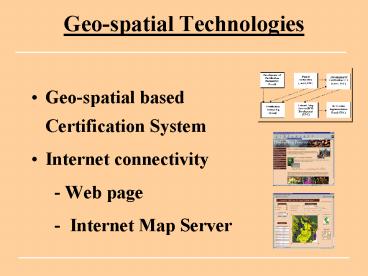
Geo-spatial Technologies
- Geo-spatial based Certification System
- Internet connectivity
- - Web page
- - Internet Map Server
2
Certification e.g. Organic, Fair Trade
3
Environmentally Sustainable Certification
e.g. shade grown, bird friendly, EKO-OK
(CAN)
4
GPS Parcel Delineation
Parcel Center
Parcel Corners
Parcel Boundaries
5
Development of a Location Database
6
Data Collection Forms
7
Database of Certification Monitoring Information
8
Upper Huallaga
Parcel Mapping
9
Zonal Mapping
10
(No Transcript)
11
GIS Analysis
Grower Locations and Agro-ecological Zones
12
Satellite Data for Environmental Monitoring
Upper Apurimac
13
Spatial Data
Database records
14
(No Transcript)
15
(No Transcript)
16
3D of Mt. Elgon with Appellation Zone
17
Coffee Production Zones
Yirgacheffe
Source FAO, 1984
18
(No Transcript)
19
Training
20
(No Transcript)
21
(No Transcript)
22
Cameroon Pilot Study
Village Site
IITA Benchmark
23
Methods
- Selection of 20 village-based extension agents
who have received training from USGS and IITA in
use of GPS technologies. - Agents collect data on location, production and
post harvest methods .
24
- Production and post harvest data
- Cocoa type and genetic characteristics
- Sources of labor used,
- Type, levels and application methods of
pesticides, - Biological and mechanical pest and disease
control - Means of fermentation, drying and storage
- Ecological characteristics of the cocoa
plantation - Extent of shade coverage
- Size and location of cocoa agro-forest
- Type and amount of forest biodiversity maintained
- Soil texture and color, slope, etc.
- Geo-referenced production
25
Farmer Data
26
Handheld Data Collection Devices
Connecting geo-referenced data and other field
data
27
Le caracteristiques d un bon handheld device
- Programmable
- Durable
- Connects to GPS
- Reasonable COST
- Easy to use (data entry, downloading data
28
Prix des handhelds et des accessoires
- Handheld device 200 2000
- PDA (e.g. Palm, Ipaq, Zaurus)
- Trimble
- Cables 50
- Software 0 3000
- Shareware (free)
- ESRIs ArcPad
Recommended
CrystalGraphics Presentations


