
NASA Water Resources - PowerPoint PPT Presentation
1 / 31
Title: NASA Water Resources
1
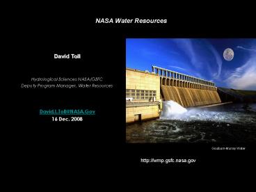
NASA Water Resources
David Toll Hydrological Sciences
NASA/GSFC Deputy Program Manager, Water
Resources David.L.Toll_at_NASA.Gov 16 Dec. 2008
Goulburn-Murray Water
http//wmp.gsfc.nasa.gov
2
(No Transcript)
3
NASA Hydrology Related Missions
SMAP - Global Soil Moisture
4
Precipitation from Space
Tropical Rainfall Measurement Mission (TRMM)
Global Precipitation Measurement (GPM)
TRMM is the first "space-based rain gauge" that
uses microwaves to "see" how much precipitation
falls from clouds around the tropics over land
and ocean with unparalleled accuracy. TRMM also
is the primary mission for studying El
Nino. Global precipitation measurement with
TRMM a great leap forward! 10 ? 85 GHz
radiometers 13.6 GHz precipitation radar
(FIRST!)
- Needed improvements
- - Longer record length
- - High latitude precipitation including snowfall
- - Better accuracy
- - Spatial-temporal sampling
- - Improved vertical resolution
5
Soil Moisture Active/Passive (SMAP) Mission
- Decadal Survey recommended that
- a dedicated soil moisture mission recently
selected as one of two new Earth science mission - NASA fly an active / passive microwave soil
moisture F/T mission in the 2013 timeframe - SMAP consists of an L-Band radar radiometer in
a low Earth, sun-synchronous orbit
Societal Benefits
- Weather Climate Prediction
- Severe Storm Forecasts
6
Surface Water Mission Concept (SWOT) Stream
Discharge and Surface Water Height
- Motivation
- critical water cycle component
- essential for water resource planning
- stream discharge and water height data are
difficult to obtain outside US - find the missing continental discharge component
Mission Concepts
Laser Altimetry Concept e.g. ICESat (GSFC)
Radar Altimetry Concept e.g. Topex/Poseidon over
Amazon R.
Interferometer Concept (JPL)
Targeted path Coincident w/ river reach
7
NASA Applied Sciences ProgramA Pathway Between
Earth Science Society
Results of NASA Earth Science Research
Uses by Partners and Stakeholder Communities
NASA Applied Sciences Program
8
NASA Societal Benefit Areas
9
NASA Applied Sciences Program Water Resources
Goal NASA Earth science routinely used in an
integrated water resources approach for the U.S.
internationally for the sustainable use of
water. Also includes extreme events of drought
and floods and the adaptation and mitigation to
climate change.
?For International activities many NASA
satellite and modeling products (e.g.,
precipitation and streamflow) the application to
data poor countries of the world may be much more
valuable. ? NASA data are typically free with
open use of data. In many cases may be obtained
in near-real time and retrospectively. ?
International work primarily through groups such
as USAID, Department of State (Paul Simon Water
for the Poor Act ), World Bank, GEO (Global Earth
Observing), USAID ? Water Resources categorized
in to functional themes (Application Funded
Projects, 54 Projects funded with close coupling
or emphasis to the end user) - Streamflow and
floods (includes snowpack 4-Projects -
Drought (monitoring and prediction)
4-Projects - Irrigation and Water Delivery
(emphasis on Evapotranspiration) 3-Projects -
Water Quality 1-Project Ended - Climate
Change and Water Resources (New)
10
Regional Visualization Monitoring System
(SERVIR)
- Highlights
- ? Real time weather monitoring.
- Tools to monitor floods, wildfires, volcanoes,
harmful algal blooms and ecological changes. - ? Through SERVIR, the Panama National civil
defense agency issued an advisory to two regions
for evacuation. Accumulated rainfall during
Panama floods as detected by the Tropical
Rainfall Measuring Mission. Sept. 17 18 2004. - ? Extended to East Africa with emphasis on floods
and public health - TRMM image courtesy Hal Pierce, Dr. Robert
Adler/TRMM Project
11
LIS Uncoupled/Analysis Mode
Inputs
Physics
Outputs
Applications
Topography, Soils
Land Surface Models
Soil Moisture Temperature
Weather/ Climate Water Resources Agriculture
Drought Military Ops Natural Hazards
Land Cover, Vegetation Properties
Evaporation Sensible Heat Flux
Meteorological Forecasts, Analyses, and/or
Observations
Runoff
Data Assimilation Modules
Snow Soil Moisture Temperature
Snowpack Properties
12
(No Transcript)
13
NASA Land Information System (LIS) Land Surface
Hydrology at AFWA
Implemented Operationally at the Air Force
Weather Agency (AFWA) to Replace their Global
AGRMET Data of Soil Moisture, Soil Temperature,
and other land hydrologic variables. Also
implemented at NOAA NCEP, INPE-CPTEC, and
numerous universities and research groups.
FEWS-NET, NOAA NOHRSC
AFWA AGRMET Soil Moisture
LIS Soil Moisture (1 km)
29-August-2005 at 1800 UTC Covering Afghanistan
and Portions of Pakistan Army Remote Moisture
System (ARMS) Moran and others
14
Extending to Mid-East and North Africa. Also
Iraqi emphasis with USDA Foreign Agriculture
Service
M. Ozdogan/U. Wisc
15
LIS Running Modes
Coupled or Forecast Mode
Uncoupled or Analysis Mode
WRF/ GFS/ GCE
Station Data
Global, Regional Forecasts and (Re-)Analyses
ESMF
Land Sfc Models (Noah, Catchment, CLM, VIC,
HYSSiB)
Satellite Products
Kumar, S. V., C. D. Peters-Lidard, J. L. Eastman
and W.-K. Tao, 2008. An integrated
high-resolution hydrometeorological modeling
testbed using LIS and WRF. Environmental
Modelling Software, Vol. 23, 169-181.
16
GRACE Data Enables More Accurate Water Budget
Predictions
GRACE water storage, mm January December 2005
Loop
Model assimilated water storage, mm January
December 2005 Loop
Zaitchik, Rodell, and Reichle, in preparation
Matt Rodell NASA GSFC
17
(No Transcript)
18
Data Integration in GLDAS
http//esdis.eosdis.nasa.gov/
INTERCOMPARISON and OPTIMAL MERGING of global
data fields
Satellite data products used to PARAMETERIZE and
FORCE sophisticated land surface models
ASSIMILATION of satellite based land surface
state fields (snow, soil moisture, surface temp,
etc.)
Ground-based observations used to EVALUATE model
output
Matt Rodell Hydrological Sciences Branch, NASA
GSFC
SNOW WATER EQUIVALENT
19
NASA - Arab Water Council
- ? US Scientists
- NASA, USDA
- Universities
- ? Regional Partners
- The Arab Water
- Council (AWC),
- MENA Countries
- Nile Basin. Supported
- by USAID World Bank
- ? Project components regional water data
platform (1/8 deg), irrigated and agriculture
land mapping, large scale aquifer monitoring,
river forecasts, climate change downscaling, ET
mapping, precipitation monitoring.
20
NASA Precipitation
Hurricane Ike in Cuba--Heavy, but not extreme
rain, flooding (calculated from hydrological
model) and landslide potential (from real-time
landslide algorithm) indicated along south side
of mountains
24-hr Rain from TRMM Multi-satellite product
http//trmm.gsfc.nasa.gov/publications_dir/potenti
al_flood_hydro.html
21
Satellite Rainfall Estimation G-WADI
Country Report
Zooming to any area of the world
Watershed Report
Rainfall amounts at any point on the globe
U. Irvine
22
NASA funded project to Enhance the Malaria and
Famine Early Warning System (FEWS) with NASA data
- Using NASA data to assist FEWS NET to
- anticipate and warn of humanitarian crises.
- Projecting Rainfall and NDVI data 1-4 months in
future for improved decision support. - Integrated climate data for WHO Health Mapper for
early identification of malaria epidemics. - NASA Data Incorporated
- AURA MLS Relative Humidity
- TRMM Precipitation
- MODIS NDVI
- GIMMS AVHRR NDVI
Projecting MODIS NDVI data 4 months ahead will
give advance warning to food and fodder
production shortfalls.
Southern Africa
Epidemic Malaria Regions where rainfall data
guides health interventions.
Funk and Brown, RSE 2006 v 101 p 249-256
Benefits Improved response and recovery from
food crises and epidemics, reducing costs to US
Government and saving lives.
Funded from 2007-2009
23
(No Transcript)
24
MODIS System Characteristics for Inputs to US
Drought Monitor PI J. Verdin (USGS)
Product Characteristics
Historic
Expedited
Aqua and Terra MODIS
Instruments
Continental U.S. (CONUS)
Extent
250, 500, and 1000 meters
Spatial Resolutions
lt 30 days after last input
1 day after last input
Product Latency
Indefinitely
90 days
Archive Persistence
7-day, Interval
7-day, Rolling
Composite Period
Example eMODIS product Terra MODIS 1000m NDVI
CONUS composite for August 2-8, 2006
NDVI, Surface Refl. Bands, Quality, Acq. Date
Layers
Lambert Equal Area Azimuthal / GeoTIFF
Projection/Format
Processing Flow
Expedited L1B (NOAA NRT)
Long Term Archive and Web-enabled Access
Cloud Mask Processing (MODIS PGE 03)
Surface Refl. Processing (MODIS PGE 11)
Historic L1B (NASA LAADS)
Composite Processing (NDVI, CONUS)
Ancillary Data
Verdin USGS
25
QSCAT, LDAS, and AMSR-E Products
9/5/2005
QuikSCAT
9/4/2004
LDAS
LDAS
AMSR-E
AMSR-E
26
Drought Monitoring Comparison
27
For months now, seasonal forecasts generated by
the GMAO have been processed at GSFC into soil
moisture predictions, and these predictions have
been forwarded to the constructors of the U.S.
Drought Monitor and U.S. Drought Outlook.
Initial conditions (Dec. 1, 2008)
1-month lead (Jan. 1, 2009)
Root zone soil moisture anomaly (expressed as
standard normal deviate)
3-month lead (Mar. 1, 2009)
2-month lead (Feb. 1, 2009)
Drought conditions given a probability to persist
into early March.
-- Started dialogue with some key NIDIS personnel
regarding the potential use of our products in
the upper Colorado River Basin pilot project.
Project
Development of a Robust Drought Index for
Agricultural Applications. (PI R. Koster)
28
(No Transcript)
29
(No Transcript)
30
Water Resource and Climate Variability
As the Earth has warmed, what has happened to
Earths water resources? Recent Trends ?
Precipitation Intensity Increases ? Increased
floods and droughts intensity ? Snowfall
decrease ? Earlier runoff ? Melting of ice
sheets and glaciers ? Sea level rise ? Increase
in hurricane ntensity
38
105
67
393
355
38
1000 km3/yr
31
NASA USDA Collaboration
- Link to Ongoing NASA Applied Sciences Projects
and Data Sets - - Applied Sciences Program has 54 ongoing
projects, many you heard from today. - - Annual Solicitations, Decisions Integrated
Projects (310/Yr over 4 Years) Feasibility
Studies (100K for 1 to 1.5 Years) - - http//nspires.nasaprs.com/external/)
- NASA Earth Science Data are Openly Available and
Free - - https//lpdaac.usgs.gov/lpdaac/
- NASA USGS summary of available MODIS (Land
Cover, Vegetation Index Surface Temp., Albedo,
etc.) - - http//nsidc.org/data/modis/data.html Snow
and Ice MODIS Products - - http//landsat.usgs.gov/products_productinforma
tion.php Landsat data are now free from the USGS - - http//modis.gsfc.nasa.gov/data/directbrod/inde
x.php MODIS from Terra and Aqua Sensors have
direct read-out capability - - Meta data. Global Change Master Directory is a
comprehensive directory of Earth science
information including climate change - Applied Sciences Program previous emphasis on US
agencies. Also pursuing international activities
where use of remote sensing data may be much more
valuable. Water Resources (W. Turner NASA AG) - - SERVIR activities in Central America and West
Africa - - Strong support to US AID Famine Early Warning
System - - Support of Paul Simon Water for the Poor Act
(DoS)