
Watershed Database - PowerPoint PPT Presentation
1 / 27
Title:
Watershed Database
Description:
ORR Watershed Database & Mapping Projects. What is a ... Crustacean. Blue Land Crab. Purple, Blackback, Freshwater. WI Topsnail (whelk) Marine Mammals ... – PowerPoint PPT presentation
Number of Views:28
Avg rating:3.0/5.0
Title: Watershed Database
1
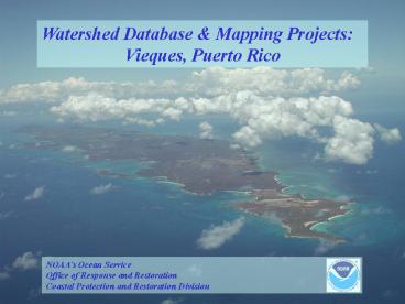
Watershed Database Mapping Projects Vieques,
Puerto Rico
2
ORR Watershed Database Mapping Projects
- What is a Watershed Project
- a collection of data, information and tools to
support the exploration of environmental
questions - a user friendly environment to help a broad range
of users to formulate and ask better questions
3
ORR Watershed Database Mapping Projects
- Watershed Project objectives
- Provide data and tools to users in an easy to use
package - Integrate site specific and watershed wide data
to protect and restore trust resources - Support coordination with external Partners
- Encourage data sharing
4
ORR Watershed Database Mapping Projects
- Support the NOAA Ecosystem approach
- Site support activities collect site specific
data - Multiple sites in a watershed influence health of
system - Watershed Projects bring these data together,
integrate information and provide a resource for
a decision making with a practical watershed
based management unit
5
ORR Watershed Database Mapping Projects
- Watershed Project audience
- Federal, state and local partners including the
public - Build and deploy standardized GIS projects with
our partners - Support all types of users, novice to expert
- Simple, cost effective, portable Query Manager
(QM)/Marplot - Easy to use, online - QM/ArcIMS
- Full function, desktop GIS spatial analysis -
QM/ArcView - ArcMAP
6
ORR Watershed Database Mapping Projects
- Provide Decision Support Tools for
- Assessment
- Site discovery/ characterization
- Remediation
- Extent/ magnitude of contamination
- Source identification
- Restoration
- Habitat/ site identification
7
Current ORR Watershed Projects
- Charles River, MA
- New Bedford Harbor, MA
- Hudson River, NY
- Newark Bay, NJ/NY
- St Lawrence River, NY
- Vieques, Puerto Rico
- Anacostia River, DC
- Christina River, DE
- Delaware River, DE/PA/NJ
- St. Andrew Bay, FL
- St. John River, FL
- Elizabeth River, VA
- Hurricane Mitch, Central America
- Kalamazoo River, MI
- Sheboygan River, WI
- St. Louis River, MN
- Calcasieu Estuary, LA
- San Francisco Bay, CA
- Southern California, CA
- Portland Harbor, OR
- Puget Sound/Duwamish Waterway, WA
- Tulalip/ Quulott, WA
- Metlakatla, AK
- Pearl Harbor, HI
8
Major Components of ORR Watershed Projects
- Query Manager database-mapping application
- ArcView Watershed GIS Project and Custom Tools
(includes ArcView 3.x/9.x, ArcGIS ArcIMS) - Watershed Project Webguide
9
Query Manager 2.61
- Query Manager Database-Mapping application
- Self-contained run-time application (free, no
additional software required) - Standardized watershed databases include studies
from a variety of sources - Menu of standard flexible queries for evaluation
of sediment (surface and subsurface) chemistry,
tissue chemistry, and sediment toxicity - Effect models dioxin toxic equivalency (TEQ),
PAH toxic unit, logistic regression model
probability of toxicity - Application and Databases Downloadable from CPRD
web site http//response.restoration.noaa.gov/cp
r/watershed.html
10
Data exploration Contaminant concentration
Dioxin in surface sediments
11
Data screening QM Sediment Quality Guidelines
- Over 30 individual guidelines supported
- 10 paired guidelines supported
12
Data export QM Tools
Output Data Table
Extract data for ArcView Graphics Statistical
analysis
ArcView/ArcMAP
Graphics
13
ORR ArcView Watershed GIS Project
- Standard Project Layers
- NOS program data
- Digital raster navigation charts
- (110K 1500K)
- Electronic Navigation Charts (ENC)
- Shoreline
- (120K 170K)
- HAZMAT ESI
- FWS National Wetlands Inventory (NWI)
- Older, 124K dataset
- EPA BASINS data
- EPA Regulated facilities
- USGS Hydrology, historic landuse, gage stations
- other basic features
- Project specific datasets
- (Federal, state, municipal, NGO)
- Contaminant data
- Habitat/Species
- Aerial photography
14
ORR ArcView Watershed GIS Project
- Watershed Project Custom Tools
- Query Manager Import Reprojection
- Data import
- Shapefile Generation
- Documentation
- Advanced analytical tools
- Remedial Design
- Ecological Risk
- ESI Tools
- Custom Feature Labeling
- Common tasks
- Integrated HTML Watershed webguide
- Programmatic data purpose
- Query Manager
- ArcView/ArcMAP
- Custom Tools
- Installation
- Tool for ArcView ArcMAP
15
Custom GIS Tools QM Import Reprojection
Utility
QM Import ArcView 3.x
- 3 Ways to easily move QM data to any ArcView
project - Directory templates
- Output projection/datum
- Import files (batch file import)
- Auto-documentation
- QM legend support
QM Direct ArcView 3.x
QM Import ArcMAP
Currently only NOAA 2005 Crab Sampling Tissue
data, but more to come
16
Custom GIS Tools Environmental Sensitivity
Index (ESI) data
ESI data provide information on living resources
and potential sensitivity to an oil spill This
includes
- Shoreline Ranking
- Classified Shoreline
- Sensitivity to oiling
- Biological Resources
- Birds, fish, marine/terrestrial mammals
reptiles - Human-use Resources
- Marinas, port facilities, significant
socioeconomic features
17
Custom GIS Tools Sample Design
- The U.S. EPA FIELDS Sampling Design Tools
- easier to create and implement several types of
sampling plans - Summary Statistics
- Supported Sample Designs are
- Judgmental
- Random
- Systematic (Gridded)
- Linear (River System)
18
Watershed Project Webguide
- HTML Project Webguide for CD-ROM and online
distribution
- Project History, NOAAs role
- Environmental setting/resources
- GIS project metadata/map products
- Application guide/help
- Integrated support to ArcView Project
- Significant Outreach Tool
19
Vieques Watershed Database Mapping Project
Current Resources
- NOAA
- NCCOS/CSC Benthic Habitats of Puerto Rico the
Virgin Islands - ORR/Hazmat Environmental Sensitivity Index data
- (queriable species/habitat, classified shoreline,
selected TE, PDF maps) - OCS ENC Digital Raster Charts
- ORR/CPRD Query Manager Application and GIS Tools
- NAVFAC (Navy CH2MHILL)
- Boundaries (Facilities, AOC/SWMU, barrios,
airports) - Physiographic features (contours, shoreline,
hydrology) - Habitat Features (Mangrove, marsh, seagrass,
coral) - Rectified Aerial Photography (36/37, 59, 62,
64, 67, 70, 84 94, 99) - FWS
- Conservation Area Boundaries
- USGS
- Mainland PR Rectified Aerial Photography (2003)
20
Vieques Watershed Database Mapping Project
Puerto Rico ESI TE Species data
- Crustacean
- Blue Land Crab
- Purple, Blackback, Freshwater
- WI Topsnail (whelk)
- Marine Mammals
- Humpback Whale
- Sperm Whale
- WI Manatee
- Turtles
- Hawksbill
- Green Sea
- Leatherback
- Birds
- Brown Pelican
- Peregrine Falcon
- PR Broad Winged Hawk
- PR Sharp Shinned Hawk
- PR Nightjar
- PR Parrot
- PR Plain Pigeon
- Yellow Shouldered Blackbird
- Habitat
- Coral
- SAV
21
Vieques Watershed Database Mapping Project
Information
- What can we doing with the Watershed Project?
- Resource and data visualization
- Sample, Remedial, and Restoration design
- Use existing data and new data collection efforts
to assess resources such as the health and safety
of Vieques crab fishery - Deliver maps, data and analysis via ArcIMS
browser based interactive mapping and/or
project CD-ROMs - Support data sharing between Partners
- Provide communication outreach for all
shareholders
22
What are we doing with the Vieques Watershed
Database Mapping Project?
- June 2005 - Land/Fiddler Crab sampling (final
report available on-line) - Pilot Underwater Ordnance Identification
Project (planned fall 2006) - Vieques Conservation Historic Trust
Outreach (ongoing) - Query Manager database population 2005 Crab
study, National Sediment Inventory and other
existing projects (final crab study data
available on-line) - Watershed Database Mapping Project (never-endin
g)
23
Vieques Watershed Database Mapping Project
Current Projects
- June 2005 - Land/Fiddler Crab sampling
- 14 Vieques Island and mainland PR sites (2
reference) - 6 Land crab and 3 Fiddler crab co-located samples
- Whole body analysis for both
- Metals, pesticides, PCBs and ordnance related
compounds - Report available on ORR website in Vieques
Webguide
24
Vieques Watershed Database Mapping Project
Current Projects
- Underwater Ordnance Survey Pilot Project
- Assess potential impact to trust resources from
ordnance and debris around Vieques - Conduct a limited underwater survey to
demonstrate effectiveness of different technology
(side scan, multibeam, video, magnetometer) - Help guide planning and technologychoices for
future underwater surveys
25
Vieques Watershed Database Mapping Project
Current Projects
- Vieques Conservation Historic Trust Outreach
- Enhance the Marine life exhibit
- Design/implement bilingual interactive exhibit on
Vieques Bioluminescent Bays - Develop educational materials on Vieques coastal
resources (draft available in watershed webguide)
26
Vieques Watershed Database Mapping Project
Partner Projects
- ORR Hazmat ESI update
- NCCOS Summit to Sea
- NCCOS 2006 R/V Nancy Foster Cruise
- Coral and Seagrass recovery
- Fishery habitat utilization
- Manatee habitat tracking
- NCCOS 2007 Coral Reef monitoring
- PR DNER Bioluminescent Bays Conservation Plan
27
ORR Watershed Database-Mapping Project Summary
- Proven framework for data integration and
management - Easy-to-use and accessible tools for looking at
data using an ecosystem approach - Specifically designed to enhance the use of data
in spatial analysis - Helps users ask better questions to support
better decisions
Recommended
CrystalGraphics Presentations


