
Adrijana Car - PowerPoint PPT Presentation
1 / 17
Title:
Adrijana Car
Description:
Centre for Geoinformatics, Salzburg University. Austrian ... Leica ERDAS: Software. Autodesk. Oracle, Clark Labs Idrisi, Definiens, Safe, ... Publishers ... – PowerPoint PPT presentation
Number of Views:50
Avg rating:3.0/5.0
Title: Adrijana Car
1
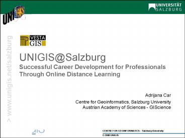
UNIGIS_at_SalzburgSuccessful Career Development for
Professionals Through Online Distance Learning
- Adrijana Car
- Centre for Geoinformatics, Salzburg
UniversityAustrian Academy of Sciences -
GIScience
2
Contents
- UNIGIS
- UNIGIS International Association partner
- Z_GIS_at_Salzburg Universtity
- Industry links
- UNIGIS_at_Salzburg
- UNIGIS professional diploma
- MSc(GIS)
- Working environment
3
- a worldwide network of educational institutions
- offers internationally recognized, academic,
distance learning qualifications in GIScience
and Systems - professional certificates / diplomas
- postgraduate Masters degrees
4
Targeted Audience
- Professionals
- mostly working in GIS industry,
- interested in continuing education or
- pursuing an academic degree, and
- whose work and responsibilities require that
their education be as free as possible from
limitations of place and time
5
UNIGIS Global Network
- First courses in 1993
- Founding members
- UK
- Amsterdam
- Salzburg
- Global network on (nearly) all continents
- Move into professional education
- Dedicated to lifelong learning!
- Cooperation in development of curricula, media,
and general innovation - Exchange in GIScience and eLearning
- Mutual recognition of degrees and credits (ECTS)
- Contributions to international curricula and
standards development - The only sustained international (online)
distance education!
6
UNIGIS_at_Salzburg
- 1000 students and alumni
- In certificate and master courses
- From German speaking areas
- International programs
- offered since 05/2006 from Salzburg
- by our partners using our materials since 2004
- gt Foundation for an important professional
network and Leading GIScience education program
7
Centre for GeoInformaticsParis-Lodron Salzburg
University
Research Development
EduProjects
MSc(GISc.)
UNIGIS
PostgraduateEducation
BasicResearch
RDProjects
AGITGI_Forum
Seminars
LearningMedia
Transferto Industry
AplusB
GI-Cluster
8
Industry partners
- Relationships with leading companies
- ESRI Software, Virtual Campus
- Intergraph Software, Internship
- Leica ERDAS Software
- Autodesk
- Oracle, Clark Labs Idrisi, Definiens, Safe,
- Publishers
- Magazines Geoinformatics, Geoconnexion, GIS
Development - Wiley Ltd Longley et al. GIS book
9
Membership
10
Recent / current projects Education/ eLearning
- Herodot
- eNews
- UniPHORM PHARE
- GeoBASE
- EMGISc, EMGISc-D
- SDiLA, LIME
- InterGIS, GISELA
- Tempus CARDS
11
Deadline abstracts for poster/presentation by
April 27, 07
12
UNIGIS_at_Salzburg Principles
- Continuing education via online distance learning
- Where When at student convenience
- In-service learning
- Alternative to full-time study
- Some presence required
- Application oriented
- professional software
- Cooperation with industry
- Academic qualification awarded by Salzburg
University
- Active Learning
- Continuous interaction and feedback
- Multimedia presentation and tools
- Problem- / Solution-oriented
- Learning to learn
13
Curriculum
- Conform to academic course
- Modular structure
- 15 lessons
- 4-7 assignments
- 6 ECTS credits120 hours of student effort
- In part-time distance-learning mode 8 weeks
when taken in sequence
14
Modular structure MSc
- Focus on conceptual, technical, and
organisational aspects of GIScience and their
application in various fields - Qualification as a project, team or department
leader - 2 year postgraduate course
- Structure
- 9 Modules
- Electives
- Collaborative project
- Master thesis
- Awarded academic degree MSc(GIS)
15
Modular structure UNIGIS professional
- designed to develop or improve application-oriente
d skills provide an understanding of GIS - 1 year
- Structure
- 7 Modules
- 1Elective or collaborative project
- Professional diploma certificate
16
UNIGIS Environment
- Blackboard
- eLearning platform
- Learning Management System
- Communication
- Via Email, Blackboard (discussion boards,
virtual classroom, wiki)Skype / GoogleTalk - Tutor, Instructor, Team
17
Future with Geoinformation
The only sustainable competitive advantage is
the ability to learn and apply the right stuff
faster Wayne Hodgkins
18
Lesson Structure
Intro TOC
- Type of current element and position within
lesson needs to be obvious - Of course, there can be more optional elements
than just Hungry minds - Feedback quiz, exercise, assignment
Learning Objectives
Motivation lead-in
Concept discussion
n
Lesson
Example / Activity
Hungry minds
Feedback
Summary / Review
References
19
Core Modules
GIScienceIntroduction
Organisationand Project Mgmt
Data Modellingand Structures
VisualisationCartography
1-9
Data Sources and Acquisition
GeographicalAnalysis
SpatialStatistics
OpenGIS
geoDBMS
20
Elective subjects Optional Modules
EuroGIS
Remote Sensing
Application Development
Photogrammetry
Thesis Electives
MasterThesis
Oracle Spatial
ExternalCourses
ESRI Virtual Campus
SummerSchools
Recommended
CrystalGraphics Presentations


