
NASA interest in UAS for Earth Observations - PowerPoint PPT Presentation
1 / 14
Title:
NASA interest in UAS for Earth Observations
Description:
key com.apple.print.PageFormat.FormattingPrinter /key dict ... key com.apple.print.ticket.modDate /key date 2002-07-11T21:38:16Z /date ... – PowerPoint PPT presentation
Number of Views:49
Avg rating:3.0/5.0
Title: NASA interest in UAS for Earth Observations
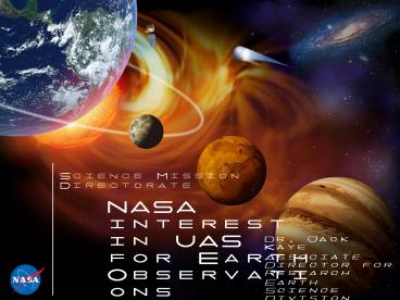
1
NASA interest in UAS for Earth Observations
- Dr. Jack Kaye
- Associate Director for Research
- Earth Science Division
- Science Mission Directorate
- NASA Headquarters
- 1 October 2007
2
NASA Science Overview and Mandates
- In implementing its Earth Science program, NASA
adheres to the goals of the NASA Strategic Plan
(2006) and the divisional Science Plans (2007)
and is guided by the recent NRC Decadal Survey - NASA is a significant contributor to three major
interagency initiatives (Climate, Oceans, Earth
Observations), as well as to other CENR
objectives - NASA Earth Science research is built around
answering interdisciplinary scientific questions,
emphasizing the use of space observations.
Related programs support use of research results
to enhance policy and decision making and advance
technology for NASA capabilities.
3
14 Major Satellites in Orbit
Comp. Service 2006
Old chart - replace by updated Earth only
(instead of Earth-Sun chart)
4
Airborne Science Programs
Airborne observations fill time and space gap
between surface observing networks and orbital
platforms.
Program Objectives Satellite Calibration and
Validation Provide platforms that when integrated
with sensor suites can perform the cal/val
requirements for Earth Observing System
satellites under broad range of environments New
Sensor Development and Testing Provide methods to
reduce risk for new sensor concepts and algorithm
development prior to committing sensors to
spacecraft Process Studies Acquire high
spatial/temporal resolution focused measurements
that are required to understand Earth system
processes, support quantitative tests of
hypotheses, and enable improved process
representation in Earth system models
Sounding Rocket Program Balloon Program Aircraft
UAS Program
Airborne observations fill unique niche in Global
Earth Observing System of Systems
5
Benefits from a hierarchy of integrated
observations
1000 km
Up-scaling for modeling and prediction
10 km
km
m
µm
Down-scaling for instrument calibration and
algorithm verification
6
Comparison of Aircraft Types and Benefits
- Cons
- Shorter duration 12 hours
- Low to Medium Risk Missions
- Not available for flying in dirty environments
(ash, nuclear debris, etc.)
- Pros
- Long heritages
- Numerous types
- Large (gt3000lb) payload, power, and volume
capacity - Airspace access
- Inexpensive
Manned Aircraft
- Pros
- Long endurance
- Long range
- Very low altitude
- Possibly Expendable (High risk missions possible)
UnmannedAircraft
- Cons
- Access to airspace
- Frequency Control issues
- Lack of civilian heritage
- Safety concerns
7
Historic Current NASA UAS usage
- NASA Mini-Sniffer program (1975-82)
- DOE ARM program
- NASA ERAST program
- USCG Alaska (Predator A, Nov. 2003)
- NASA sub-orbital science/airborne science
missions - NASA UAV SDP (11 proposals sent to phase 2), 2
selected based upon low cost after funding cuts
to overall program (one-time only) - Aerosonde in CAMEX 4 (2001)
- USCG NASA Alaska (Altair, 2004)
- NOAA/NASA Channel Islands (April-Nov. 2005)
- Western States Fire Missions
- NASA/USFS Small UAS demonstration (Summer 2005)
- Esperanza Fire rapid response
- NOAA/NASA Hurricane Boundary Layer Mission
8
ERAST Goals Objectives
- Transfer technology to grow a robust UAV
industry - in the United States that is capable of asserting
a - leadership position as the premier provider of
UAVs - for worldwide government and civil uses
- Develop and demonstrate UAV flight capability
at - altitudes up to 100,000 feet and four days
duration - Advance development of miniaturized payloads
and - payload integration capabilities that are
responsive - to the data collection and measurement
requirements - of the atmospheric science community
- Investigate means towards further resolution of
UAV - certification and civil operational issues and
- Demonstrate UAV viability to scientific,
government, - and civil users, that will lead to increased
- applications of UAVs.
ERAST Goal Provide focus for critical technology
development and flight demonstration that reduce
the technical and economic risk of using Remotely
Piloted Aircraft as a means to collect scientific
data in a timely and cost-effective manner
ERAST Environmental Research Aircraft and
Sensor Technology See http//www.nasa.gov/centers/
dryden/history/pastprojects/Erast/erast.html
9
UAVSDP Experiments Flown in Summer / Fall 2002
- Altus Cumulus Electrification Study (ACES) flew
from Naval Station Key West - Coffee Harvest Optimization experiment flew solar
Pathfinder Plus from Pacific Missile Range
Facility
10
Altus Cumulus Electrification Study
- Science objectives
- Lightning Imaging Sensor (LIS) validation
- Lightning type, cloud-top optical energy, and
power statistics - Lightning-storm relationships
- Storm electric budget
- August 2002 13 flights, 30 hours of data
- PI Richard Blakeslee (NASA MSFC)
- Altus capability was successful for thunderstorm
flights - high altitude, slow flight speed, electrically
quiet platform - Demonstrated prototype of RTMM used in TC-4
11
Coffee Harvest Optimization Mission
- Flew all-day flight over Kauai Coffee Plantation
in NAS - Real-time flight path directed to avoid cloud
cover by ATC - Demonstrated real-time image data access to
scientists and valuable to user
Long duration allowed for remote sensing coverage
even under mostly cloudy conditions Limited
payload Unstable aircraft design
12
NOAA/NASA UAV Demonstration Project
- Major Accomplishments
- 20 hour missions
- over 2500 miles of ocean coverage
- UAS in the National Airspace with FAA
experimental type certificate
- Issues
- Airspace coordination complications
- UAS systems reliability under extended high
altitude operation - Complexity of internal payload integration
13
Western States Fire Mission 2007
- Flight profile through CA, OR, WA (Route A)
- Mission endurance 20-hours 3200 miles
- Collected and transmitted real-time fire data on
eleven fires spread through CA (Butler, North,
Fairmont, Grouse, Lick, Bald, Moonlight, Zaca),
OR (GW Big Basin Fires), and WA (Domke Lake and
South Omak Fires), - Made repeat passes over most, (total of 18 fire
visits) spending significant time over high
priority fires (Lick, Moonlight, and GW) - Delivered real-time data to Incident Command on
Lick, Moonlight and GW Fires. NASA / USFS teams
on each to assist in data integration Data
immediately used for operations and redeployment
of resources on the fire based on our data. - Situation Unit Leader on Moonlight Fire
- You guys rock! We gained some excellent
intel on the northeast and southwest sides of our
fire that will greatly help for tomorrow
morning's briefing! Please pass our thanks along
to your team.
14
UAS Hurricane Mission 2007
- Mission Review Status
- Mission Readiness Review completed 8/31/07
- WFF King Air is the Aerosonde escort aircraft
- Mission documentation completed
- Required mission documents signed off
- Written communication plan being prepared
- Improving display capability in Real Time Mission
Monitor (RTMM) in Google Earth - Tropical Storm Gabrielle 9/10/07
- NOAA forecasted track near Wallops (WFF)
- NOAA anticipated low level hurricane
- Team was mobilized for likely mission
- Some UAS Assets were relocated to WFF
- Team was prepared for 9/10/07 flight from WFF
- Storm dissipated evening of 9/9/07
- Mission flight called off 9/10/07 - 0700
- Upcoming weather events
- NOAA watching all storms reporting to team
- Now prepared to fly into hurricanes within reach
of NASKW or WFF (using restricted warning
areas) - Map at right shows max potential range from NASKW
WFF without overland restrictions (white
circles), current operational area in Gulf of
Mexico (green), and Gulf oil rig no fly zone
(red)
15
Mission requirements drive NASA UAS flights
- Emphasize optimization of the platform/sensor
suite combination based upon science requirements
- what sensor,
- where, when
- how long
- New platforms must be able to support the kind of
sensors AND help us expand the scope of NASAs
airborne science missions - Need is for campaign ready UAS
- if theyre really hard to use, expensive to fly,
and risky for sensors, their potential usefulness
is limited. - Need for being able to access general airspace is
important. - NASA goal is to apply UASs to missions that cant
be done with on-board piloted platforms.
NASA seeks to take advantage of the unique
capability of UAS to provide new observations
Recommended
CrystalGraphics Presentations


