
Aids to Navigation Program - PowerPoint PPT Presentation
Title:
Aids to Navigation Program
Description:
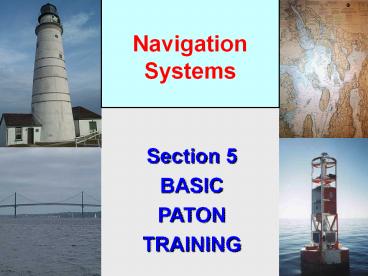
Section 5 BASIC PATON TRAINING Navigation Systems 2003 Aids to Navigation Workshop * 2003 Aids to Navigation Workshop * 2003 Aids to Navigation Workshop * 2003 Aids ... – PowerPoint PPT presentation
Number of Views:475
Avg rating:3.0/5.0
Title: Aids to Navigation Program
1
Navigation Systems
Section 5 BASIC PATON TRAINING
2
ATON Training Objectives
- 1. Review the definitions for the various Federal
and Private Aids. - 2. Understand why Aids are established.
- 3. Understand the specific purpose for the
various Aids. - 4. Become familiar with the flash characteristics
used on Aids to Navigation.
3
ATON FEDERAL SHORT RANGE AID TO
NAVIGATION.PATON PRIVATE AID TONAVIGATION.
- TERMINOLOGY UPDATE
4
ATON System Definitions
- IALA - International Association of Lighthouse
Authorities. - Divides the world into 2 regions
- Region A Most of the World
- Region B North South America, Japan, Korea,
and the Philippines.
5
ATON System Modes
- Region A
- Green Even Triangles
- Red Odd Squares
Region B Red Even - Triangles and nuns. Green - Odd - Squares and cans.
6
Different ATON Systems
- U.S. Marking System
- Intracoastal Waterway System
- Western River System
7
U. S. Marking System
- A Lateral System
- Employs a simple arrangement of . . .
- 1. colors,
- 2. numbers, and
- 3. shapes,
- and when you cant see the shape,,
- light colors and light characteristics.
- . . . to show on which side an aid should be
passed when proceeding in the Conventional
Direction of Buoyage. - Red Right Returning from the sea
8
Conventional Directionof Buoyage
- Purpose To identify how aids should be passed
in areas other than channels. - Regions
- Atlantic Coast Southerly
- Gulf Coast North and Westerly
- Pacific Coast Northerly
- Great Lakes North and Westerly(Lake Michigan
Southerly)
9
Conventional Direction of Buoyage
Used for marking the Intracoastal Waterway (ICW) and the off-shore ocean buoys along the coast.
10
LATERAL AIDS TO NAVIGATION
- IALA-B Aid to Navigation System
10
11
Definition of an Aid to Navigation
- Any device, external to a vessel,
- intended to assist navigators to
- a. Determine their position,
- b. Determine a safe course, or
- c. To warn them of dangers or
- obstructions to navigation.
12
Definition of a Buoy
- Any unmanned, floating aid to navigation that is
moored to the seabed. - May be lighted or unlighted.
- The seabed is owned by the Corps of Engineers
(USACE) and is licensed to the Coast Guard who
deploys ATON and authorize private owners to
deploy PATONs.
13
Nun Buoy
Conical shape
White Number
6
Red Retro
14
Definition of a Beacon
- Any fixed aid to navigation located
- on a shore or marine site.
- Lighted beacons are called Lights.
- Unlighted beacons are called
- Daybeacons or Daymarks.
15
Definition of a Daymark
- The daytime identifier of an aid to
- navigation presenting one of
- several colors, shapes, numerals
- or letters.
- Shape may be square, triangle,
- rectangle, diamond or octagon.
16
Red Daymark
2
17
Starboard Lateral Marks
- Color Red
- Shape Triangular
- or conicalnuns.
- Character Even Numbers
- Light Red
Lighted Buoy
Small Light
Daymark
Nun
18
Lighted Red Buoy
19
Red Daymark on Dolphin Called a Small Light
20
Port Lateral Marks
Lighted Buoy
- Color Green
- Shape Square /
- Cans
- Character Odd
- Numbers
- Light Green
Small Light
Daymark
Can
21
Can Buoy
7
22
Green Can Buoy
23
Lighted Green Buoy
24
Green Daymark
3
25
A good reason to take it slow and watch where
youre going!
26
9
10
2
1
7
8
OK . . . Lets add in a few more buoy types!
5
6
3
2
3
1
2
Any questions about the IALA-B lateral system?
27
Preferred Channel Marks
- Purpose Marks junctions / bifurcations
- Description
- Color Red Green horizontally banded(top
color band is preferred channel) - Shape Same as preferred channel (uppermost
band is preferred channel) - Character Letter not number.
- Light Same color as uppermost band.
- Characteristic Gp Fl (21) 6s
28
- JUNCTION
- Two channels join to form one channel.
- Preferred channel buoy is upstream.
- BIFURCATION
- One channel splits to form two channels.
- Preferred channel buoy is downstream.
- CROSSING
- One channel crosses another channel.
- No requirement to mark all four corners.
29
Junctions and Bifurcation Patterns
30
In the main (primary) channel, pass on your port
side (to your left) returning from the sea.In
the secondary channel, pass on your starboard
side (to your right) Red Right Returning from
the sea.
31
You always have to reference your nautical chart!
How do you know which is the main channel?
BR
32
Safe Water Mark
- Purpose Indicates navigable water
- all around the mark.
- Description
- Color Red and White vertically striped.
- Shape Sphere or Buoy with Topmark.
- Character White letters.
- (ex. NC North Channel)
- Light Color White
- Characteristic Mo(A)
33
Safe Water Marks
MR
Spherical
Lighted and or sound
34
Lighted Safe Water Mark
35
Isolated Danger Mark
- Purpose Marks isolated dangers or obstructions
that can be passed on all sides - Description
- Color Black and Red horizontal bands.
- Shape Buoy with two black top marks.
- Character White Lettering no numbers.
- Light White.
- Light Characteristic Gp Fl (2) 5s.
36
Special Purpose Aids
37
Special Purpose Aids
- Purpose Not intended to assist safe navigation
but to indicate special areas marked on charts
(anchorages, traffic separation schemes, data
gathering, etc) - Description
- Aid Color Yellow.
- Aid Shape Various.
- Characters Black lettering, no numbers.
- Light Color Yellow
- Light Characteristic Fixed, Flashing (except
Mo A, 21, Qk)
38
(No Transcript)
39
Regulatory and Information Marks
- Diamond - means danger and words may appear
explaining the danger. - Called a Danger Buoy
- Circle- means restricted operations.
- Speed Buoys (5 MPH) or No Wake Buoys.
- Diamond with a Cross - tells you that vessels are
not allowed in the area. - Called Exclusion Buoys
- Square - contains directions for the boater.
- Bridge Regulatory Signs.
40
Regulatory and Information Marks
Whats wrong with this picture?
Restricted Operations
DANGER
Exclusion Area
If lighted White only
No Cross inside the diamond
41
Regulatory and Information Marks
- Purpose Alert the mariner to such things as
submerged pipes, no wake zones, etc. - Description
- Aid Color White with orange band or border.
- Shape Square, Round, or Diamond.
- Character Lettering (black, usually words)
- Light Color White
- Light Characteristic
- Anything not otherwise
- reserved
42
Restricted Operations - Minimum Wake
43
Restricted Operations - Manatee Zone
Bridge Discrepancy Report
44
DANGER
45
Restricted Operations - No Wake
46
Restricted Operations Area
These are non-lateral aids. The accuracy of the location of these aids is usually not a major issue. The location of these aids in the navigable channel is considered a problem. These aids are normally Private.
47
Restricted Operations - No Wake
48
Exclusion Area - No Anchoring
49
Definition of a Range
- A pair of beacons arranged so
- that, when they are aligned, they
- indicate the navigable center line of the channel.
50
Range Marks
- Purpose Indicate the navigable center line of a
channel when they are in line (aligned) as you
traverse the channel. - Description
- Aid Color They will have colored panels equal in
size with vertical stripes. - Aid Shape Rectangle with tall side up.
- Aid Light - Green, Red, White or Yellow.
- Front range light is lower of the two.
- Rear range light is higher and further from the
mariner. - KGW Range, Green, with a White Stripe.
51
Range Marks
RR - Rear Range Mark
FR Front Range Mark
52
WRECK MARKS
- Purpose To alert the mariner to wrecks.
- Description
- Aid Color Appropriate to side of channel.
- Aid Shape Appropriate to side of channel.
- Character White lettering WR, numbered
- in sequence with channel (WR2).
- Aid Light Same as buoy color.
- Light Characteristic Quick Flashing
- (unless aid is a preferred channel aid)
53
LOCATION MARK
- Some markers will have no lateral significance.
They are not designed to indicate the channel but
rather, to help you determine where you are.
54
9
10
2
1
7
8
5
6
3
DANGER
2
3
N
Is this a junction or a bifurcation?
2
1
A
55
Light Structures
- Major Lighthouses
- Are named. e.g. Boston Light
- Symbol is large exclamation point.
- Fixed position
- Minor Lights
- Not named
- Same symbol
- Fixed position
56
Boston Light
57
Inside the Boston Light tower.
58
Understanding Light Patterns
- Learn how to time a light.
- 1. Time multiple light cycles.
- 2. Divide the time by the number of cycles.
59
Light Patterns
Fixed (F) continuous, unblinking light
Flashing (Fl) light duration shorter than
darkness. Frequency not greater than 30 per
minute. Quick Flashing (Q) light duration
shorter than darkness. Frequency is at least 60
per minute. Very Quick Flashing (VQ) light
duration shorter than darkness. Frequency is at
least 100 per minute. Interrupted Quick Flashing
(IQ) like quick flashing but having a brief,
extended darkness period. Isophase (Iso) Light
has equal duration between light and darkness.
Period consists of both light and dark interval.
Also called Equal Interval (E Int).
60
Light Patterns
Group Flashing (Gp Fl (xx)) Combination of two
patterns in one period, i.e. 2 flashes followed
by three flashes. Occulting (Occ) Opposite of
flashing light is on more than it is
off. Alternating (AL) Alternating light changes
color. Special purpose light for situations
requiring significant caution. Example shows
AL.WGalternating white and green light. Morse
(Mo) Morse code light signal. Example is Morse
U which is two short flashes followed by one
prolonged flash then a period of darkness. Shown
as (Mo(U)) on charts. Long Flashing (LFL) One
long flash in a period with lighted period of at
least 2 seconds.
61
Charted symbols and abbreviations.
- When a PATON is charted
- Always compare your observations to the PATON
specifications, the Light List and the NOAA
chart. - Report any difference(s) as a discrepancy.
- You may have to make a CU Report to NOAA.
62
Charted symbols and abbreviations.
63
Chart Symbols
- CAN - Green Diamond with
- small watch circle
NUN Red diamond with small watch circle.
Watch circle overprinted with magenta when lighted. Italics used for buoys and other floating aids.
64
Symbols - Daymarks and Minor Lights
Green Daymark Green square.
Red Daymark Red triangle
- Minor Light - Magenta exclamation mark
- (teardrop with black dot)
- Vertical letters used for fixed marks
65
Symbol data in quotes indicates that the characters appears on the aid. Symbol data in italics indicates that the aid is floating. Vertical symbol data indicates that the aid is fixed.
66
Is there anything on this chart . . .
9
10
88
90
2
1
7
8
87
92
89
6
5
91
3
DANGER
2
3
N
2
1
that you do not understand?
A
67
RECORD YOUR OBSERVATIONS ON YOUR PATON REPORT FORM
- Update your PATON Report as is demonstrated.
68
RECORD THE SPECIFICATIONS FOR AIDS TO NAVIGATION ON YOUR REPORT
Check off the items that reflect what you observe on the aid.
69
CHECK THE SPECIFICATIONS FOR AIDS TO NAVIGATION ON YOUR REPORT
Simply check off everything that applies to the aid that you are verifying. Update your form.
70
The next section deals with reporting observed
discrepancies.
- Every AV must be able to recognize discrepancies
on Private Aids. - Keep an ATON Kit on board as your reference
document.
Recommended
CrystalGraphics Presentations


