
Floods - PowerPoint PPT Presentation
Title: Floods
1
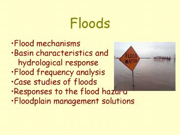
Floods
- Flood mechanisms
- Basin characteristics and hydrological
response - Flood frequency analysis
- Case studies of floods
- Responses to the flood hazard
- Floodplain management solutions
2
Flood mechanisms
- Hydrometerological floods- snowmelt runoff-
storm rainfall- rain-on-snow- ice jams - Natural dam failures- earth dams (e.g
landslides)- ice dams (e.g jökhalaups)
3
Vancouver I.A.
Stormrainfall precipitation and river
response (October, 2003)
?
14 15 16 17 18 19 20 21 22
Coquitlam R. at mouth
4
Understanding hydrological responses
Peak discharge?
Rate of recession?
Lag time?
5
Stream order and flood response
6
Regional climate and flood response
7
Geological substrate and flood response
8
Basin geometry and flood response
circular
elongated
effect of storm path?
9
Land use and flood response
10
Flood frequency curves for small drainage basins
undergoing urbanization
11
Flood plain morphologyeffects on water depth (D)
broad floodplain
D
narrow floodplain
D
12
Flood frequency analysis e.g. Squamish River
(54-year record N)
Brackendale
(1923-2006)Year Max Q
Recurrence N1/
541/1 55 years
541/2 27.5 years
541/3 18.3 years
541/4 13.8 years
541/5 11 years
541/6 9.2 years
peak daily (cumecs)
etc.
rank
13
Flood frequency analysis e.g. Squamish River
14
Should the dykes be 11 m or 14 m high to
withstand a 200-yr flood?
?
15
- Extending the instrumental record
- Historical archives e.g. journals, letters,
newspapers, photographs may extend the record
several decades - Native oral traditions (several centuries?)
- Ecological evidence (e.g. scarred trees
centuries?) - Geological evidence (e.g. flood deposits
centuries - millennia)
16
Ecological evidence
17
Recent hydrometerological floods
- Causative factors
- Heavy snowfall/rapid melt - ND/Man. 1997
- Intense rainfall/hail events (flash floods)
- Saguenay, Qué. 1996 Edmonton, Alta. 2004
- Protracted rainfall mid-latitude depressions
- Mississippi, 1993 hurricanes - Mozambique,
2000 - monsoons - India/Bangladesh, 2000-2004
18
The Red River flood of 1997
1 cause heavy snowpack in the Dakotas 2
cause ice-jams on northern reaches of Red River
reduce flow
gt3000 people evacuated 1G property damage?
Precipitation (Nov 1, 1996-Apr 13, 1997) of
normal
19
The Red River flood of April 1997
20
Red River May, 1997
- Discharge 4500 cumecs (estimate for 1826
and 1776 floods 6000 cumecs). - River levels up to 9m above flood stage in Grand
Forks, ND (largest flood in 20thC estimated
RI 62 years).In Manitoba - gt25,000 evacuees
- 3 people drowned
- Damages gt0.8 billion
- 7 000 military personnelemployed in flood relief
efforts
21
Saguenay and des Sables Rivers (Québec), July 1996
22
Saguenay Flood, 1996
- Up to 280 mm of rain fell in 36 hours
- Dams overtopped and breached, releasing dammed
waters - Roads washed out, houses and bridges. destroyed
12,000 people evacuated. - Farms covered with up to 2 m of sand and mud in
some areas. - Damage 0.7 - 1 billion 10 deaths
23
Chicoutimi, July 21, 1996
24
Flash flood, Edmonton(July 11, 2004)
Intense storm dumped mixed hail and rain (gt30 mm
of ppt in a few hours) led to flooding of
low-lying parts of the city, and partial collapse
of the roof at West Edmonton Mall. Cleanup cost
the city 1 million Disaster relief for damage
to flooded basements, etc. 74 million
25
Images of the Edmonton flash flood
26
The Mississippi River floods of 1993(note the
extra Great Lake!)
27
The Mississippi River floods of 1993
Rainfall in the upper basin gt3000 mm in June,
1993 (highest gt100 years of record)
50 deaths, 70,000 people evacuated damage (inc.
loss of crops gt12G. 800 of 1400 dykes breached
Some engineers claim this was a 500 yr flood
2 months of flooding
28
The Great Flood of 1993
Grafton, Illinois
The flood gauging station at Grafton
29
Floods in Mozambique (February - March, 2000)
- 1 cause heavy rainfall at end of summer wet
season (intense tropical storms in western Indian
Ocean - Cyclones Eline Gloria). - 2 cause bad farming practices on South African
veldt (RSA to Malawi) have led to destruction of
wetlands which reduce and retard peak flows.
30
Cyclone Eline(Feb. 18-22)
Tropicalstorm Gloria (March 1-5)
31
Floods in Mozambique (February - March, 2000)
- Feb 8/2000 gt400 mm of rain in previous four
days in highlands of S. Africa and
Zimbabwe.Floods knocked down power lines, no
power or drinking water in cities in Mozambique.
Land mines from 1976-92 civil war eroded and
swept downstream. - Feb 8-18 continuing heavy rain in SE Africa ( up
to 600 mm in 24 h in places) - Feb 28 gt200 dead, 100 000 villagers stranded by
floodwaters - Mar 4 Cyclone Gloria makes landfall in
Mozambique.
32
Floods in Mozambique (February - March, 2000)
The Province, Feb. 28, 2000
Consequences loss of crops loss of livestock
(cattle and goats) flood-borne diseases
(diarrhoea, malaria, cholera). 100 M rescue
operation largely funded by EU and RSA.
33
The summer monsoon
Mean monthly rainfall, Dhaka, Bangladesh
34
Recent floods
Indian Prime Minister Manmohan Singh says floods
in the northern state of Bihar are a "national
calamity". He has visited areas where 55 people
have died and some two million are displaced
after the Kosi River breached its banks, changing
course. BBC News 28 Aug 2008 (by 120 km)
In north India, where water is receding after
two weeks of floods, health workers are starting
a clear up. About 28m people have been affected
by the floods in India, Bangladesh and Nepal.
BBC News 9 Aug 2007 The army, navy and air
force have been deployed in flood affected areas.
Floods have also forced the evacuation of 200
villages in the central states of Chattisgarh and
Madhya Pradesh. BBC News 9 Aug
2006 Waterborne diseases kill 66 people after
floods in India's western Maharashtra state,
officials say. BBC News 11 Aug 2005 More than
300 people have lost their lives in India's
floods and more than 19m have been affected. BBC
News 21 Jul 2004 Flooding caused by monsoon
rains has left up to half a million people
homeless in India. BBC News 7 Jul 2002 At
least 120 people have died after floods hit large
parts of the countrys north-east. BBC News 12
Aug 2000
35
The un-predictable monsoon (rainfall for
June-July, 2004, compared to normals)
drought
floods
36
Monsoon floods
1 cause intense, long-lasting seasonal rains
cause flooding of intensely populated floodplains
and deltas in South Asia 2 causes - hillslope
deforestation in headwaters reduces soil water
storage capability - irrigation for agriculture
causes silting of channels, reduces flood
storage - global warming (?) speeds melting of
Himalayan snowpack
37
Flood hazards Loss of homes, crops, livestock,
limited access to firewood (therefore food
improperly cooked, water not boiled)
Some mitigation measures currently underway
Improved flood forecasting for local
rivers Evacuation maps to identify villages (and
villagers) most at risk Built and maintain dykes
for evacuation to higher ground
Post-flood hazards poor sanitation disease
38
Responses to flood hazard
- Protection - embankments (Huang River dykes)
- channelization (San Diego River) - diversion
(e.g. Red River floodway) - storage structures
(dams and reservoirs)
39
Dyking
- Huang River has been dyked since at least 600 BC.
- In last 2500 years the Huang has undergone 10
major avulsions (next slide) - In 1887 22m-high dykes were breached 900,000
people drowned - In 1931 some 3.7M people drowned by floodwaters
40
Other flood hazardschannel avulsionse.g. Huang
Ho(Yellow River)
Beijing and Shanghai are about 1100 km apart
- Consider effects on
- port facilities
- river navigation
- irrigation
- domestic water supply
- sewage disposal
Can such shifts in river location be controlled
without channelization?
41
Channel avulsions
1) the Atchafalaya/Mississippi, and 2) the
Fraser River
42
Channelization
Produces higher discharges and faster flow from
given rainfall
Forester Ck, El Cajon, California
43
Responses to flood hazard
- Regulation - floodplain mapping - land-use
zoning - flood insurance - Education
- Abatement - watershed management - floodplain
reforestation - wetland creation
rehabilitation - drainage modification on
agricultural and urban land
44
Floodplain mapping
If the river floods, or the dykes are breached,
which areas will be under water, and how deep
will the floodwaters be?
Source Community Mapping Network(www.shim.bc.ca)
45
Flood-proofing residential buildings on an
idealized floodplain. Note no construction
allowed in floodway (setback)
Floodplain 1 annual flood probability Floodway
5 annual flood probability
46
Natural floodplain
Fully developed floodplain
47
Effect of floodplain development on channel
discharges
48
Managed floodplain
Source BC Min. of Environment
Recommended
CrystalGraphics Presentations


