
Geology of the Oceans - PowerPoint PPT Presentation
1 / 13
Title:
Geology of the Oceans
Description:
Geology of the Oceans Formation of the Oceans: 1. Solar system was formed 4.6 billion years ago. 2. World s oceans believed to have formed more than 3 billion – PowerPoint PPT presentation
Number of Views:48
Avg rating:3.0/5.0
Title: Geology of the Oceans
1
Geology of the Oceans
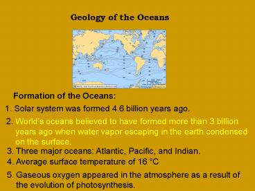
Formation of the Oceans
1. Solar system was formed 4.6 billion years
ago.
2. Worlds oceans believed to have formed more
than 3 billion years ago when water vapor
escaping in the earth condensed on the
surface.
3. Three major oceans Atlantic, Pacific, and
Indian.
4. Average surface temperature of 16 C
5. Gaseous oxygen appeared in the atmosphere as a
result of the evolution of photosynthesis.
2
Composition of the Earth
Layers of the Earth
1. Solid inner core- very dense, hot and rich
in iron and nickel.
2. Liquid outer core- cooler and under less
pressure.
3. Lower mantle- rigid
4. Upper mantle- fluid Mantle is the
thickest layer, composed of magnesium iron
silicates.
5. Crust- thinnest and coolest of all
layers. a. continental- older than oceanic,
composed of granite. b. Oceanic-
composed of mainly iron and magnesium.
3
Supercontinent Pangea
Asthenosphere- the region of mantle below the
crust. Lithosphere- solid region of crust and
upper mantle.
Moving Continents Alfred Wegner proposed
that there was only one supercontinent named
Pangea.
4
Moving Continents
Midocean Ridge- forms where oceanic crust is
cracked and magma is emerging
Subduction zones- is where old oceanic crust is
being destroyed. Harry Hess was the first person
to describe the Mechanism of seafloor spreading
by which continents drift apart.
5
Seafloor spreading- lateral movement of the
crust. This causes continental drift.
6
Theory of Plate Tectonics
Theory of plate tectonics- all of the information
concerning the movement of the earths crust.
Faults- a break in the earths crust where one
plate can move past the other.
Rift zone- region where the lithosphere splits,
separates, and moves apart as new crust is
formed.
7
Deep Sea Vent Communities
Deep sea vent communities are unique because they
represent food webs that exist in the absence of
sunlight. The first one discovered was
the Galapagos Rift.
8
Continental Shelves
Bathygraphic features- the physical features of
the ocean bottom.
Continental shelf- flat areas that slope gently
toward the bottom of the ocean.
Mountainous coasts- narrow continental shelf.
Low-lying land- wide continental shelf.
Continental rise- a gentle slope that can be
present at the base of a steep continental slope.
Composed of sediments deposited deposited from
land.
Turbidity currents- are swift avalanches of
sediment and water that erode a slope as they
sweep down.
9
Ocean Floor
a. Continental slope b. Seamount c. Abyssal
plain d. Mid ocean ridge e. Volcanic island f.
Continental shelf
Abyssal plain- a flat expanse at the bottom of an
open ocean. Seamount- a steep sided formation
that rises sharply from the bottom. They are
formed from underwater volcanoes.
10
Seamounts and underwater volcanoes tend to be
concentrated near ocean ridges and subduction
zones.
Deepwater trenches are more common in the Pacific
and are associated with the volcanic islands
called island arcs. The deepest trench in the
world is the Marianas trench.
Composition of Seafloor
Types of Sediments Biogenous sediments-
sediments that are composed of the remains of
once living organisms.
11
Ooze- sediment is made up of more than 30
biogenous particles a. Diatomaceous- remains of
diatoms, found mainly in temperate latitudes.
b. Radiolarian-remains of radiolarians, found
in tropics.
Finding Your Way Around the Sea
Latitude Equator- line drawn around the
center of the Earth perpendicular to the
earths north-south axis. Between Tropic of
Capricorn and Cancer defines the tropical zone.
12
Longitude Lines of longitude also known as
meridians. Primary line of longitude is
Greenwich Meridian. Nautical mile is equal
to one minute of latitude.
Maps and Charts
Bathymetric chart- indicates variations in ocean
depth by lines that connect areas of similar
depth.
13
Physiographic chart- uses coloring or shading
instead of lines to show the varying degrees of
change.
Sextant- used to measure the angle of the north
star with respect to the horizon. Chronometer- a
seagoing clock.
Recommended
CrystalGraphics Presentations


