
Highlighting the use of GIS in Climate Change Studies - PowerPoint PPT Presentation
1 / 16
Title:
Highlighting the use of GIS in Climate Change Studies
Description:
Title: GIS IN DISASTER MANAGEMENT Author: nthomas Last modified by: econstaff Created Date: 5/16/2006 8:14:11 PM Document presentation format: On-screen Show – PowerPoint PPT presentation
Number of Views:222
Avg rating:3.0/5.0
Title: Highlighting the use of GIS in Climate Change Studies
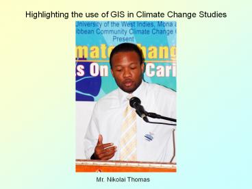
1
Highlighting the use of GIS in Climate Change
Studies
Mr. Nikolai Thomas
2
HIGHLIGHTING THE USE OF GIS IN CLIMATE CHANGE
- UWI CLIMATE CHANGE
- JUNE, 2007
3
Overview of presentation
- What is GIS
- Associated tools
- Remote Sensing
- Global Positioning System
- Web publishing of maps/data
- Application at ODPEM
4
What is GIS?
- Geographic Information Systems (GIS) is a
spatial database management system that can
analyze, query and display data using digitized
maps and tables for planning and decision-making
(Anonymous)
5
Remote Sensing
- Remote sensing is the short or large-scale
acquisition of information of an object or
phenomenon, by the use of either recording or
real-time sensing device(s) that is not in
physical or intimate contact with the object
(such as aircrafts, satellites).
6
(No Transcript)
7
Remote Sensing allows for
- Image interpretation classification
- Time-series image analysis
- Drought analysis
- Tracking of hurricanes
8
Global Positioning System
- GPS is a satellite navigation system used to
determine ground position (coordinates) a
worldwide satellite navigational system formed by
24 satellites orbiting the earth and their
corresponding receivers on the earth.
9
GPS devices allows you to
- Gather accurate spatial data
- Flood extent
- Sea level rise
- Storm surge runup
- Heights above sea level
10
WEB PUBLISHING
- Web delivery of geographic data and maps.
- Allows you to
- Publish high-quality interactive maps that can be
accessed by thousands of people simultaneously
over the Internet. - Integrate data from multiple sources (Internet or
local) and serve it on the Web.
11
GIS allows for
- Data capture
- Data integration
- Analysis
- Projection
- Data modeling
- Display
- Attribute table which forms a database
12
Possible effects of Climate change in the
Caribbean
- Sea level rise
- Increased saline intrusion of groundwater
- Expansion of wetlands
- Loss of beach
- Damage to coastal infrastructure
- Increased severity of floods
- Increase in the number and severity of hurricanes
- 2005 Hurricane Season
13
Application at ODPEM
- JAHGIS
- Create and Manage associated Database
- Remote Sensing
- NASA Whirlwind (Servir)
- Hurrevac
- UN Space Charter
- Data Analysis
- Vulnerability Assessment
14
Application at ODPEM
- Collect damage assessment data
- Storm surge run up
- Flood area
- Data Modelling
- Preparation of Hazard Maps
- Landslide and Flooding susceptibility
15
Application at ODPEM
- Map preparation
- Portmore Evacuation Map
- Publishing of spatial data over the web
- Collaboration with the Ministry of Agriculture
16
THE END
- GIS SAVES LIVES
Recommended
CrystalGraphics Presentations


