3d Aerial View PowerPoint PPT Presentations
All Time
Recommended
The Cheesy Animation Studio offering Services Is 3D Flythrough, Bird View, Aerial view, Architectural 3D Flythrough Company.
| PowerPoint PPT presentation | free to download
The Cheesy Animation Studio offering Services Is 3D Flythrough, Bird View, Aerial view, Architectural 3D Flythrough Company.
| PowerPoint PPT presentation | free to download
Blitz 3D Design Studio offer services like 3D Aerial Visualization, 3D Bird Eye View, 3D Aerial View Rendering Services. http://www.blitz3ddesign.com/aerial-view-rendering-services.html
| PowerPoint PPT presentation | free to download
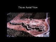
Tiryns Aerial View Tiryns Tiryns Gate Tiryns Corbel Vaulting Pylos Plan Pylos Megaron Reconstruction Tiryns Aerial View Tiryns Tiryns Gate Tiryns Corbel Vaulting ...
| PowerPoint PPT presentation | free to download
A long-term revamping of Klystron control. A new look at the ... Toroid Charge Monitors. Trigger Gate and Synchronizer. Klystron Controls. Gated ADC readout ...
| PowerPoint PPT presentation | free to download
Helicopter tours in New York are just another way to treasure any occasion in your life. Book your tour now @ Helicopternewyorkcity.com
| PowerPoint PPT presentation | free to download
Spatially Accurate Aerial Oblique Views
| PowerPoint PPT presentation | free to view
AERIAL VIEW OF EXISTING CONDITIONS. Mare Island Strait. SUTTER ST. SANTA CLARA ST. MARIN ST ... ASSOC. GGLO KIMLEY-HORN. Mare Island. Public Realm. Framework ...
| PowerPoint PPT presentation | free to view
aerial view new concrete pad
| PowerPoint PPT presentation | free to view
... de los m s bellos, tranquilos y frescos pinares de la Costa del Sol, lindante ... La playa de Cabopino es un lugar caracter stico para los turistas que visitan la ...
| PowerPoint PPT presentation | free to view
Aerial view of the agora, Athens ...
| PowerPoint PPT presentation | free to view
Take the advantage of the best aerial photography in Singapore and capture the most amazing bird's eye view of the city’s favorite spots. See more @ http://www.singaporeaerialphotography.com/
| PowerPoint PPT presentation | free to download
Benefit of 3D Architectural Aerial View Rendering. The industry is now too competitive and gaining new clients, even for the most talented.
| PowerPoint PPT presentation | free to view
The Southern African Large Telescope (SALT ) is funded by partners ... Digging in: VIP's taking part in the ceremony signalling the start of SALT construction. ...
| PowerPoint PPT presentation | free to view
Growing demand in emerging application areas including natural resources management, energy, and disaster prevention is expected to drive the market over the next six years.
| PowerPoint PPT presentation | free to download
Conduct Program Reviews (System Assessments) ... 4 Different ship test programs shared 3 targets 7 Required ... Advanced cruise missile and aircraft threats ...
| PowerPoint PPT presentation | free to view
... filled with rubble, and parked cars were crushed under large blocks of ... AP Photo/Pier Paolo Cito. Before and After Photos. Magnitude 6.3 CENTRAL ITALY ...
| PowerPoint PPT presentation | free to view
Justin Hollander, Property Theory & Land Use Policy, 4/04 (A) PLANNING FOR URBAN DECLINE. Justin Hollander, Property Theory & Land Use Policy, 4/04. PRESENTATION ...
| PowerPoint PPT presentation | free to download
Capture breathtaking aerial views with our premier aerial drone photography services in Mumbai. Ashesh Shah Photography offers professional drone photography and videography solutions, perfect for real estate, events, landscapes, and more. Our expert team ensures high-quality, stunning visuals that elevate your projects. Contact us today to book our aerial drone photography services. Visit to know more: https://www.asheshshah.photography/drone-photographer
| PowerPoint PPT presentation | free to download
The Cheesy Animation Studio offering Services Is 3D Flythrough, Bird View, Aerial view, Architectural 3D Flythrough Company.
| PowerPoint PPT presentation | free to download
Old Aerial Photos Willmar 1973 Old Aerial Photos Willmar 1973 pf088046 Aerial view Haug Implement Company 1973 pf088047 Aerial view Livestock sale barn 1973 pf088049 ...
| PowerPoint PPT presentation | free to view
Colour Aerial imagery Perth (combination of Red, Green and Blue) is what we are accustomed to seeing with our own eyes.
| PowerPoint PPT presentation | free to download
Modern fitness conscious girls and ladies not only see comfort but also When it comes to hiring an agency for creative real estate photography in Brisbane, Victoria, Sunshine Coast and NSW, OZ Aerial is the name strikes first at mind. We make use of latest cameras and techniques to capture the close view of your property from the aerial root. Hire us for pre and post purchasing photography.
| PowerPoint PPT presentation | free to download
Aerial Lift Safety Session Objectives Aerial Lift Hazards Falling out of the lift Tipping vehicle over Power lines Falling objects Know Your Equipment Warnings ...
| PowerPoint PPT presentation | free to download
Blitz 3D Aerial View Rendering Design Studio provides more scope for your project. Our studio also provides Professional Bird Eye view rendering design services in India, UK and USA.
| PowerPoint PPT presentation | free to download
Here in this presentation explain the list of industries that use aerial photography. Contact Action Filmz, We offer Aerial photography, Aerial Films, and Aerial Video services in a cost-effective way.
| PowerPoint PPT presentation | free to download
Explore the vast collection of Indshine’s ariel maps. Indshine offers access to updated ariel maps to reduce field inspections with a better resolution than satellite maps. Indshine is one of the recognized ariel maps services provider that offers orthographic ariel maps across numerous industries.
| PowerPoint PPT presentation | free to download
Aerial photography is all the rage these days and more and more businesses are using it for various marketing purposes. It’s no wonder, given how we’re always appreciative and jealous of that “birds-eye” view. The entire story revolves around flying drones and navigating the skies while taking pictures or shooting videos!
| PowerPoint PPT presentation | free to download
Take the advantage of the best aerial photography in Singapore and capture the most amazing bird's eye view of the city’s favorite spots. See more @ http://www.singaporeaerialphotography.com/
| PowerPoint PPT presentation | free to download
If you weren’t using a drone, this would be executed using a tripod. Source: http://www.wildrabbitaerial.com. Information shared above is the personal opinion of the author and not affiliated with the website.
| PowerPoint PPT presentation | free to download
Homeowners want to showcase the best features of their property, but what if the biggest selling point goes beyond the property, to the private neighborhood, expansive lands, beachy location or picturesque views? Taken from great heights not accessible by people, aerials paint a full picture of the property that you can’t capture with regular, on-the-ground photography. visit, https://www.blankcanvasproduction.com/uncategorized/how-aerial-photography-can-capture-the-most-beautiful-parts-of-your-house/
| PowerPoint PPT presentation | free to download
... inspections by qualified mechanic Insulated aerial lifts have special electrical test requirements De-energize and lockout/tagout aerial ... 2 of fatal falls ...
| PowerPoint PPT presentation | free to download
Our Website: http://www.maidstoneaerials.co.uk We have a group of professional installers on board that can make any installation task look easy, whether it be a small domestic installation or a large commercial installation they have experienced CCTV installer Kent who can get the job done.
| PowerPoint PPT presentation | free to download
Aerial installation and repair, satellite, CCTV and broadband services. ATV Aerial and Satellite Company is a family run business specialising in a range of TV, aerial installation, satellite, broadband, rooftop bird protection and CCTV services across the North East of England. Services are for domestic homeowners, new homes, those extending and renovating. ATV also deliver on existing and new build communal or corporate sites, as stand alone services or bespoke property packages.
| PowerPoint PPT presentation | free to download
By partnering with High Exposure, you can inspect assets anywhere in the country, easily and affordably. For more details, please visit at https://www.highexposure.com.au/aerial-photography-for-asset-inspection/
| PowerPoint PPT presentation | free to download
Multi-view Projection ... Missing views END OF CHAPTER 5 Multi-view Projection ... Projections Orthographic projection Front View Projection ...
| PowerPoint PPT presentation | free to view
At VIP 360, we use UAV/Drone Aerial Surveillance for surveillance & intelligence feature for your event. It allows us to catch criminals on your property, provides building inspection, and get the professional photography of your premises from bird’s eye view.
| PowerPoint PPT presentation | free to download
Real estate photographers specialize in capturing and editing photographs that provide warm lighting and ascetically pleasing angles, resulting in increased click through rates and home interest. Commercial spaces can be difficult to market and so require some fast creative photography to focus on work space elements for commercial applications and potential opportunities.
| PowerPoint PPT presentation | free to download
Servo Control: 4 Servo output slots. Speed Sensing: Ability to receive GPS inputs ... Servo plug boar sold separately. Benchmarking: Autopilot. Mavionics ...
| PowerPoint PPT presentation | free to view
Helicopter Tours in Dubai | Explore Dubai With Beautiful Views
| PowerPoint PPT presentation | free to download
Aerial Imaging Market is projected to grow at a CAGR of 25.7% during the forecasting period 2021-2027. The technological advancement in the field photography has been always in a positive picture. Aerial photography is useful both for regional analysis and for evaluating specific sites. It can also provide a historical perspective that allows us to view changes in landscapes overtime.
| PowerPoint PPT presentation | free to download
Aerial Video Surveillance and Exploitation Roland Miezianko CIS 750 - Video Processing and Mining Prof. Latecki Agenda Aerial Surveillance Comparisons Technical ...
| PowerPoint PPT presentation | free to download
Front elevation View of Ramkumari Residency consisting Stilt (Parking) + Ground + 4 floors Near Punjab National Bank / Khushi Shoping Mall, RTC colony Rd.,
| PowerPoint PPT presentation | free to view
Aerial Photography has become very popular in the recent times and it is not only used for personal purposes such as wedding aerial photography but it also has been used for commercial uses now, this kind of photography is considered the best for the purpose of taking pictures for giving a full view from all the angles of a particular space, land, buildings, and other such real estate property. See more @ http://www.singaporeaerialphotography.com/
| PowerPoint PPT presentation | free to download
Course Code GEOG2112 Department of Geography Faculty of Humanities and Social Sciences United Arab Emirates University Dr. M. M. Yagoub E-mail: myagoub@uaeu.ac.ae
| PowerPoint PPT presentation | free to download
Bestech Park view Altura Gurgaon is a residential project. read more at http://www.favista.com/Gurgaon/bestech-park-view-altura-sector-79-P58493.html
| PowerPoint PPT presentation | free to download
Aerial photography is the process of taking photography from any one source to earth surface to create the photographic negative. The platforms used involves taking aerial photography from ground to down position with the help of aircraft, airplanes, helicopters, balloons, rockets, and parachutes etc. This negative contains both favorable and unfavorable factors in the earth surface. Geometrical accuracy is the heart of aerial photography.
| PowerPoint PPT presentation | free to download
UAV aircrafts are manufactured using latest technology and capable in flying at height of 400 feet. It can also capture the unseen views with extendable flight timing. Browse our website to checkout more features of our products.
| PowerPoint PPT presentation | free to download
The growth can be credited to the increasing adoption of light weighted helicopters across various sectors. Helicopters
| PowerPoint PPT presentation | free to download
Aerial video photography and aerial photography are two important areas of photography that have become quite popular in the recent times. See more @ http://infinytemedia.com/
| PowerPoint PPT presentation | free to download
We seek to deliver cost effective results for farmers, vineyard and golf courses owners. We can map hundreds of acres quickly and accurately for general crop monitoring and farm planning using aerial NDVI and RGB cameras. For more details please visit at https://www.highexposure.com.au/aerial-photography-for-aerial-mapping/agriculture/
| PowerPoint PPT presentation | free to download
Aerial Lift Safety in Construction Michael McCann, PhD, CIH Director of Safety and Ergonomics The Center to Protect Workers Rights mmccann@cpwr.com
| PowerPoint PPT presentation | free to download
Unmanned Aerial Vehicle(UAV), for Oil Palm Plantation
| PowerPoint PPT presentation | free to download
Aerial Lift Safety in Construction Michael McCann, PhD, CIH Director of Safety and Ergonomics The Center to Protect Workers Rights mmccann@cpwr.com
| PowerPoint PPT presentation | free to download
The accuracy of aerial drone surveying is significantly influenced by the performance and kind of drone, the quality of its components, the camera resolution, the height at which the drone flies, the vegetation, and the method and technology used to geolocate the aerial photos. With a high-end surveying drone, absolute precision may now be achieved under ideal conditions.
| PowerPoint PPT presentation | free to download


