Airsar PowerPoint PPT Presentations
All Time
Recommended
Volcano study in Aleutians and Kamchatka; topographic change; filling voids in SRTM coverage. Alaska/Canada Tundra; Ice studies in Arctic, Beaufort Sea, grounding ...
| PowerPoint PPT presentation | free to view
AIRSAR is a multi-frequency, quad-polarization, multi-baseline ... Dobson. Blom. Jackson, Njoku. Davies. Discipline. Polar Science. Code YS Hydrology ...
| PowerPoint PPT presentation | free to view
This presentation will examine the utility of remote sensing to the distribution ... potential as a tool for archaeologist to detect and locate features associated ...
| PowerPoint PPT presentation | free to download
Integration of a LargeArea Invasive Spread Network LISN with Climate Models for Decision Support
| PowerPoint PPT presentation | free to download
Surface structure analysis for the Bulalo Geothermal Field
| PowerPoint PPT presentation | free to view
L-band radiometer. BIOMASCA Study Team. P-HV data from different published papers. ... from high temporal resolution systems, such as SMOS (L-band radiometer) ...
| PowerPoint PPT presentation | free to view
Soil moisture accuracies compared to in situ measurements of the top 5 cm were ... In situ measurements generally provide good definition with depth, but due to ...
| PowerPoint PPT presentation | free to view
Integration Posters (32) Integration of a range of remote sensing and other ... A number of posters ( 4) on either developing or testing a MODIS derived ET product. ...
| PowerPoint PPT presentation | free to view
Primary Productivity/Phenology: AVHRR, SeaWiFS, MODIS, Landsat, ASTER, ALI, ... Phenology. Vegetation Structure. Elevation. Surface Temperature. SST, SSH, ...
| PowerPoint PPT presentation | free to view
Parametric statistical models ... From Ukraine. Criterion: Comparison with parametric approaches. Algorithm adapted to Gamma PDF ...
| PowerPoint PPT presentation | free to download
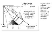
Layover Layover occurs when the incidence angle (q) is smaller than the foreslope (a+) i.e., q
| PowerPoint PPT presentation | free to download
EMISAR: Greenland Sea (March 1995), C-band ... Classification Rules for Greenland Sea Ice (Winter) ... Classification, Greenland Sea, C-Band. Intensity R(HV) G ...
| PowerPoint PPT presentation | free to view
Active Microwave Remote Sensing ... a receiver, one or more antennas, GPS, computers Microwaves Band Designations (common wavelengths Wavelength ...
| PowerPoint PPT presentation | free to download
Department of Information and Knowledge Management ... WMF RAF, 1994-1995 (Jelen, Kuszinger, Di szegi, Winkler, Moore, Evans, Freeman) ...
| PowerPoint PPT presentation | free to view
Land surface hydrology-atmosphere interaction studies using ground and aircraft ... Requirements for continuation of mission have been met. Implications for hydrology ...
| PowerPoint PPT presentation | free to view
SAR Application Policy Study : Analysis of SAR-Related Journal Papers Hoonyol Lee Department of Geophysics Kangwon National University Email: hoonyol@kangwon.ac.kr
| PowerPoint PPT presentation | free to download
Azimuth (or along-track) Resolution ... Great improvement in azimuth resolution could be realized if a longer antenna were used. ...
| PowerPoint PPT presentation | free to download
Remote sensing imagery and airphotos are used as major basis map in GIS ... The nominal GPS Operational Constellation consists of 24 satellites that orbit ...
| PowerPoint PPT presentation | free to view
Dust Emission in SW United States
| PowerPoint PPT presentation | free to view
The false-color image to the left shows Minos Linea. ... Shows thermal pollution and geothermal sites. 150. Thermal infrared. 10.4 to 12.5 ...
| PowerPoint PPT presentation | free to view
History of volcanoes, volcanology
| PowerPoint PPT presentation | free to view
Science Measurement Technology Options Challenges ... Six technology scenarios (3 active, 3 passive) were proposed and evaluated ...
| PowerPoint PPT presentation | free to view
Most radar systems and data providers now provide the data in ground-range geometry Pulse duration (t) = 0.1 x 10 -6 sec t.c called pulse length.
| PowerPoint PPT presentation | free to download
Acquisitions occur when data is received in real time by an international ground ... 46-days cycles on a bi-annual basis to enable interferometric applications. ...
| PowerPoint PPT presentation | free to view
WatER: proposal to ESA Earth Explorer. ... (with possible high frequency band augmentation) to correct for wet-tropospheric delay ...
| PowerPoint PPT presentation | free to download
Longer wavelength microwave radiation can penetrate through cloud ... while azimuth (E) refers to the along-track dimension parallel to the flight direction. ...
| PowerPoint PPT presentation | free to view
'Another matter which must not be passed over without consideration is, whether ... Climate: AIRS/AMSU/HSB, TRMM (PR, LIS, TMI), AVHRR, MODIS, MISR, CERES, QuikScat ...
| PowerPoint PPT presentation | free to download
microwave phenology. model/data preparation for ... Delivery of 1km phenology maps of the UK. Uncertainty analysis of ... MODIS phenology product (01) Zhang ...
| PowerPoint PPT presentation | free to view
key com.apple.print.PageFormat.PMHorizontalRes /key dict ... key com.apple.print.ticket.modDate /key date 2003-07-28T11:56:05Z /date ...
| PowerPoint PPT presentation | free to view
Weather monitoring and forecasting was one of the first civilian (as opposed to military) applications of satellite remote sensing, dating back to the first true ...
| PowerPoint PPT presentation | free to download
Consider a moving automobile that is being tracked by radar, say moving at 100 ... to compensate for the range dependence across the synthetic aperture prior to ...
| PowerPoint PPT presentation | free to view
... e.g. the multi-squint mode whereby data is collected simultaneously at multiple squint angles to enable vector deformation measurements with a single repeat pass.
| PowerPoint PPT presentation | free to download
This image shows Hurricane approaching the southeastern United States and the ... in a parking lot or plane on a runway, to a bridge or roadway, to a large ...
| PowerPoint PPT presentation | free to download
Scott Ollinger (co-chair) Dar Roberts (co-chair) ... Proteus (normally piloted): leased from Scaled Composites. What does NASA have now? ...
| PowerPoint PPT presentation | free to download
Road closures that cause lost retail trade, wages, and tax revenue. Exceeds $2B / yr ... User can query any of 40,000 stations shown on interactive map. March 2 ...
| PowerPoint PPT presentation | free to view


