Geoinformation PowerPoint PPT Presentations
All Time
Recommended
Proseminar Geoinformation II Thomas Artz 13/01/2003 Raster Datenstruktur und Operationen
| PowerPoint PPT presentation | free to view
Benefit to OCHA and UNDP: ... Benefit to OCHA: Only source for large area overview ... Benefit to OCHA and UNHCR ( others) ...
| PowerPoint PPT presentation | free to view
... relevant standards : LADM a new work item proposal to ISO/TC 211 ... basic land/water, below/above surface, information-related Land Administration components ...
| PowerPoint PPT presentation | free to download
Down load this presentation from MGI - portal: https://portal.wur.nl/C17/C2/MGI ... GRS-10306: Introduction Geo-information Science' Start: Monday 07 September ...
| PowerPoint PPT presentation | free to view
BOTSWANA: VISIONARY GEOINFORMATION DEVELOPMENT PROGRAMMING'
| PowerPoint PPT presentation | free to view
Title: ARAL SEA GIS presentation Subject: Short look to Aral Sea GIS Author: Andrei Ptichnikov Keywords: Aral Sea, AmuDarya delta, dry bottom Description
| PowerPoint PPT presentation | free to view
Department of Geoinformation Science. Technische Universit t Berlin. WS 2006/07 ... developed at the Institute for Cartography and Geoinformation, Univ. of Bonn, ...
| PowerPoint PPT presentation | free to view
Overall to give a brief overview of the discussed and proposed academic ... Bordeaux I. Berlin. Algarve. Warsaw. Southampton. 5 ...
| PowerPoint PPT presentation | free to view
The vision is for all staff of ECA engaged in socio ... Symbolisation. Coordinate Transformation. Analysis or topologic overlay services. Data integration ...
| PowerPoint PPT presentation | free to view
To carry out activities that encourage the growth of the economic and social ... Custodianship principle. Infrastructure ... Standard delivery and standard equipment ...
| PowerPoint PPT presentation | free to view
The vision is for all staff of ECA engaged in socio-economic ... Data Typology & A User-centric view. of a virtual database. A new geoinformation architecture ...
| PowerPoint PPT presentation | free to view
wanted: a data model for the terrain s relief ... a special tesselation of the plane with the height as an additional attribute ...
| PowerPoint PPT presentation | free to view
Does the policy say anything about Geo-Information for Disaster Risk Reduction? ... National Information and Communications Technologies Policy (March, 2003) ...
| PowerPoint PPT presentation | free to view
Age of the discoveries: world atlases ... Atlas as analyser (compare, correlate, ... future not the national atlas but the world atlas will provide the easiest ...
| PowerPoint PPT presentation | free to download
diffluent edges form. water sheds. transfluent. confluent: direction of. water drain. diffluent: border of a catchment area. WS 2006/07. 10 ...
| PowerPoint PPT presentation | free to view
Credits: This material is mostly an english translation of the ... Integration / elimination of relations in principle analogously to the 1:n relationship ...
| PowerPoint PPT presentation | free to view
Example: Taxonomy of flies with two wings (from biology) Diptera Flies (with two wings) Brachycera - flies. Nematocera - mosquito. Orthorrhapha ...
| PowerPoint PPT presentation | free to view
Formulating national policies for the management of geographical information; ... The lack of national geographic information strategy ...
| PowerPoint PPT presentation | free to view
The European Dimension of. Geo-Information. by. Horst Forster. European Commission ... Regulate the way public sector bodies behave in information market ...
| PowerPoint PPT presentation | free to view
For years paper based maps have been the best way to facilitate access to ... success story in that it's elephant herds have grown while others have dwindled ...
| PowerPoint PPT presentation | free to view
Turn-by-turn in-car navigation systems (often with spoken directions) ... Motor insurance based on driving patterns. Real estate ...
Francisco Caldeira Instituto Nacional de Estat stica GeoInformation Unit Strategies for Geographical information Web dissemination in the Statistics Portugal Portal
| PowerPoint PPT presentation | free to view
CityGML - Modelling our environment Alexandra Stadler, Thomas H. Kolbe Technische Universit t Berlin Institute for Geodesy and Geoinformation Science
| PowerPoint PPT presentation | free to view
Projektgruppe Vertiefer Kartographie und Geoinformation WS 00/01 Referentin: Ariane Middel Einf hrung Geodaten-Modelle Shapefiles ArcView 2 Desktop-GIS r umliche ...
| PowerPoint PPT presentation | free to view
Seminar zur Geoinformation Implementation von 3D Objekten Referent: Alexander Linke Betreuer: Dr. rer. nat. Thomas H. Kolbe Motivation Anwendungen f r die ...
| PowerPoint PPT presentation | free to view
The benefit of plant models for laser generated data - advantages of a symbiosis - Dipl. Inf. Stefan Paulus Institute of Geodesy und Geoinformation
| PowerPoint PPT presentation | free to download
Institute for Geoinformation TU Wien 16 June 2004. The Promise of Open Source ... Design is the hardest part of software (Fred Brooks) ...
| PowerPoint PPT presentation | free to download
Institute for Geodesy and Geoinformation Science. Technische Universit t Berlin ... given: A table containing information about students ...
| PowerPoint PPT presentation | free to view
Services and Standards. Athens, May 2003. New Task? Geoinformation network Printing of maps ... Digital World Data models Object catalogues Data exchange formats ...
| PowerPoint PPT presentation | free to view
Issues and Method for In-Flight and On-Orbit Calibration (only geometry) Karsten Jacobsen Institute of Photogrammetry and GeoInformation University of Hannover
| PowerPoint PPT presentation | free to download
Centre for Real Estate Studies. Faculty of Engineering and Geoinformation Science ... 2. (i.e. between 10 15 points on the vertical axis of ogive) ...
| PowerPoint PPT presentation | free to view
Javi Carrasco, Alberto Romeu & Miguel Montesinos. 1530 - 1600 From Geodata to Geoinformation - 52 North Web Processing Service ...
| PowerPoint PPT presentation | free to download
( Geo-Datenbanksysteme ) of the open e-content platform www.geoinformation.net. 4/29/09 ... A student is assigned the mark -6 (in Germany from 1 to 6) ...
| PowerPoint PPT presentation | free to view
GEOG 670 Applied Climatology. Geography & GeoInformation Science. Invited Lecture Series ... Open to the University Community 'Global Distribution and ...
| PowerPoint PPT presentation | free to view
... 20. Utilizing Multi-Resolution Images to Build Near Real-Time ... Earth Systems & GeoInformation Sciences. Center for Earth Observing and Space Research ...
| PowerPoint PPT presentation | free to view
Survival of the GISSEST Teachers opinions on the incorporation of GI-based learning in upper secondary schools in Finland AGIT2008 Learning with ...
| PowerPoint PPT presentation | free to download
Epidemiology: Challenges and Answers in the Context of Globalization Moyses Szklo Professor of Epidemiology and Medicine The Johns Hopkins Bloomberg School of Public ...
| PowerPoint PPT presentation | free to download
Title: Author: Last modified by: Created Date: 1/22/2002 2:22:41 PM Document presentation format
| PowerPoint PPT presentation | free to download
Growing importance of geographic information within an information society ... Management System (IRMS)/National Geographic Information System (NAGIS) Project ...
| PowerPoint PPT presentation | free to view
'GIS technology may well have disappeared as a 'free standing' activity in many ... It represents a good way to develop partnerships in the IT world ...
| PowerPoint PPT presentation | free to view
GDI NRW Testbed 1 berblick Lars Bernard Testbed 1.0 Organisation: Start im M rz 2001 als Initiative der SIGs Idee: Im Sinne eines OpenGIS Testbed: Iterative ...
| PowerPoint PPT presentation | free to view
... Users characterization and their needs analysis Survey on accessibility and usability of datasets ... as a Multilingual and multicultural ... I DS Testing ...
| PowerPoint PPT presentation | free to view
First African Leadership Conference on Space Science & Technology for ... Symbolisation. Analysis or topologic overlay services. Web Mapping Services ...
| PowerPoint PPT presentation | free to download
... Nano-Analytics of Cellular Systems Logische Methoden in der Informatik Specials: ... Excellence Center of Tribology K1-Zentren: ACMIT ...
| PowerPoint PPT presentation | free to view
Geographische Lage Elsfleth Fachhochschule OOW Fachbereich Seefahrt - Elsfleth Hauptgeb ude in der Weserstra e Schiffsf hrungssimulator, ...
| PowerPoint PPT presentation | free to view
Berlin: Management of 3D geo data. Collect, compare, adapt, update, exchange. Data from various sources (cadastre, planning, architecture, utility networks, etc. ...
| PowerPoint PPT presentation | free to view
1975: name changed to 'Technische Universit t' (TU) 1999: ... Josef & Johann Strau (composers) Herbert Boeckl (painter) Rudolf Steiner (anthroposopher) ...
| PowerPoint PPT presentation | free to view
Context and Adaptive Cartography for Risk and Disaster Management Milan KONE N President (Former) ICA Vice-President, ISDE Chairman: ICA WG Cartography for EW and CM
| PowerPoint PPT presentation | free to view
Technology for People Vienna University of Technology at a Glance History | Alumni | Research Teaching | Mobility | Organisation | Location Beyond Technology | Facts ...
| PowerPoint PPT presentation | free to view
Spatial Data: spatial, temporal and thematic. Data Models. What sort of Models are These? Raster Model - The world as regular tessellations defined by areal property ...
| PowerPoint PPT presentation | free to download
Title: Startseite Zur Bearbeitung des Textes bitte unter Ansicht in die Schwarzwei ansicht wechseln Author: raucht Last modified by: raucht Created Date
| PowerPoint PPT presentation | free to view
Barkatullah University - [BU], Bhopal was came to existence in the year of 1970 in Madhya Pradesh’s capital city. It was approved by NAAC and assigned ‘B’ Grade (2015). Barkatullah University also offers Full time and distance learning opportunities for all the students to pursue their dream. It maintains perfect infrastructure inside the campus, providing hostel facility for both boys and girls, library with 75,000 books, 5,703 theses, 3000 research journals, indoor and outdoor sports facility, etc.
| PowerPoint PPT presentation | free to download
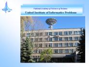
National Academy of Sciences of Belarus United Institute of Informatics Problems Interpretation of remote sensing images and digital maps and their applications The ...
| PowerPoint PPT presentation | free to download
Soil This category contains geospatial features such as Histosols, Spodosols, Andisols, Oxisols, Vertisols, Ultisols, Mollisols, Alfisols, Inceptisols and Entisols.
| PowerPoint PPT presentation | free to view
(Burkina Avian Flu Example) The Concept of Geo-Spatial Data ... 80% common content in spatial data used by three ministries in this Burkina avian flu scenario ...
| PowerPoint PPT presentation | free to view
Scientific Applications of Online Geoprocessing Technology A Review Barbara Hofer Department of Geoinformatics Z_GIS, University of Salzburg, Austria
| PowerPoint PPT presentation | free to download


![Barkatullah University - [BU], Bhopal PowerPoint PPT Presentation](https://s3.amazonaws.com/images.powershow.com/9665873.th0.jpg)


