Geosat PowerPoint PPT Presentations
All Time
Recommended
Space Geodesy Branch, Code 926, NASA GSFC. Nikita P. Zelensky. Raytheon ITSS Corp., Greenbelt, MD. GFO CalVal Meeting. NOAA. Washington DC June 12, 2001 ...
| PowerPoint PPT presentation | free to view
Manufactured by: Ball Aerospace for the US Navy. Launched: February 10, 1998. ... By COB, or 21:00 to 23:00 UT, deliver MOE orbit to users at NOAA and the US Navy. ...
| PowerPoint PPT presentation | free to view
Three-axis stabilized (MWs), single solar array with 1-axis ... Launched Feb 10, 1998 on Taurus. Spacecraft tumbled instead of. achieving correct attitude ...
| PowerPoint PPT presentation | free to download
Laboratory for Space Geodesy and Remote Sensing, The Ohio State University, ... reprocess the GEOSAT Geophysical Data Record (GDR) (Lillibridge and Cheney, 1997) ...
| PowerPoint PPT presentation | free to download
Images received locally are from AVHRR (thermal, visible: ... Altimeter: Skylab, Geos 3, Seasat, Geosat, ERS, Topex/Poseidon, Jason, Envisat, ... RADAR ALTIMETER ...
| PowerPoint PPT presentation | free to view
Exploring the oceans The ocean floor By Tyler How do scientist study the ocean floor? the ocean floor can be as far to 11,000 meters down they can t survive ...
| PowerPoint PPT presentation | free to download
Data for Plate Tectonics. Earthquakes. World wide network for detecting nuclear tests ... Mapping ocean floor key to understanding Sea Floor Spreading ...
| PowerPoint PPT presentation | free to view
Utilize operational Doppler and precision laser orbits. Time tagging via ground-segment ... Time-tag stability & uniformity. Spacing between records ~ 0.98 s ...
| PowerPoint PPT presentation | free to view
Ocean Floor Exploration HMS Challenger (1872-1876) SONAR (Echo Sounder) Satellites In the 1970s, orbiting satellites began to collect ocean data This method proved to ...
| PowerPoint PPT presentation | free to view
Gravity Field and the Geoid
| PowerPoint PPT presentation | free to view
Files of elevation data with each pixel assigned a height value. What is a DEM (Digital Elevation Model)? What the numbers mean when converted to a DEM ...
| PowerPoint PPT presentation | free to view
ODINAFRICA/GLOSS Sea Level Training Course TIDE GAUGES AND ALTIMETRY IN THE GULF OF GUINEA 13-24 November 2006, Oostende Angora AMAN Contents The system - Principles ...
| PowerPoint PPT presentation | free to download
In the resort town of Skagen you can watch an amazing natural phenomenon. ... Oceans and Sunlight Sunlight will barely reach 150-m deep into the ocean.
| PowerPoint PPT presentation | free to download
Ocean Climate Data Records from Space
| PowerPoint PPT presentation | free to view
Oceanography An Invitation to Marine Science, 7th Tom Garrison Chapter 4 Continental Margins and Ocean Basins
| PowerPoint PPT presentation | free to view
What's it like on a ship? 1998 L'Atalante cruise. What? ... satellite altimetry against 'ground-truthed' shipboard bathymetry measurements. ...
| PowerPoint PPT presentation | free to view
Chapter 13 Exploring the Oceans Preview Section 1 Earth s Oceans Section 2 The Ocean Floor Section 3 Life in the Ocean Section 4 Resources from the Ocean
| PowerPoint PPT presentation | free to download
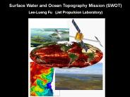
... Ocean Topography Mission (SWOT) Lee-Lueng Fu (Jet Propulsion ... Precision timing of the sampling system allows precise ranging of the returned signals. ...
| PowerPoint PPT presentation | free to download
Title: FFC Standard Template Author: administrator Last modified by: lamar.russell Created Date: 2/17/2005 1:34:37 PM Document presentation format
| PowerPoint PPT presentation | free to view
The importance of positioning in cooperative systems. Position is needed ... The availability of the EGNOS signals, normally send by a geostationary satellite ...
| PowerPoint PPT presentation | free to view
Gravity (or, lies my physics class told me about physical contants) Couple of things ... Another reading: Turcotte and Schubert, chapter 5 (outside office tonight) ...
| PowerPoint PPT presentation | free to view
Most scientists prior to the 1900's thought the ocean floor ... Surface Temperature Changes Surface-zone temperatures vary with latitude and the time of year. ...
| PowerPoint PPT presentation | free to download
This shows us information that we could not see in the air photo. Air photo ... Digital Elevation Model of Downtown Cleveland. WHY USE DIGITAL ELEVATION MODELS? ...
| PowerPoint PPT presentation | free to view
Aruba Eclipse Support. Full solar eclipse February 26, 1998 ... Functional duplicate of SPTR S-band system put together for the Aruba side of the link ...
| PowerPoint PPT presentation | free to view
Probably 50,000 seamounts 1 km tall remain undetected. ... Raney et al. will demonstrate improved H and reduced sensitivity to SWH over ocean surface. ...
| PowerPoint PPT presentation | free to download
Geodesy in the 21st century Shimon Wdowinski University of Miami Susan Eriksson UNAVCO Related but .. Big Idea #2: Earth is 4.6 billion years old. 2.7 Over Earth ...
| PowerPoint PPT presentation | free to view
Ocean Surface Topography Science Team Meeting. Venice, Italy: March 16 - 18, 2006 ... Editing thresholds and engineering flags. Sea surface height, SWH, Wind ...
| PowerPoint PPT presentation | free to view
... is considered a nuisance for many applications, including solar sailing ... counteract unwanted torque induced by solar radiation on asymmetric solar panels ...
| PowerPoint PPT presentation | free to view
... X X X X X X X X X X X X X X X X X X X X X X X X X X X X X X X ... 3 4 5 6 6 6 8 9 9 ; ; @ C D F H K M Q S U X YP[ ] a d h k l ...
| PowerPoint PPT presentation | free to view
Support: JCSDA Grant 'Improving analysis of tropical upper ocean conditions for ... and Hou, 1999; D'Andrea and Vautard, 2000; Griffith and Nichols 1996, 2000 ...
| PowerPoint PPT presentation | free to download
Decision on establishing new geodetic datums and maps projection will be brought ... the Book of rules for fundamental geodetic works will finally be finished ...
| PowerPoint PPT presentation | free to view
Microwave Remote Sensing: Principles and Applications
| PowerPoint PPT presentation | free to download
ODINAFRICAGLOSS Sea Level Training Course
| PowerPoint PPT presentation | free to view
... that corresponds to the magnitude of the angular velocity ... The magnitude of this vector corresponds to the radius of the sphere, measured in meters (m) ...
| PowerPoint PPT presentation | free to view
CReSIS OSU Remote Sensing
| PowerPoint PPT presentation | free to download
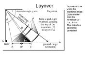
Layover Layover occurs when the incidence angle (q) is smaller than the foreslope (a+) i.e., q
| PowerPoint PPT presentation | free to download
Satellite Contributions to the Global Ocean Observing System for Climate Ocean Climate Data Records
| PowerPoint PPT presentation | free to view
Radar altimetry Frontiers 4:
| PowerPoint PPT presentation | free to view
Physical geodesy: gravity, geoid '' with basics of airborne gravity
| PowerPoint PPT presentation | free to view
There is a similar set of coordinates for the night sky. ... Figure out roughly where arc or segment is in the sky ... 1 minute before and scan section of sky ...
| PowerPoint PPT presentation | free to view
Least Squares Collocation. Global Marine Altimetric Gravity Field ... This will be treated in the subsequent Least Squares Collocation interpolation procedure. ...
| PowerPoint PPT presentation | free to view
Models developed to compute wave period T from altimeter data ... TOPEX altimeter Hs - used for model results verification (WERATLAS) ...
| PowerPoint PPT presentation | free to view
M. Bosiljevac, M. Marjanovic. EUREF Symposium 2004, Bratislava, 02 05 Juni ... model for height data between new and old hight system will be complex ...
| PowerPoint PPT presentation | free to view
The NOAA Satellite Altimetry Program: Closing the Sea Level Rise Budget with Altimetry, Argo and Grace Laury Miller, Eric Leuliette & John Lillibridge
| PowerPoint PPT presentation | free to view
Strong wind stirring occurs at the surface of the ocean ... Advanced Very High Resolution Radiometer (AVHRR) ... Advanced Microwave Scanning Radiometer (AMSR-E) ...
| PowerPoint PPT presentation | free to view
EM wavelength (defines radiometer operating frequency) EM polarization ... SSM/I is a seven channel passive microwave radiometer operating at four frequencies ...
| PowerPoint PPT presentation | free to view
Laxmi Ridge margin: Here, ... (MCS) reflection data along a 480 km profile from anomaly A27 to the continental rise north of the Gop Rift.
| PowerPoint PPT presentation | free to download
The role of GODAE as a prescriber for the altimetry constellation ... Map of SLA (1994/07/20) for TP (left) and TP ERS1geodetic (right) ...
| PowerPoint PPT presentation | free to download
Lodyc team (J. Etcheto, L. Merlivat, Y. Rangama) ... because of accumulation of dead phytoplancton cells & zooplankton detritus) ...
| PowerPoint PPT presentation | free to view
Param tres de surface oc anique par t l d tection Oceanic surface parameters by remote sensing Dominique DAGORNE IRD Centre de Bretagne US025
| PowerPoint PPT presentation | free to download
NASA s Earth Science Planning Update presented at the Joint Meeting of Ocean Sciences and Surface Water Hydrology in Support of Wide-Swath Altimetry Measurements
| PowerPoint PPT presentation | free to download
Airborne gravity '' A new data source for geoids
| PowerPoint PPT presentation | free to view
1. A Pacific Predictability Experiment - Targeted ... FASTEX Targeting Flight Meteo France / NCAR / NRL / NOAA. Goose Bay, Canada 22 Feb 1997 IOP-18 ...
| PowerPoint PPT presentation | free to view


