Geoscientific PowerPoint PPT Presentations
All Time
Recommended
Although Latin American nations were newly independent, this freedom did not ... Rio de la Plata, Paraguay. 1825 all Spanish South America independent. Brazil ...
| PowerPoint PPT presentation | free to view
Title: A framework for representing, manipulating and reasoning with geographic semantics Author: Mark Gahegan Last modified by: Mark Gahegan Created Date
| PowerPoint PPT presentation | free to view
Some Challenges and Approaches to Representing Geoscientific Knowledge in Cyberinfrastructure ... Evolution replicating existing geo-technology practise in CI ...
| PowerPoint PPT presentation | free to view
The Integrated Data Viewer IDV: A tool for geoscientific visualization and analysis
| PowerPoint PPT presentation | free to view
Steve Weaver. San Diego Supercomputer Center (GEON) Kai Lin. Chaitan Baru ... 'You can know the name of a bird in all the languages of the world, but when ...
| PowerPoint PPT presentation | free to view
Geoscientific Model Development (GMD) is an international scientific journal ... discussion of the description, development and evaluation of numerical models of ...
| PowerPoint PPT presentation | free to download
Introduction to the National Geo-data Repository of the Netherlands DINO ... DINO is designed to store some 225 geoscientific data types 'One-stop-shop' ...
| PowerPoint PPT presentation | free to view
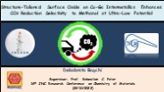
Electrochemical CO2 reduction reaction (eCO2RR) is performed on two intermetallic compounds formed by copper and gallium metals (CuGa2 and Cu9Ga4). Among them, CuGa2 selectively converts CO2 to methanol with remarkable Faradaic efficiency of 77.26% at an extremely low potential of −0.3 V vs RHE. The high performance of CuGa2 compared to Cu9Ga4 is driven by its unique 2D structure, which retains surface and subsurface oxide species (Ga2O3) even in the reduction atmosphere. The Ga2O3 species is mapped by X-ray photoelectron spectroscopy (XPS) and X-ray absorption fine structure (XAFS) techniques and electrochemical measurements.
| PowerPoint PPT presentation | free to download
Integrated Data Viewer IDV for RICO
| PowerPoint PPT presentation | free to view
3D STRUCTURE MODELING AT THE FEDERAL INSTITUTE FOR GEOSCIENCES AND NATURAL RESOURCES (BGR), GERMANY Birgit Willscher, Rolf R diger Ludwig, Bettina K hn
| PowerPoint PPT presentation | free to view
Dan Lunt, James Annan, Julia Hargreaves, Ian Rutt, Rolf Sander ... Numerical Methods: Annan, Rutt, Sandu, Tobis. Oceanography: Roberts ...
| PowerPoint PPT presentation | free to download
205 Billion Barrels of O OEG For 15 Sedimentary Basins only; needs up-gradation ... Synergetic approach through administrative reforms ...
| PowerPoint PPT presentation | free to download
of the Community Land Model (CLM) Global distribution of number of subgrid PFTs within each 0.5 degree grid cell from the new (left) and CLM4.0 (right) data
| PowerPoint PPT presentation | free to download
World Data Center
| PowerPoint PPT presentation | free to download
Graz University of Technology. Introduction SagaGIS ... Unzip the file (16.3 Mbyte) Run 'saga_gui.exe' Similar process under Linux ...
| PowerPoint PPT presentation | free to view
Birgit Willscher, Rolf R diger Ludwig, Bettina K hn ... not applicable for complex faulting (ramps, overthrust faults) 4 Conclusions ...
| PowerPoint PPT presentation | free to view
Classical RangeQuery hits TooManyClausesException on large ranges and is very slow. ... pangaea.de (main site) www.wdc-mare.org (displays query time) 10. Thank ...
| PowerPoint PPT presentation | free to download
Surface topography of Hungary
| PowerPoint PPT presentation | free to view
Responsibility for model development and bug-fixes. ... papers describing subsequent model development and bug-fixes will be encouraged. ...
| PowerPoint PPT presentation | free to download
A paleo-solfatara near the north end of Frigate Bay and Fort Tyson. ... the main road between Brown Hill and Church Ground and also north of Craddocks. ...
| PowerPoint PPT presentation | free to download
Ben Weltevrede. 10/13/09. 2. Mission of OpenSpirit Alliance ... 10/13/09. 3. Shell (EPT and OU) commitments. Shell is committed to: ...
| PowerPoint PPT presentation | free to view
IRC Status Report: The Baseline Surface Radiation Network (BSRN) And its Central Archive The World Radiation Monitoring Center (WRMC) Julian Gr bner, Gert K nig-Langlo
| PowerPoint PPT presentation | free to download
Quantifying Carbon Uptake by Vegetation for Europe on a 1km Resolution M. Tum, C. Seipp, M. Niklaus, K.P. G nther German Aerospace Center (DLR), German Remote ...
| PowerPoint PPT presentation | free to download
Seabed Mapping Technology and Ocean Management
| PowerPoint PPT presentation | free to view
Seismicity (ANSS) Paleoseismology. Local site effects. Faults (USArray) Stress transfer ... Seismic velocity (USArray) (from Leinen, 2004) ...
| PowerPoint PPT presentation | free to view
Binaries are free and are available for most common Linux/Unix, Mac OS and Windows. ... CAM-CLM Subroutine Call Tree. GT HTML Version of CAM3.1-CLM3 code see at ...
| PowerPoint PPT presentation | free to view
TopAS is a program system for automatic evaluation of Digital Terrain Models ... By the use of modules of the program SISCAT, TopAS calculates and ...
| PowerPoint PPT presentation | free to view
Introduction to NCL The NCAR Command Language
| PowerPoint PPT presentation | free to download
International Association of Geodesy The Electronic Geophysical Year GFZ ISDC portal Unique door to data and information B. Ritschel (1), ISDC Team (1,2,3,4)
| PowerPoint PPT presentation | free to download
Kwok, R., 'Exchange of sea ice between the Arctic Ocean and the Canadian Arctic ... much more realistic Atlantic Water in the Eurasian basin compared to A0. ...
| PowerPoint PPT presentation | free to view
... aerial photographs and spatial (GIS) data throughout the state of Florida. ... Imagery/ Base Maps/ Earth Cover. Inland Waters. Intelligence/ Military ...
| PowerPoint PPT presentation | free to view
The IRIS Earthquake Browser (IEB) is an interactive map service for finding and ... The user chooses earthquake times, locations, depths, magnitudes, and how ...
| PowerPoint PPT presentation | free to view
GFZ Potsdam IAG GGOS Project
| PowerPoint PPT presentation | free to view
... for GSC was launched Important work was undertaken on the development and the accessibility of key ESS datasets e.g. geochronology and marine geoscience ...
| PowerPoint PPT presentation | free to download
lithological units. Earth Materials. rocks. Structures. contacts, faults. What ... Lithology. Geological Age. Essentially produce two thematic maps. OTHER WORK ...
| PowerPoint PPT presentation | free to view
The gravity field of the Earth is an equipotential surface. ... Earth's gravitational force and the centrifugal force caused by the rotation of ...
| PowerPoint PPT presentation | free to view
Outline of the Geoscience Spatial Framework (GSF) data model ... Tectonic Plate Extent. Tectonic Plate Pole of Rotation. Spatial Feature/Attribute Model (3) ...
| PowerPoint PPT presentation | free to view
PreCompetitive Geoscience Information and other Australian Government support for Geothermal Develop
| PowerPoint PPT presentation | free to view
... continua on predicted Darcy fluxes, groundwater residence times and flow paths ... of obtaining hydraulic head and Darcy velocity distributions in the fracture and ...
| PowerPoint PPT presentation | free to download
... many other bodies in recognizing that knowledge is the common wealth of humanity. ... Article 6: Common standards and cooperation ...
| PowerPoint PPT presentation | free to view
... offered by modern digital communications and information management technologies. ... with advanced information technology and communications capabilities ...
| PowerPoint PPT presentation | free to download
are being run by universities, in real time, at dozens of sites. around the country, often in ... Penn State University MM5 Tropical Prediction System ...
| PowerPoint PPT presentation | free to download
... environmental and occupational health issues are based on good science. ... Support mining education and research and development within the mineral industry. ...
| PowerPoint PPT presentation | free to view
A profession is a 'calling requiring ... Professions assign their highest obligation to society above all others ... geology, geophysics and geochemistry ...
| PowerPoint PPT presentation | free to view
Trunojoyo M I / 135 Jakarta 12160 INDONESIA Telephone : 62.21 721122/7261875 ... (4) Exploratory drilling (wildcat) ; drilled in a news geothermal prospect which ...
| PowerPoint PPT presentation | free to view
Using the SCEC Computational Platforms for Seismic Hazard Analysis Research
| PowerPoint PPT presentation | free to view
Presentation to The AusIMM Congress, Ballarat 2006. Monika Sarder ... so that where appropriate they promulgate them in their professional roles. ...
| PowerPoint PPT presentation | free to download
When geologists say they are 'optimistic', the truth is that ' ... Congo Kinshasa. Jordan. Belarus. UK. Oman. South Africa. Denmark. Norway. Bangladesh. China ...
| PowerPoint PPT presentation | free to view
A chronostratigraphic division of the Precambrian: possibilities and challenges
| PowerPoint PPT presentation | free to view
Computational Science, Applied Math, and Nanoscience. Ananth Grama ... a marriage of geophysics, computational science and applied math the best way to ...
| PowerPoint PPT presentation | free to download
Title: Discovery of software systems for composition and their customizability in free and open source geospatial software environments A Case Study
| PowerPoint PPT presentation | free to download
Delaunay Triangulation & Application Course Presentation by Wei-Chao Chen Oct. 29, 1998
| PowerPoint PPT presentation | free to download
Draft of a core meta data block for the SINEX-Format: ... Hardware: PC, dual core 2,4 GHz, 2Gbyte Mem, Linux, SuSE 10.3. REFSYSNAME ITRF2000 ...
| PowerPoint PPT presentation | free to view
data are from satellites (CHAMP, GRACE, SAC-C, GPS) and from ground stations (GPS, Laser, SG, ... ISDC portal CHAMP ISDC homepage: isdc.gfz-potsdam.de/champ ...
| PowerPoint PPT presentation | free to view
Society has given the professions the privilege and authority of self regulation. As part of this 'social contract' ... geology, geophysics and geochemistry ...
| PowerPoint PPT presentation | free to view
The Netherlands Institute of Applied Geoscience TNO ... institute in the Netherlands for information and research ... of the Subsurface of the Netherlands. ...
| PowerPoint PPT presentation | free to view


