
Geosystem PowerPoint PPT Presentations
All Time
Recommended

Air Condition ANY building on Earth ! GeoExchange Heating & Cooling. How does it work? ... No fuel tanks, chimney/flue. No fuel cost spikes (natural gas/propane) ...
| PowerPoint PPT presentation | free to view

POST WILDFIRE SLOPE AND CHANNEL PROCESSES EXPECTED FOR THE MARTIN BURN FIRE-ADAPTED GEOSYSTEM B. Vasiliki Vassil, PG Associate Director, RCD of Santa Cruz County
| PowerPoint PPT presentation | free to view

Usually triggered by high intensity or long duration rain on saturated ground. FLOODS ... (James Taylor) HIGH INTENSITY RAIN STORM ...
| PowerPoint PPT presentation | free to view

Geosystems FIFTH EDITION AN INTRODUCTION TO PHYSICAL GEOGRAPHY Robert W. Christopherson Chapter 1 Essentials of Geography Geosystems 5e An Introduction to Physical ...
| PowerPoint PPT presentation | free to download

one of the seven technical committees established in 1997 by ECA Conference of Ministers ... Leica Geosystems. Maps Geosystems. Oakar Sevices Ltd, Kenya ...
| PowerPoint PPT presentation | free to view

Designing and Implementing a successful GNSS Infrastructure Project Neil Ashcroft, J v Cranenbroeck, V Lui Leica Geosystems
| PowerPoint PPT presentation | free to view

MetricVision/Leica Geosystems. http://www.mensi.com/ 3Dipsos, ... HDS 2500 (former Cyrax 2500) Leica Geosystems/ Cyra Technologies. http://www.callidus.de ...
| PowerPoint PPT presentation | free to download

Calibration services provide various advantages, many of which are crucial to the successful and safe operation of a manufacturing or industrial plant. Visit: https://www.falcon-geosystems.com/calibration-servicing-2/
| PowerPoint PPT presentation | free to download
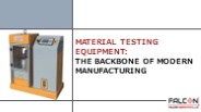
we will dive into the significance of material testing equipment, its key applications, and how it contributes to creating a safer and more reliable world. Know more: https://www.falcon-geosystems.com/alfa-testing-equipment-products/
| PowerPoint PPT presentation | free to download

Chapter 7. Water and Atmospheric Moisture. Geosystems 6e. An Introduction ... Eustasy, Glacio-eustasy, Isostasy. Ocean and Freshwater Distribution. Figure 7.3 ...
| PowerPoint PPT presentation | free to download
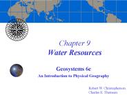
Chapter 9 Water Resources Geosystems 6e An Introduction to Physical Geography Robert W. Christopherson Charles E. Thomsen Water Constantly cycling through the ...
| PowerPoint PPT presentation | free to download

Chapter 19 Ecosystem Essentials Geosystems 6e An Introduction to Physical Geography Robert W. Christopherson Charles E. Thomsen What is this an example of?
| PowerPoint PPT presentation | free to download

Chapter 14 River Systems and Landforms Geosystems 5e An Introduction to Physical Geography Robert W. Christopherson Charlie Thomsen
| PowerPoint PPT presentation | free to view

Materials testing is a well-known and widely used method of determining the physical and mechanical properties of materials derived from powders or raw materials, components, and composite finished products. Visit : https://www.falcon-geosystems.com/
| PowerPoint PPT presentation | free to download

Chapter 8 Weather Geosystems 5e An Introduction to Physical Geography Robert W. Christopherson Charlie Thomsen Air Masses Air Masses Jet Stream Jet Stream Weather Map ...
| PowerPoint PPT presentation | free to view

Some of the players in the LiDAR market are Beijing Surestar Technology, Geodigital, Leica Geosystems, Michael Baker International, Ouster, Teledyne Optech, Topcon Positioning Systems
| PowerPoint PPT presentation | free to download
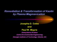
Remediation & Transformation of Kaolin by Plasma Magmavication Josepha D. Celes and Paul W. Mayne Geosystems Division Civil & Environmental Engineering
| PowerPoint PPT presentation | free to download

A total station is a surveying tool that combines an electromagnetic distance measuring instrument and an electronic theodolite. It also includes a microprocessor, an electronic data collector, and a storage system. Visit: https://www.falcon-geosystems.com/used-survey-equipments/used-total-stations/
| PowerPoint PPT presentation | free to download

Figure courtesy of Michael Vellinga, Hadley Centre. End of Chapter 6. Geosystems 5e ... Turning off thermohaline circulation: Hadley Centre ...
| PowerPoint PPT presentation | free to view

Chapter 10 Global Climate Systems Geosystems 5e An Introduction to Physical Geography Robert W. Christopherson Charlie Thomsen Key Learning Concepts After reading the ...
| PowerPoint PPT presentation | free to download
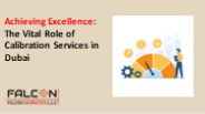
Calibration services play a crucial role in ensuring accuracy and reliability across various industries. From manufacturing to healthcare, calibration services are vital for maintaining precise measurements and quality assurance. This article highlights the significance of calibration services in achieving excellence and reliability in Dubai's industries. https://www.falcon-geosystems.com/calibration-servicing-2/
| PowerPoint PPT presentation | free to download

Ett svenskt f retag. HEXAGON v lk nt f r Leica Geosystems, Lantm teriet och Scanlaser GPS p gr vmaskiner S ljare GPS Lantbruk i Sverige.
| PowerPoint PPT presentation | free to download
images and related data that are obtained from ground-based, air-or space-borne ... ERDAS Imagine: http://www.gis.leica-geosystems.com/Products/Imagine ...
| PowerPoint PPT presentation | free to download

Whether you're in the manufacturing, healthcare, or scientific sector, the need for calibrated instruments is universal. In Dubai, a bustling hub of industry and innovation, calibration services are not just a requirement; they are an essential part of maintaining quality and reliability. Know More: https://www.falcon-geosystems.com/calibration-servicing-2/
| PowerPoint PPT presentation | free to download
Chapter 11 The Dynamic Planet Geosystems 5e An Introduction to Physical Geography Robert W. Christopherson Charlie Thomsen Overview Earth is a dynamic planet whose ...
| PowerPoint PPT presentation | free to download

Chapter 15 Eolian Processes and Arid Landscapes Geosystems 5e An Introduction to Physical Geography Robert W. Christopherson Charlie Thomsen Final Exam The final exam ...
| PowerPoint PPT presentation | free to download

Chapter 2 Solar Energy to Earth and the Seasons Robert W. Christopherson Charlie Thomsen * * * * * * * * * * * Seasonal Observations Figure 2.18 Geosystems 7e An ...
| PowerPoint PPT presentation | free to view

Principal Survey Advisor, Queensland Government, Australia. Vice President, International Federation ... Leica Geosystems. 3. Enabling Real-Time Positioning. 13 ...
| PowerPoint PPT presentation | free to view

Direct Spatiotemporal. Interpolation of Reservoir Flow Responses. Presented by Shekhar Srinivasan ... The University of Texas at Austin. Petroleum & Geosystems ...
| PowerPoint PPT presentation | free to view

Chapter 16 The Oceans, Coastal Processes and Landforms Geosystems 5e An Introduction to Physical Geography Robert W. Christopherson Charlie Thomsen
| PowerPoint PPT presentation | free to download

Petroleum & Geosystems Engineering Graduate Students Assembly. January 26, 2005. ... Two-dimensional chemical flow simulator which includes the effect of salt mixing ...
| PowerPoint PPT presentation | free to view

Chapter 18 The Geography of Soils Geosystems 5e An Introduction to Physical Geography Robert W. Christopherson Charlie Thomsen Final Exam: Correction!
| PowerPoint PPT presentation | free to download

Chapter 20 Terrestrial Biomes Geosystems 5e An Introduction to Physical Geography Robert W. Christopherson Charlie Thomsen Final Exam On April 11 at the Alumni Hall ...
| PowerPoint PPT presentation | free to download

Technical possibilities estabilished by WETLIVONIA for remote sensing, GIS and ... ERDAS IMAGINE , from Leica Geosystems Geospatial Imaging, is the leading imagery ...
| PowerPoint PPT presentation | free to view

1. MRF Clean for FME. MRF Geosystems Corporation. 2. Parcel. Streets. Topography. Typical GIS User. 3. 4. 5. 6. How do people solve this problem? ...
| PowerPoint PPT presentation | free to view
Chapter 11 The Dynamic Planet Geosystems 6e An Introduction to Physical Geography Robert W. Christopherson Charles E. Thomsen The Dynamic Planet The Geologic Time ...
| PowerPoint PPT presentation | free to download

Leica Geosystems. Trimble. Royal Institution of Chartered Surveyors. Reviewed by: ... based on data from Ordnance Survey, Leica SmartNet' and Trimble VRS NOW' ...
| PowerPoint PPT presentation | free to view

Martin Nix and Dr Craig D. Hill Leica Geosystems AG Heerbrugg Switzerland Rapid GIS Spatial Data Quality Introduction GIS Data Quality Integrating Survey and GIS ...
| PowerPoint PPT presentation | free to view

Chapter 9 Water Resources Geosystems 5e An Introduction to Physical Geography Robert W. Christopherson Charlie Thomsen Web URL for GEOG 123b: http://instruct.uwo.ca ...
| PowerPoint PPT presentation | free to view

Influence of mT Air Mass. RW Christopherson. Geosystems 4ed. Figure 8-3 ... How does forming over land or water determine the specific humidity of an air mass? ...
| PowerPoint PPT presentation | free to view

Company 'Leica Geosystems', Switzerland. Company 'IX AB', Sweden ... Leica (Disto) 36,756.00 USD. Yamayo 5,478.00 USD. Robotoolz 19,760.00 USD ...
| PowerPoint PPT presentation | free to view

The Sand Pouring Cylinder is a simple, yet effective device used in geotechnical engineering for determining the field density of soil. It plays a crucial role in assessing the quality of soil compaction, which directly affects the stability and load-bearing capacity of structures. When it comes to Sand Pouring in Dubai, Falcon Geomatics is a name you can trust. Visit Here:- https://www.falcon-geosystems.com/sand-aggregate-fillers-testing/
| PowerPoint PPT presentation | free to download

United Nations Economic Commission for Africa. ICT and Sciences ... Two CORS were donated by Leica Geosystems and were installed in Kenya and Nigeria. ...
| PowerPoint PPT presentation | free to view

'Geospatial Data: The Cornerstone of Information Dominance' ... Sponsored by Leica Geosystems GIS and Mapping. Wed 4 May, 1630-1930. SOSA Rec. Center ...
| PowerPoint PPT presentation | free to view

Project Leader Matt Higgins, Department of Natural Resources ... Energy GPS-Ag, Industrea, Leica Geosystems, Position One, Trimble Navigation, V-TOL Aerospace. ...
| PowerPoint PPT presentation | free to view

GPS stands for Global Positioning System and provides a live time Location that can be used for data collection and analysis. It is a Primary part of several surveying and mapping projects of Lands. It is often our most reliable source because it has helped increase the productivity of people surveying a location. The Main Thing about this equipment is giving accurate and much more reliable data compare to Old Manual Methods. Falcon Geosystem GPS Providers In UAE have all the advanced GPS tools.
| PowerPoint PPT presentation | free to download

Encryption-- Where and How Makes all the Difference ... Motorola, USCG, Leica Geosystems, and AMCO Automated Systems. Why is Locus Qualified to Talk ...
| PowerPoint PPT presentation | free to view

Texas A&M University. Petroleum Engineering Department. CSM Industrial Affiliates Meeting ... Project with National Instruments (NI) ...
Falcon Geomatics LLC. is a leading provider of Calibration service in Dubai, UAE . FALCON reference types of equipment are accurately calibrated and tested as per the company’s quality procedures. We provide an extensive scope of items and administrations from convenient calibrators.
| PowerPoint PPT presentation | free to download

Let's look at some intriguing applications of material testing devices in various sectors.
| PowerPoint PPT presentation | free to download

Let's look at the complexities of calibration services in Dubai, where accuracy meets the demands of a tough environment.
| PowerPoint PPT presentation | free to download

Today, we'll go on a journey to discover the unexpected uses of sieve shakers in research, revealing their astonishing diversity and utility beyond standard applications.
| PowerPoint PPT presentation | free to download
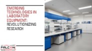
We will look at some of the most intriguing developing innovations in laboratory equipment and how they are altering the field of scientific research.
| PowerPoint PPT presentation | free to download

If you're looking for the best sieve price online in Dubai, look no further than Falcon Geomatics. With their wide selection of sieves, fast shipping, and commitment to quality, you can be sure that you're getting the best value for your money.
| PowerPoint PPT presentation | free to download

We'll go over some expert tips and tactics for maximizing surveying efficiency with Nikon Total Station, allowing you to streamline your surveying procedures like never before.
| PowerPoint PPT presentation | free to download

This is where metrology equipment comes in, acting as the foundation of quality assurance from the lab to the production floor.
| PowerPoint PPT presentation | free to download