Hydrometeorology PowerPoint PPT Presentations
All Time
Recommended
GIS for Hydrology and Hydrometeorology One-day Short Course American Meteorological Society Dallas, Texas 10 January 1998 Speakers David R. Maidment, Center for ...
| free to download
1. NWS-COMET. Hydrometeorology Course. 23 February 9 March 2000. Meteorology Primer ... Very long term average for mid-latitudes. Average surface pressure 1013 mb ...
| free to view
... Atmospheric Research at Colorado State University Annual Review Jan 7-9, 2003 ...
| free to view
Hydrology, Hydraulics and Hydrometeorology of Floods in the Eastern United States
| free to view
More than 200 rivers enter with 1000 s ... The stream bed is constantly changing and evolving via ... and in streamflow it is the roughness of the channel bottom ...
| free to view
Russian Federal Space Agency Federal Service for Hydrometeorology and Environmental Monitoring High-elliptical Orbits Satellite System
| free to download
... and Vjosa, is situated in Greece, FYR of Macedonia and Serbia ... The climate of Albania, in general, is Mediterranean. with some degree of continentality. ...
| free to view
Statistical pre-processing and analyses of hydrometeorologic time series in a geologic clay site (methodology and first results for Mont Terri s PP experiment)
| free to download
Center for Geosciences Hydrometeorology - CASC2D Model Pierre Julien Darcy Molnar Joe Spah Andy Jones Tom Vonder Haar Civil Engineering Department Colorado State ...
| free to download
Communicating What We Know in 2005. Eve Guntfest: Public Response During ... To stimulate the faculty audience to think and probe more deeply on the topics ...
| free to download
Q2 Description, Results, and Plans Jian Zhang Hydrometeorology
| free to download
Microwave Remote Sensing of Snowpack Do-Hyuk DK Kang Postdoctoral Fellow Northern Hydrometeorology Group (NHG) Environmental Science and Engineering
| free to download
Objective: a 'better world': Sustainable development, ... vegetation, hydrometeorology/surface moisture, human activities. 14. Climate affects air quality: ...
| free to view
There is little snow cover to insulate the soil ... From Center for Hydrometeorology and Remote Sensing, University of California, Irvine ...
| free to view
Determine characteristics of landscape boundaries in terms of ... 10 current PhD students in RS/GIS/Hydrometeorology. ICONE Infomation - University of Salford ...
| free to view
To understand the role of the South American low-level jet in moisture and ... Terrestrial cryosphere and hydrometeorology of cold regions. CPA2. ...
| free to view
The diurnal cycle in precipitation remains a very difficult challenge for global ... inferred from geostationary IR (Joyce et al., 2004, J. Hydrometeorology) ...
| free to view
... Murmansk Administration for Hydrometeorology. tel./fax. ... Hydrometeorology and ... Administration for Hydrometeorology and Environmental Monitoring ...
| free to view
However, it is ambitious, timelines are too optimistic, more money ... Improve the understanding of the hydrometeorology of mountainous areas. ...
| free to view
Models and data resulting from NASA and NOAA research have the potential to ... streamflow forecast ensemble mean and spread, J. of Hydrometeorology (in review) ...
| free to view
Title: PowerPoint Presentation Author: Susan Moran Last modified by: Dara Entekhabi Created Date: 9/8/2004 6:32:37 PM Document presentation format
| free to download
NASA Soil Moisture Active Passive (SMAP) Mission Susan Moran (USDA ARS) Vanessa Escobar, Molly Brown and Peggy O'Neill (NASA GSFC) Dara Entekhabi (MIT)
| free to download
... //www.orcbs.msu.edu/environ/programs_guidelines/wellhead/glossary_faq/capillary_fringe.jpg http://techalive.mtu.edu/meec/module06/Packing.htm http://research ...
| free to download
Snoqualmie. Hydromet Performance 2. Observed. MM5-DHSVM. NWRFC ... Snoqualmie Cedar. Average Relative Error in Peak Flow Forecast. Obs-based. Control. No Bias ...
| free to download
Title: No Slide Title Author: Surface Water Hydrology Research Last modified by: Dennis Lettenmaier Created Date: 5/16/1998 8:18:59 PM Document presentation format
| free to download
Research at the Hydrology and Quantitative Water Management Group
| free to view
Climate and Cryosphere Project (CliC) Activities in Asia ... Yellow River. Lu River. Meikong. Ili. Eb. Cryosphere in central Asia. Potentially impacted areas ...
| free to view
... to advance the science of high-resolution climate modeling by taking advantage ... strengths and weaknesses of high-resolution climate modeling on specific domains ...
| free to download
Title: Civil & Environmental Engineering Author: Scherfig Last modified by: boyerc Created Date: 10/23/2003 3:06:43 AM Document presentation format
| free to download
coupling of land-surface processes to clouds 'cloud albedo' ... tested snow albedo changes for two months, and presented a fait accompli' to Tony ...
| free to download
University of Oklahoma; Cooperative Institute for Mesoscale Meteorological Studies. Norman, Oklahoma. Hazardous Weather Testbed- Experimental Forecast and Warning ...
| free to download
The British are coming The British are coming
| free to view
Hydrologic science studies the occurrence, distribution, circulation and ... Boundaries of hydrologic science. Water links atmosphere, earth, and ocean sciences ...
| free to download
Uruguay River basin land cover change potential vegetation vs 1990s ... Daily simulated streamflow for basin 3802, Uruguay at Paso de los Libres (Area: ...
| free to view
Farghalli A. Mohamed (Chemical Engineering & Materials Science) Adjunct. Xiaogang Gao ... Computer Engineering 43 34. Chemical 55 54. Electrical 49 42 ...
| free to download
Teleconnections means that weather changes at one location might be related to ... Mote, Philip W., Martyn Clark, and Alan F. Hamlet, 2004. ...
| free to view
In 1998, NSSL became involved in AMBER work. ... AMBER and the new display were operational in Tulsa and Sterling by Fall 1998. ...
| free to download
The methodology was the Tier 1 of the IPCC Revised Guidelines (1996) ... from the base year, provide description of data sources and calculation methods, ...
| free to download
Deliver decision support tools to users in public and private sectors ... model output useful for ecosystem studies. Learning and Professional Development - M ...
| free to view
NWA Annual Meeting,18 October 2006. Hydrometeorological Training: ... Most notable in coniferous burn areas. Hydrophobic layer. Soil layers downhill ...
| free to view
Japan Agency for Marine-Earth Science and Technology (JAMSTEC) ... (Hokkaido U) R. Shirooka, M.Katsumata (IORGC) Data Analysis. M. D. Yamanaka (IORGC/KobeU) ...
| free to view
Downscaling for Climate Change
| free to view
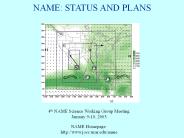
NAME: STATUS AND PLANS 4th NAME Science Working Group Meeting January 9-10, 2003 NAME Homepage: http://www.joss.ucar.edu/name OUTLINE OVERVIEW What is NAME?
| free to download
The Challenge of the 'Upper Tails' The Standard iid Assumption for FFA ' ... or if the available flood record omits. important sources of flooding, ...
| free to view
Operational Environmental Prediction: Nearshore Water Quality ... Multi-class phyto- and zooplankton, organic and inorganic nutrients, sediment digenesis, etc ...
| free to view
Hydrology Services. RFCs River Forecast Centers. WFOs Weather Forecast Offices ... Develop virtual RFC concept not inhibited by physical locations ...
| free to view
Pacific decadal oscillation and the filled capacity of dams on the rivers of the ... by a strong summertime signal concomitant with summer monsoon rains (Fig. 2a) ...
| free to download
... snow. High snow. Elevated ... at 700mb for low snow conditions. More stable beneath ... Snow. Severe thunderstorm data. Delayed onset of SVRWX reports ...
| free to view
TRANSFERABILITY EXPERIMENTS FOR ADDRESSING CHALLENGES TO UNDERSTANDING. GLOBAL ... Search for 'meta-comparisons' that might be done by blending intercom ...
| free to download
This paper describes territory and annual distribution of precipitation in ... be concluded that weather characteristics in 2003 were extreme deviations of air ...
| free to view
Typhoons, Floods,droughts. Warning. Send Warning. To. Countries at risk. Warnings to. communities ... END TO END ALL HAZARDS FORECAST AND WARNING ...
| free to view
A combined microwave and infrared radiometer approach for a high resolution ... Interpolation Algo. How do we get a global precipitation map? ...
| free to view
... 2002: Open Radar Product Generator ... 1) Weather radar research ... National Weather Radar Testbed. Storm Prediction Center (SPC) FY06 budget $4.4 M. People ...
| free to view


