Greg Keller greg'kellergov'mb'ca - PowerPoint PPT Presentation
1 / 42
Title: Greg Keller greg'kellergov'mb'ca
1
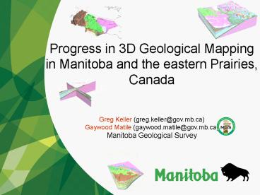
Progress in 3D Geological Mapping in Manitoba and
the eastern Prairies, Canada
Greg Keller (greg.keller_at_gov.mb.ca) Gaywood
Matile (gaywood.matile_at_gov.mb.ca) Manitoba
Geological Survey
2
Progress in 3D Geological Mapping in Manitoba and
the eastern Prairies, Canada
Acknowledgements Harvey Thorleifson (thorleif_at_um
n.edu) Minnesota Geological Survey Saskatchewan
Geological Survey
3
Manitoba Geological Surveys 3D program
Who?
- Its basically a two man show (Gaywood/Greg)
- Harvey helps keep us on the straight and
narrow path - Support from the director of the geological
survey, both in spirit and financially (to
purchase and maintain Gocad/3D workshops) - Total of 10 000/year budget (includes software,
travel, expenses)
What?
- Province wide 3D geological modeling
- Groundwater modeling is not undertaken by the
MGS. - Manitoba Water branch and universities
4
Manitoba Geological Surveys 3D program
Where/Why?
- Nearly all of the one million inhabitants of the
Province of Manitoba live in a 400 km x 700 km
area of Phanerozoic terrane in the southern
portion of the province. - The majority live in the Winnipeg area, a 200 km
x 230 km area, in the southeastern corner of the
province. - The City of Winnipeg obtains water from Shoal
Lake - However the 200,000 residents of surrounding
areas rely on groundwater obtained from bedrock
aquifers.
5
(No Transcript)
6
(No Transcript)
7
Manitoba Geological Surveys 3D program
Where/Why? Contd
- Models to used to support groundwater studies
- University of Manitoba Thesis (Paula Kennedy
groundwater flow modeling) - Water Branch (Manitoba Government) Drill
targeting (exploration) ie. buried valley aquifer
delineation - Educational tool (in house, and for the general
public)
8
3D Geological Mapping in Manitoba
1) Southeast Manitoba (complete)
2) Lake Winnipeg region (complete)
3) TGI Williston Basin (bedrock complete)
4) Southwest MB Quaternary (in progress)
5) Hudson Bay Lowland (future)
6) International Model (future)
9
3D Geological Mapping in Manitoba
10
Model Inputs
11
Digitize existing bathymetric charts
Large Lake Bathymetry
12
Lake Winnipeg Seismic
- Seismic surveys 94, 96 (MGS/Feds)
- Echosounding on Lake Winnipeg
- Better understanding of subsurface deposits in
Lake Winnipeg
13
Digital Elevation Data (SRTM)
14
Surficial Mapping
- Guide for model interpretation
15
Bedrock Model
- Guide for model interpretation
- Provides the termination of each unit below
surface
16
Drillhole Data
- Over 100 000 drillholes
- Waterwells, test holes,
- academic holes, oil and
- gas holes
- Data is sparse in fringe
- areas
17
3D Model Requirements Overview
- Geological Maps (surficial and bedrock)
- Drillhole databases
- Process Model
- Paleogeography
- Stratigraphy
Infrastructure
Process
18
Modeling Methodology
Southeast Manitoba/Lake Winnipeg
19
Cross-sections
20
Standardized lithological legend
21
Standardized lithological legend
- 5 km grid of PSPs
22
Access Database
PSP
Gocad Model
23
Southeast Manitoba
Block Model
- Modeled 31 units
- 17 are Quaternary
Section View
24
Lake Winnipeg
25
Modeling Methodology
TGI Willilston Basin
26
Targeted Geoscience Initiative II (TGI) Williston
Basin Architecture and hydrocarbon potential in
southwestern MB and southeastern SK
- Drillhole data is screened by Phanerozoic
stratigraphers
27
TGI Model - Data
- Five to eight deep, stratigraphically
significant drillholes per township (10 km by 10
km) were selected and re-picked by geologists
(9000 wells over the study area). - The resulting dataset of formation tops, plus a
dataset of formation edges, form the basis of the
TGI Williston Basin model. - Data was available for 60 formations, however
the key 42 were selected and modeled.
28
TGI Model GOCAD Surface Modeling
29
(No Transcript)
30
(No Transcript)
31
TGI Williston Basin 3D model
700 km
3000 m
32
TGI Williston Basin 3D model
33
Modeling Methodology
Western Canada Sedimentary Basin (WCSB)
34
(No Transcript)
35
Geological Atlas of the WCSB
Tertiary
Cretaceous
Jurassic
Triassic
Permian
Carboniferous
Devonian
Ordovician/Silurian
Cambrian
Precambrian
Valuable resource, assists in modelling TGI
36
Geological Atlas of the WCSB
37
Modeling Methodology
Southwest Manitoba
Southeast Manitoba
TGI
38
Modeling Methodology
Canada
International
USA
Southeast/Southwest Manitoba
Fargo/ Moorhead
TGI
39
Modeling Issues
- In areas with a large number of drillholes, a 5
km n/s width merged onto a single cross-section
trace can make interpretation difficult
- In areas with a small number of drillholes, the
same 5 km cross-section trace can generate data
that aids interpolation
40
Data Sharing Issues
- How to get 3D models out to the public?
- Static images of the model on the internet map
server (IMS) - Convert to VRML and serve
- Simplified version of the model
- Provide raw data?
- Public has paid for the work
- Manitoba government tries to make all data
freely available to the public
- We use GOCAD for all of our modeling work
- - Very powerful modeling tool
- Great visualization capabilities
- But
- GOCAD does not have a free data viewer
41
Pointset Curve Surface Solid Voxet (block
model) Sgrid
GEOCANDO
http//tu-freiberg.de/fakult3/geo/mageo/projekt_ge
ocando.html
42
Questions? GREG.KELLER_at_GOV.MB.CA
More information about Manitobas 3-D Modeling is
available at http//www.gov.mb.ca/itm/mrd/geo/3dm
odel/index.html
More information about the TGI 3-D Model is
available at http//www.willistonTGI.com
More information about the Fargo/Moorhead 3-D
Model is available at http//www.geo.umn.edu/mgs/


![[DOWNLOAD]⚡️PDF✔️ Bouchon Bakery (The Thomas Keller Library) PowerPoint PPT Presentation](https://s3.amazonaws.com/images.powershow.com/10062273.th0.jpg?_=20240622093)
![Download [PDF] Bouchon Bakery (The Thomas Keller Library) PowerPoint PPT Presentation](https://s3.amazonaws.com/images.powershow.com/10063319.th0.jpg?_=202406240910)
![Download [PDF] Bouchon Bakery (The Thomas Keller Library) PowerPoint PPT Presentation](https://s3.amazonaws.com/images.powershow.com/10063322.th0.jpg?_=202406240911)


![[DOWNLOAD]⚡️PDF✔️ Bouchon Bakery (The Thomas Keller Library) PowerPoint PPT Presentation](https://s3.amazonaws.com/images.powershow.com/10075665.th0.jpg?_=20240709093)

