Nad83 PowerPoint PPT Presentations
All Time
Recommended
The datum is the coordinate system that we use to locate ourselves on the earth ... GEOID. Earth Mass. Center. Approximately. 236 meters. Approximately. 2 meters ...
| PowerPoint PPT presentation | free to view
pleides100@yahoo.com. About Me. Schooling in Geology ... Older maps used NAD27. Newer maps use the more accurate NAD83 made using satellites and sophisticated ...
| PowerPoint PPT presentation | free to download
The Crazy Mountains Joint Venture. NAD27 Alaska. NAD27. GPS. Courtesy NOAA Photo Library ... Attribute NAD83 coordinate to NAD27 database. Custom Navigation Software ...
| PowerPoint PPT presentation | free to view
A 'good' map is one that is being successfully used for its intended purpose and ... WGS84 (World Geodetic System of 1984) uses GRS80, almost the same as NAD83 ...
| PowerPoint PPT presentation | free to view
ALWAYS collects in: Latitude/Longitude. WGS84. Projected X/Y (NAD83 UTM Zone 16N) Latitude/Longitude. WGS84 (raw GPS coordinates) LOCATION setting for DISPLAY only ...
| PowerPoint PPT presentation | free to view
... Parcel Map Database ... NAD83 Lat Long World Degrees. Stanley County, NC. With Parcel File ... Parcel Outline (Polygon) - This is geographic extent of the ...
| PowerPoint PPT presentation | free to view
Projected Coordinate Systems (UTM & State Plane) Week 4 Lecture 7 ... again between a ... NAD83: A Geocentric Datum; Aligns the ellipsoid center with the ...
| PowerPoint PPT presentation | free to view
... 1986 10 METERS (1 part in 100,000) NAD83(86) 1986-1990 1 METER (1 part ... HARN 1990-1997 0.1 METER B-order (1 part in 1 million) A-order (1 part in 10 million) ...
| PowerPoint PPT presentation | free to download
Chapter 3 in Jan Van Sickle s Basic GIS Coordinates (2004) ... Map Projection: (3D to 2D) 1) Purpose: 2) Difficulty: Shape of the earth 3) ...
| PowerPoint PPT presentation | free to download
Developed by National Imagery and Mapping Agency (NIMA, formerly Defense Mapping ... National Geographic's 'Round Earth, Flat Map' ...
| PowerPoint PPT presentation | free to download
Use offset measurements or Laser Rangefinder. Light Canopy Heavy Canopy GPS Global Positioning System Glonass GLObal Navigation Satellite System GNSS ...
| PowerPoint PPT presentation | free to download
GIS GIS Geographic Information Systems ...
| PowerPoint PPT presentation | free to download
Transverse Mercator Projection. Secant cylindrical projection ... Universal Transverse Mercator ... Each of 60 zones mapped onto transverse mercator projection. ...
| PowerPoint PPT presentation | free to download
Trails of the Prentiss Woods
| PowerPoint PPT presentation | free to view
Universal Transverse Mercator (UTM) NATO system. Metric units (meters) ... Distorted above North 84 , and South 80 , not applied above these latitudes. ...
| PowerPoint PPT presentation | free to view
Title: NATIONAL SPATIAL REFERENCE SYSTEM Author: DAVE DOYLE Last modified by: Mark W.Huber Created Date: 11/10/1997 9:52:36 PM Document presentation format
| PowerPoint PPT presentation | free to download
Projected Coordinate Systems Cylindrical Conical Planar Projected Coordinate Systems Transverse Mercator ... Universal Transverse Mercator ...
| PowerPoint PPT presentation | free to view
Map Projections and Datums of the Atlantic Provinces Making it Fit - or - Having a Fit by M. Donnelly & D. Raymond revised - 2002 With selected s from
| PowerPoint PPT presentation | free to view
Using a hand-held GPS unit. Online method (more on this later) GPS Equipment. Handheld ... Most USGS topographic maps used the survey points from 1927 (NAD27) ...
| PowerPoint PPT presentation | free to download
CE 453 Horizontal / vertical reference systems and mapping
| PowerPoint PPT presentation | free to download
Session: GP52A-02 Decade of Geopotential Research III Use of G99SSS to evaluate the static gravity geopotential derived from the GRACE, CHAMP, and GOCE missions
| PowerPoint PPT presentation | free to download
Mapping Projections of Kentucky Bryan W. Bunch, PLS, PG Geoprocessing Specialist III Kentucky NREPC-OIS-GIS 500 Mero Street 14th FL CPT 502-564-5174
| PowerPoint PPT presentation | free to download
Free adjustment analysis of each GPS project that contributed to the National ... Control for the NAD 83(NSRS2007) adjustment was provided by the CORS. ...
| PowerPoint PPT presentation | free to download
41 - Deciduous Forest. 42 - Evergreen Forest. 43 - Mixed Forest. 51 - Dwarf Scrub. 52 - Shrub/Scrub ... 3 - deciduous needleleaf forest. 4 - deciduous broadleaf ...
| PowerPoint PPT presentation | free to download
0.00 0.00 0.00 1.00 0.00 1.00 4.79 2462.00 49349.00 51303.00 140071495.00 111.00 5.00 5.00 1.00 10.20 103.00 0.00 1/1/1990. 1/3/2001. 6/22/2004.
| PowerPoint PPT presentation | free to view
Diffuser Performance Assessment Kanawha River, WV
| PowerPoint PPT presentation | free to download
Universal Transverse Mercator (UTM) Projection. Maximum scale error 0.25 percent at ... Eight tranvserse mercator, 2-degree wide zones. 1 zone conic projection ...
| PowerPoint PPT presentation | free to view
National Readjustment
| PowerPoint PPT presentation | free to download
National Readjustment of NAD 83
| PowerPoint PPT presentation | free to download
National Ocean Survey, NOAA. Silver Spring, MD 20910. February 2006. National CORS. National CORS ... City or Town : LEXINGTON. State or Province : KENTUCKY ...
| PowerPoint PPT presentation | free to download
Traitement et analyse de donn es (OD, recensement), mod les d'affectation des ... Fr quences et horaires de service, suivi automatis des v hicules, traitement ...
| PowerPoint PPT presentation | free to view
Gopher State One Call, One Call Concepts, and Call Center Mapping
| PowerPoint PPT presentation | free to view
Title: No Slide Title Author: rtravis Last modified by: Gordon Adams Created Date: 8/23/2000 6:41:53 PM Document presentation format: On-screen Show
| PowerPoint PPT presentation | free to download
Everything in Digital GPS itself is relying on digital ... To show driving directions for somewhere you want to go. To correct your GPS data collections ...
| PowerPoint PPT presentation | free to view
2. Digital Orthophoto Quarter Quads ... Allows photo to be shifted or scaled, but does not deform image. Requires at least 3 links ...
| PowerPoint PPT presentation | free to download
GEODESY OUTLINE: definition and history three major models how are reference shapes used geodetic systems mapping involves determining locations on earth ...
| PowerPoint PPT presentation | free to view
MANNING'S N VALUES ASSICITED WITH LANDUSE LAYER AND FLOODPLAIN INUNDATION MODELING USING ArcGIS ... Gage datum 280.16 feet above sea level NGVD29. h = 33.38 ft. ...
| PowerPoint PPT presentation | free to view
Water Balance Components. http://www.srs.fs.usda.gov/gallery/images/5_rain_gauge.jpg ... http://sflwww.er.usgs.gov/sfrsf/rooms/hydrology/compete/obspatialmapx.jpg ...
| PowerPoint PPT presentation | free to view
Composite Geoids. Gravimetric Geoid systematic misfit with benchmarks ... A, B, and 1st order GPS only. ABCRMH criteria for 1st, 2nd, and 3rd order leveling ...
| PowerPoint PPT presentation | free to download
NGS/NRL/GSFC joint airborne gravity and LIDAR mission in Golf of Mexico region ... GRAVITY-LIDAR COLLECTION MISSION. Future Plans: ...
| PowerPoint PPT presentation | free to download
The required free adjustment analysis of each GPS project that contributes to ... New adjustment procedures will be developed that incorporate local and ...
| PowerPoint PPT presentation | free to download
Orange County Real Time Network
| PowerPoint PPT presentation | free to view
Datum & Coordinate Systems Lecture 6
| PowerPoint PPT presentation | free to view
Map Projections (1/2) Francisco Olivera, Ph.D., P.E. Center for Research in Water Resources University of Texas at Austin Overview Geodetic Datum Map Projections ...
| PowerPoint PPT presentation | free to view
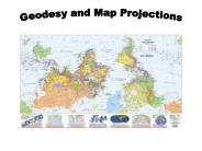
Title: Geodesy and Map Projections Author: Jude A. Benavides Last modified by: rgordon Created Date: 1/28/2004 8:29:42 PM Document presentation format
| PowerPoint PPT presentation | free to view
Extensive suite of instrumentation including spectral line, continuum, pulsar, ... Includes instrumentation, servos (existing), algorithm and control system design, ...
| PowerPoint PPT presentation | free to download
Geodetic Survey Division, Natural Resources Canada. 3rd SNARF Workshop ... Reginal Solns. Included: GSD Bernese. GSD GIPSY. NGS PAGES. PGC Bernese. SIO GAMIT. 4 ...
| PowerPoint PPT presentation | free to view
Is this a good map of the Earth? How about this? The Answer It depends A good map is one that is being successfully used for its intended purpose and was ...
| PowerPoint PPT presentation | free to download
... Survey (NGS) designed plane coordinate system for each ... UTM Zones Over New York State. Zone 18. Zone 19. Zone 17. ERE 371. Coordinate Systems and Datums ...
| PowerPoint PPT presentation | free to view
Each is identified by a unique Hydrologic Unit Code (HUC), containing 2 to 8 digits. ... 1:250,000 Scale Quadrangles of Land Use/Land Cover in the Conterminous U.S. ...
| PowerPoint PPT presentation | free to view
Example: What is the length of a 1 increment along. on a meridian and on a parallel at ... Parallels converge as poles are approached. Horizontal Earth Datums ...
| PowerPoint PPT presentation | free to download
Karen Smith, Justin Wilson, Nick Moebius, Ben Risser. To Begin: ... However the DOQQ file will need to be unzipped. Browse for the .sid file extension from dlvg32. ...
| PowerPoint PPT presentation | free to download
Logan: (42 N, 112 W) Length on Meridians and Parallels. 0 N. 30 N. Df. Re. Re. R. R. A. B. C ... Example: What is the length of a 1 increment along. on a ...
| PowerPoint PPT presentation | free to download
IWAA2002, 2. Metrology Department Goals. Support SLAC physics experiments. ... Visualization Tool: SIMS. Software Packaging: WinGEONET. Others: Refraction Studies ...
| PowerPoint PPT presentation | free to view


