Web-based Data Analysis PowerPoint PPT Presentation
1 / 30
Title: Web-based Data Analysis
1
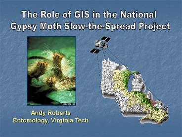
The Role of GIS in the National Gypsy Moth
Slow-the-Spread Project
Andy Roberts Entomology, Virginia Tech
2
What Ill do
- Introduce the gypsy moth problem
- Describe the Slow-the-Spread Project
- Give an overview of the seasonal activities of
STS, with an emphasis on GIS - Discuss specific STS needs that we are
addressing through GIS
3
Late summer
Fall / Winter
Gypsy moth life cycle
Late Spring
Summer
4
We know exactly how, where, when, and by whom
gypsy moth was introduced
- Introduced into Medford, MA in1869 by E. Leopold
Trouvelot - artist, astronomer, entomologist
5
Gypsy moth has spread through the midatlantic and
into the midwest since 1869
1900
1965
1934
1983
1994
1971
6
Slowing the rate of spread has positive economic
effects
- Historical rate 21 km/yr
- STS target rate 10 km/yr
7
Gypsy moth populations expand by establishment of
isolated colonies
Non-infested
Generally infested
To reduce the rate of spread we eradicate
isolated colonies.
Dynamics of colonization
8
The project is structured into different zones
2001 trapping grid
9
STS is a large and complex project
- 9 states
- 2 federal agencies
- 2 universities
- 280 trappers address 90,000 trapping sites in
10 grid densities - 170 treatment blocks totaling 592,000 acres using
4 products - 367,000 km2 in official project
10
GIS addresses project needs at multiple levels
ArcGIS ArcView
STS Decision Model
Oracle
W W W
- Field Data (GPS)
- DB Queries
- Error correction
- GIS data
ArcIMS
- Reports
- Support files
- GIS data
- Digital maps
ftp
Project personnel
11
GIS activities have a strong seasonality
Fall
Winter
Decision making (evaluation, analysis)
Data base preparation
Project planning
Spring
Summer
Treatment support
Trapping survey
12
Efficiency in STS demands preparation
Fall
Winter
Decision making
Data base preparation
Project planning
Spring
Summer
Treatment support
Trapping survey
13
Trapping activities for the coming year are
predetermined
- Where to trap
- Grid density
- Trap type, agency, etc.
- Distribute information to agencies
- Pre-load database
- Issue Field maps
14
Winter and Spring are used to finalize survey and
treatment plans
- State cooperators use custom GIS software to
update trapping plans and treatment operations - Issue Coordinating and standardizing decisions
among states, feds, and contractors.
15
Implementation of the treatment phase of STS is
very involved
Process
- DA suggests treatment blocks
- Cooperators refine blocks submit to GIS
- Feds sign off with states
- Blocks formatted for on-board DGPS and posted to
web for aerial applicators
16
Agencies use desktop treatment editing tools
ArcSDE?
17
The trapping season is labor intensive
Fall
Winter
Decision making
Data base preparation
Project planning
Spring
Summer
Trapping survey
Treatment support
18
Trappers work from maps gridded in accordance
with the project structure
- Maps were traditionally gridded by hand
- Now working to produce computer generated maps
19
Trap survey data are submitted to the DB
according to STS Protocols
- Inexpensive GPS receivers
- Quality control issues dealt with at upload from
receiver at database - Data are loaded automatically
- Generally a quiet time for the GIS
- Issue Improving field data collection and flow
to from the DB
ArcGIS ArcView ArcIMS
Oracle database
Decision model
20
Field supervisors use STS Trap Tools to
error-check GPS data from trapping survey
21
Decision-making ends the survey cycle
Fall
Winter
Decision making
Data base preparation
Project planning
Spring
Summer
Treatment support
Trapping survey
22
STS activities are planned and evaluated
biologically
- Project boundaries
- Trapping intensity
- Treatment strategies
Start here
2-km grid of traps
23
STS activities are derived using current trapping
data
Suggested boundaries Suggested treatments Suggeste
d delimiting grids Previous treatments Previous
catch Current catch
24
The roadshow is a traveling decision-making
process
- Maps prepared and shipped prior to meetings
- Cooperators meet to plan next years activities
- Plans are captured real-time in GIS
- Issue Time crunch for finalizing, modeling,
planning
25
Evaluation STS has been successful in reducing
the rate of spread of gypsy moth
STS target
26
Project personnel use a suite of ArcView tools to
manage project data
27
The Trapper Gadget will revolutionize gypsy
moth survey
- Problem Errors, limitations, and inefficiencies
of GPS as data logger - 2002
- iPAQ 3870 Pocket PC
- Visual Basic custom software
- Teletype GPS receiver
- 2003
- iPAQ 3900
- Trimble GeoXM w/ Windows CE
28
Gadget software restricts trappers to only
correct operations
29
Gadget desktop software will facilitate data
transmission
- Synchronization with DB
- Increased functionality for supervisors
30
The players
- Virginia Tech
- Denise Dodd
- Mannin Dodd
- Shahrooz Feizabadi
- Matt Learn
- Ben Logan (now elsewhere)
- Andy Roberts
- Alexei Sharov (now at NIH)
- Luke Scharf
- Michigan State
- Steve Crisp
- Matt McKimmy
- Amos Ziegler

