
ids 3.5.x Product Overview Tear Sheet PowerPoint PPT Presentation
1 / 2
Title: ids 3.5.x Product Overview Tear Sheet
1
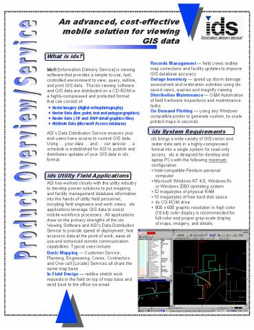
An advanced, cost-effectivemobile solution for
viewing GIS data
What is ids? ids Information Delivery Service
is viewing software that provides a
simple-to-use, fast, controlled environment to
view, query, redline, and print GIS data. The
ids viewing software and GIS data are distributed
on a CD-ROM in a highly-compressed and protected
format that can consist of ASIs Data
Distribution Service ensures your end-users have
access to current GIS data. Using your data
and our service a schedule is established for
ASI to publish and distributes updates of your
GIS data in ids format. ids Utility Field
Applications ASI has worked closely with the
utility industry to develop proven solutions to
put mapping and facility management database
information into the hands of utility field
personnel, including field engineers and work
crews. ids applications leverage GIS data to
assist mobile workforce processes. All
applications draw on the primary strengths of the
ids Viewing Software and ASIs Data Distribution
Service to provide speed of deployment, fast
access to data at the point of work, ease-of-use
and enhanced remote communication capabilities.
Typical uses include Basic Mapping Customer
Service, Planning, Engineering, Crews,
Contractors and One-call (Locate) Services all
share the same map base In-Field Design
redline sketch work requests in the field on top
of map base and send back to the office via email
Records Management field crews redline map
corrections and facility updates to improve GIS
database accuracy Outage Inventory speed up
storm damage assessment and restoration
activities using ids saved views, queries and
magnify viewing Distribution Maintenance OM
Automation of field hardware inspections and
maintenance tasks On Demand Plotting using any
Windows compatible printer to generate custom,
to-scale printed maps in seconds
- Aerial imagery (digital orthophotography)
- Vector Data (line, point, text and polygon
graphics) - Raster Data (.TIF and .BMP detail graphics files)
- Attribute Data (Microsoft Access database)
- ids System Requirements
- ids brings a wide variety of GIS vector and
raster data sets in a highly-compressed format
into a single system for read-only access. ids
is designed for desktop and laptop PCs with the
following minimum configuration - Intel-compatible Pentium personal computer
- Microsoft Windows NT 4.0, Windows 9x or Windows
2000 operating system - 32 megabytes of physical RAM
- 10 megabytes of free hard disk space
- 4x CD-ROM drive
- 800 x 600 graphic resolution in high color (16
bit) color display is recommended for full-color
and proper gray-scale display of maps, imagery,
and details
Product Overview/Service
2
ids Local Government Applications ASIs ids
viewing software lets local governments leverage
their GIS data assets to increase efficiency and
productivity with a minimum of effort. ASI works
with local governments to publish GIS data as ids
CD-ROM products to distribute internally, to
other governmental agencies and to the business
community. Common uses of ids within local
government organizations include Real Estate
Zoning Commission, Permits and Licensing
locate property, view infrastructure determine
land use and zoning restrictions field
inspection remote communication generate mailing
list. Field Assessor and Building Inspector --
locate and view property, verify permitting,
redlining and property improvement reporting via
remote communication, update GIS Economic
Development -- identify development sites,
determine impact on public services, storm,
sanitary infrastructure compare land use and
values, tax rates, boundaries. Public Works
Public Utilities -- locate and view facilities
create work orders remote communication
generate mailing list for notification
purposes. Street Maintenance -- locate areas,
view infrastructure perform construction
estimates determine rights-of-way determine
detours remote communication with
utilities. Surveying Engineering Department --
determine property details prior to dispatch
locate monuments, USGS control points , section
corners remote communication and
redlining. Public Transportation -- determine
routes, pick-up point for school bus, handicap
and public transportation systems, turn-around
space. Field Crews Comprehensive viewing of
field data remote communication and redlining.
Public Safety an All-hazards tool that provides
first responders with a common geographic
reference for Fire EMS Services -- determine
fire location, routes, access, infrastructure,
measure hydrant distances, view structure size,
determine hazardous materials, traffic control,
fire reporting. Police Departments locate
crime scene, tracking and reporting substation
placement generate mailing list for offender
notification. Disaster Planning, Mitigation,
Management, and Recovery - help identify
disaster and restricted areas, locate evacuation
routes and shelters, plan and redline first
responder and resource deployment locations, and
communicate this information electronically or
through on-demand printed maps with all involved
local, state, federal, and private
organizations. Sales and Distribution of
idsCD-ROM Map Products to the Business
Community There is a strong demand by the
business community for GIS information from local
government. An ids product helps significantly
reduce the workload on agency staff to meet this
demand by offering your GIS data to the public
sector as a value-added ready to use product.
Recommended
