
Users meeting Summary Performance of the Forecasting System 1 PowerPoint PPT Presentation
1 / 13
Title: Users meeting Summary Performance of the Forecasting System 1
1
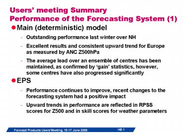
Users meeting SummaryPerformance of the
Forecasting System (1)
- Main (deterministic) model
- Outstanding performance last winter over NH
- Excellent results and consistent upward trend for
Europe as measured by ANC Z500hPa - The average lead over an ensemble of centres has
been maintained, as confirmed by gain
statistics, however, some centres have also
progressed significantly - EPS
- Performance continues to improve, recent changes
to the forecasting system had a positive impact - Upward trends in performance are reflected in
RPSS scores for Z500 and in skill scores for
weather parameters
2
Users meeting SummaryPerformance of the
Forecasting System (2)
- Severe weather event prediction
- Tropical cyclone forecasts have improved
significantly last year, providing generally good
guidance - Core pressure is underestimated, better in higher
resolution - Bias towards slow movement
- Delineating the TC in the analysis is important,
bogussing should be re-considered - Some overconfidence in strike probabilities
- First steps towards verification of the EFI
- Station verification of extreme precipitation
events over Europe using the EUMETNET/ECSN
Climate Atlas - Self-calibrating properties of the EFI provide
improved guidance over raw model probabilities - Example of successful indication of freak waves
in analysis and forecast
3
Users meeting SummaryPerformance of the
Forecasting System (3)
- Weather parameters
- One day gain per decade in predictive skill of
moderate amounts of precipitation - Same improvements cannot be demonstrated for
large amounts - Up-scaled precipitation analysis based on high
resolution observing network is used for
verification in delayed mode - Provides more reliable and robust results
obtained at the scale of the model - Reduced frequency bias in particular for small
amounts compared with verification results
obtained when using scattered SYNOP network - Problems with treatment of low level clouds
during persistent inversions over central Europe
in winter, improved boundary layer cloud scheme
was introduced in April 2005 and will help
alleviate these deficiencies - Some evidence of positive trend in T2m forecasts
over North America and parts of Europe - Episodes of strong low level inversions and
extreme cold conditions over Europe in February
contribute to larger errors
4
Users meeting SummaryPerformance of the
Forecasting System (4)
- Monthly forecasts
- Operational since October 2004, dissemination was
added spring 2005 - ROC area score indicates skill in T2m over
persistence for days 12-18, to a lesser extent
for days 19-32 - Good predictions of transition between flow
regimes last winter - Outer quintiles for T2m are skilful
- Meteo France finds moderate skill in T2m
forecasts for week 3 over France
5
Users meeting SummaryPerformance of the
Forecasting System (5)
- Seasonal forecasts
- Predictions of the monsoon precipitation for JJA
2004 verified well - Good representation of ocean currents in tropical
Pacific - Over the West Pacific basin the forecast
predicted successfully higher tropical storm
activity than the climatology over the Atlantic
the forecast has not been as good - Dry conditions over the Iberian Peninsula were
consistently predicted since November 2004 - Potential benefit from multi-model system
reduced rms error and improved correlation, eg
for NINO3 SST forecasts
6
Users meeting SummaryDevelopment of the
Forecasting System(1)
- Cy29r2 end June, to include
- 3-hourly EPS post-processing to 132 hours
- Near-real-time hindcast runs to create model
climate for EFI - Plans to implement higher resolution forecasting
system in autumn 2005 (T799L91/T399L62) - First test data in Mars end June
- E-suite data in Mars from mid-July
- Test dissemination by arrangement early September
- Information on web
- Unified system (VAREPS) with extension to 15 days
end 2005 - VAREPS to merge with monthly forecast early 2006
- Seasonal forecast system3
7
Users meeting SummaryDevelopment of the
Forecasting System(2)
- Product development
- Extended EPSgrams for Unified System
- Global and regional multi parameter EFI maps
- Prototypes of combined multi-model seasonal
products - New monthly forecast products, eg synoptic view
of temperature and flow anomalies - Additional archiving from monthly forecasting
system - Weekly anomalies
- Terciles
- Additional verification from monthly system on
web - Fields from up-scaled precipitation data to be in
MARS
8
Users meeting SummaryUse and evaluation in
Member States (1)
- Users report on a wide range of applications and
usage of medium and extended range products - Early delivery system improved the usefulness of
the forecasts, also in the early stages of the
forecast range - Presentation of probabilistic forecast
information to the public - On the web (DK, NL,), EPS spread expressed as
range, probabilities used for exceeding
thresholds - Weather scenarios are presented for days 7-9 (DK)
- Newspaper (S,..)
- On TV (NL, S..)
- Several case studies of successful severe weather
event forecasts (HUN, DWD, N,) - Influence of weather data (T, precipitation,
wind) on energy markets, probabilistic
information is used to create level of confidence
- Weather risk applications
9
Users meeting SummaryUse and evaluation in
Member States (2)
- Limited area ensemble prediction (COSMO-LEPS,
LAMEPS) - Encouraging results were reported from several
applications - Aiming at downscaled severe weather event
prediction - Use of LAMEPS output in Eurorisk project, storm
surge model, input to hyrdological models (N) - Ensemble prediction
- Ensemble mean is found useful for point forecasts
- Benefits of probabilistic forecast information
was emphasized - EFI used to alert forecasters (e-mail sent
automatically (SUI)) - Probability forecasts under development for
locations along the Finnish coast - Meteo France plans to study the skill in
predicting weather regimes in the monthly
forecasts - Used as input for hydrological forecasts (river
discharge) - Experimental use of new CAPE parameter (NL)
- Automatic generation of weather alarms for
forecasters (NL)
10
Users meeting SummaryUse and evaluation in
Member States (3)
- Other issues
- IRI reported on the potential benefit of extended
range forecasts for predicting rainfall in
regions epidemically affected by malaria
outbreaks - MetO reported on significant problems with the
generation of convective snowfall over the North
Sea in north-easterly flow in late winter 2005 - MetO further investigated the verification
results for early warnings, previously
experienced anomalies in the results with a
maximum in skill disappear when applying
verification procedures which are more in line
with standard NWP procedures - KNMI presented a web catalogue of high impact
weather events, using ERA-40 as a documentary
11
Users meeting SummaryUser requirements
- Medium range forecasting system
- Provide 3-hourly post-processing from the EPS
- Consider the development and extension of
suitable products to 15 days with the planned
extension of the forecast range - Develop suitable products for the unified
forecast system - Requirement for hindasts/learning sample prior to
model upgrades
12
Users meeting SummaryUser requirements (2)
- Monthly forecasting system
- Increase the number of members (from currently 5)
in the hindcast ensembles - Time of the runs and the delivery should be
reviewed - Multi-model seasonal forecasting system
- Develop combined and calibrated multi-model
products - Standardize the hindcast periods
- Standardize the reference periods for anomalies
- Standardized toolbox for verification is of
interest - Support for time critical applications run at the
Centre by Member States
13
Users meeting SummaryUser requirements (3)
- Requests for products
- Timely updating of products on the web is
important - Extend the range of web products
- Global EFI products to be made available to WMO
members - CAPE parameter in future ERA
- Times of product delivery to be reviewed after
the implementation of the planned upgrades in
2005/early 2006
Recommended
