
COSPASSARSAT - PowerPoint PPT Presentation
1 / 55
Title:
COSPASSARSAT
Description:
COSPASSARSAT – PowerPoint PPT presentation
Number of Views:686
Avg rating:3.0/5.0
Title: COSPASSARSAT
1
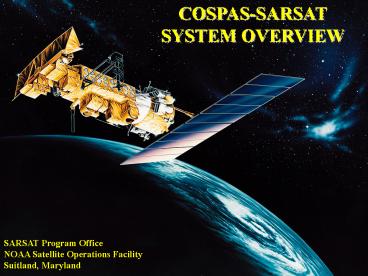
COSPAS-SARSAT SYSTEM OVERVIEW
SARSAT Program Office NOAA Satellite Operations
Facility Suitland, Maryland
2
COSPAS-SARSAT
COSPAS Cosmicheskaya Systyema Poiska Aariynyich
Sudov Which loosely translates into The
Space System for the Search of Vessels in
Distress SARSAT Search And Rescue Satellite
Aided Tracking
3
Its about saving lives
The Cospas-Sarsat Program protects life and
property by providing accurate, timely, and
reliable distress alert and location
information to search and rescue authorities.
In short, Cospas-Sarsat works to take the
search out of Search Rescue
4
Cospas-Sarsat
- Services are provided world-wide and free of
charge for the user in distress - Alerts are provided using satellite and ground
systems to detect, process, and relay the
transmissions of emergency beacons operating on
either 121.5/243 MHz or 406 MHz
5
Cospas-Sarsat History
- First beacons were 121.5/243 MHz Emergency
Locator Transmitters (ELTs) designed for military
aircraft in the 1950s. - U.S. Congress mandated ELTs on all U.S. aircraft
after Boggs-Begich tragedy in SE Alaska in early
1970s. Canada follows suit. - Problems soon emerge
- No identification of aircraft/beacon
- Designed for audible detection by over-flying
aircraft - No means of accurately locating ELTs
6
Cospas-Sarsat HistoryInternational Cooperation
- 1978 Canada, France and the USA agree to
co-operate on the development of the SARSAT
low-altitude polar orbiting system to - Locate existing 121.5 MHz beacons
- Develop a new technology for improved performance
406 MHz
- Russia declares its interest in co-operating
with the objective of ensuring inter-operability
of their COSPAS system with SARSAT. - Cooperative venture Governments were looking
for additional cooperative efforts after success
of Apollo-Soyuz and humanitarian nature of SAR
was an easy fit
7
Cospas-Sarsat HistoryThe First Satellites
- 1982 First Cospas satellite
- Cospas-1 (USSR) launched in June 1982.
- First rescue in September 1982
- 1983 Second Cospas and First Sarsat satellites
- NOAA-8 satellite (USA) with Canadian (SARR) and
French (SARP) instruments - 1985 System declared operational
- 406 MHz beacon technology arrives
8
International Cospas-Sarsat Program Organization
- Initially developed under interagency Memorandum
of Understanding signed in 1979 (USSR, USA,
Canada, France) - System declared operational in 1985
- 406 MHz beacons accepted by IMO for GMDSS in 1988
- International Cospas-Sarsat Programme Agreement
(ICSPA) formally signed on July 1, 1988 among the
governments of Canada, France, the former U.S.S.R
and the United States - ICSPA ensures continuity of the space system and
availability to all States on a
non-discriminatory basis
9
(No Transcript)
10
Elements of the Cospas-Sarsat System
- Users
- Beacons
- Space Segment
- LEOSAR
- GEOSAR
- Ground Segment
- Local User Terminal
- Mission Control Center
- Rescue Coordination Centres SPOCs
11
Emergency Beacons
- Two types 121.5/243 MHz and 406 MHz
- Four applications
- Emergency Position Indication Radio Beacons
(EPIRB) for Maritime Uses - Emergency Locator Transmitters (ELT) for Aviation
Uses - Personal Locator Beacons (PLB) for Remote Area
Personal Use - Ship Security Alerting System (SSAS) for
Shipboard Terrorism/Piracy Alerting (covert)
12
Emergency Beacons
EPIRBs
ELTs
PLBs
SSAS
13
Emergency Beacons
- 121.5/243 MHz Beacons
- Older technology
- Not designed for satellite processing (no store
forward capability) - Analog signal only no identification code
- Does not have global coverage!
- Low power ( lt 1 watt)
- Less rigid standards
- Poor location accuracy Usually no better than
20 km - USMCC handles 300-400 hits per day. 99 are
false.
Will Not Be Detected by Satellites After
February 1, 2009
14
Emergency Beacons
- 406 MHz Beacons
- Newer technology
- Designed for satellite processing (store
forward) - Global coverage
- Digital signal
- Increased power (5 watt)
- Unique Identification
- Rigid specifications
- More Accurate 3-5 km location accuracy.
- Even better with integral GPS units 100 meter
accuracy
15
Emergency Beacons
406 MHz with GPS
Comparison of 121.5 MHz vs 406 MHz
406 MHz
121.5 MHz
Search Time Minimal
Search Time 2 - 3 hours
Search Time 12 hours
16
Termination of 121.5/243 MHz Satellite Alerting
- International Termination of 121.5/243 MHz
Satellite Alerting Occurs On - February 1, 2009
- U.S. Termination of 121.5 MHz EPIRBs - 3
Phases - Certification of new 121.5 EPIRBs ceased in 1999
- Sales and manufacture of 121.5 MHz EPIRBs ceased
on February 1, 2003 - Operation/Use of 121.5 MHz EPIRBs became
prohibited on January 1, 2007 - 121.5 MHz ELTs will still be in use on general
aviation aircraft after 2009must get pilots to
transition ASAP!
17
Making the Switch to 406
- Reasons
- Coverage Global vs Local
- False Alerts
- Identification
- Accuracy
Projected Beacon Growth (worldwide)
18
406 MHz Beacon Carriage Regulations
- IMO - SOLAS Class Vessels
- All vessels 300 gross tons or greater
- Vessels engaged in transporting 6 or more
persons - In the U.S. all Commercial Fishing Vessels
- All vessels in Hawaiian waters operating
beyond 1 nmi - of shore shall carry a 406 MHz EPIRB or
DSC-VHF Radio
General Aviation
- ICAO Convention Aircraft
- New aircraft that fall under the ICAO convention
to carry 406 MHz ELTs by 2002 - All aircraft that fall under the ICAO convention
to carry 406 MHz ELTs by July 1, 2008
- Mandatory carriage of 121.5 MHz,
- ELT- 406 MHz ELT will fulfill
requirement - No mandated requirements for 406 MHz carriage
19
406 MHz Beacon Users in the U.S. (as of July 2008)
Beacon Registration in the U.S 212,000 Total
406 MHz Beacons 151,000 406 MHz EPIRBs
25,000 406 MHz ELTs 36,000 406 MHz
PLBs 300 406 MHz SSAS
Estimated 121.5 Population in U.S. 282,000
Total Beacons 250,000 121.5 MHz ELTs 32,000
121.5 MHz EPIRBs
20
406 MHz Beacon Users in the U.S.
- Government Military Use
- The Military and Government use more than
65,000 406 and 243 MHz beacons. - There is currently a large effort u/w for
transitioning to 406 MHz beaconsover 15,000
beacons currently in use by DoD
21
406 MHz Beacon Users in the U.S.
www.beaconregistration.noaa.gov
22
(No Transcript)
23
Space Segment
- 2 Types of Satellites
- Low Earth Orbiting Search And Rescue (LEOSAR)
- - Altitude 500 miles in Pole-Pole orbit
- - Performs Doppler locating function (primary
means of locatingnot GPS) - - Stores Forwards alerts continuously for 48
hours (provides worldwide coverage and total
system redundancy) - Geostationary Orbiting Search And Rescue (GEOSAR)
- - Altitude 23,000 miles in fixed orbit
- - Performs instantaneous alerting function. No
locating capability unless beacon is equipped
with GPS. - - Coverage from 70N 70S
24
Space Segment
- 2 Types of Satellites
- Low Earth Orbiting Search And Rescue (LEOSAR)
- (5) Satellites in Orbit
- - SARSAT 7, 8, 9, 10 (POES satellites operated
by NOAA) - - METOP (aka SARSAT-11 / operated by EUMETSAT)
- Geostationary Orbiting Search And Rescue (GEOSAR)
- (5) Satellites in Orbit
- GOES East West (Operated by NOAA)
- - INSAT (Operated by India)
- - MSG (Operated by European Space Agency)
GOES
POES
Cospas
25
LEOSAR
Satellite
406 MHz beacon detections can be stored on board
the satellite and re-broadcast later
LUT
121.5/243 MHz Beacon
Satellite
Detection of a 121.5/243 MHz beacon requires
mutual visibility between beacon, satellite and
ground station (LUT)
LUT
406 MHz Beacon
26
GEOSAR
- GEOLUTs detect transmissions from 406 MHz
beacons relayed by high altitude geostationary
satellites - Continuous coverage between 70N and 70S
- Position information must be acquired from GNSS
and encoded in beacon message
27
Combined LEO/GEO System
- At 406 MHz, the Cospas-Sarsat system combines the
benefits of its LEO and GEO components - Global LEOSAR coverage
- Real-time GEOSAR alerting
- Independent LEOSAR Doppler positioning capability
- Highly accurate GNSS positioning (in equipped
beacons) - High probability of LEO detection even when GEO
blocked - High system capacity
28
Typical Satellite Footprints
LEO footprint
29
LEOSAR Space Segment Status
30
GEOSAR Space Segment Status
31
(No Transcript)
32
LEOLUTS and GEOLUTS
(Cospas-Sarsat Ground Stations)
- LEOSAR Local User Terminals
- (LEOLUT)
- Track COSPAS and SARSAT satellites (POES METOP)
- Recover beacon signals
- Perform error checking
- Perform Doppler processing
- Send alert to Mission Control Center
- GEOSAR Local User Terminals
- (GEOLUT)
- Track GOES, MSG, INSAT satellites
- Recover beacon signals
- Perform error checking
- Send alert to Mission Control Center
33
LEOLUTS and GEOLUTS
46 LEOLUTs track the Cospas-Sarsat polar-orbiting
satellites
15 GEOLUTs track the geostationary satellites
34
U.S. Local User Terminals (LUTs)
Guam
Maryland
California
Miami
Alaska
Hawaii
35
(No Transcript)
36
Mission Control Centres (MCCs)
- Receive alerts from national LUTs and foreign
MCCs. - Validate, match and merge alerts to improve
location accuracy and determine the correct
destination. - Query 406 MHz Registration Database and transmit
registration info with distress alert. - Transmit alerts (SIT msgs) to Rescue Coordination
Centers (RCCs) and SAR Points of Contact (SPOC)
and filters redundant data. - Most MCC functions are handled automaticallyno
manual intervention efficiency!
USMCC Suitland, Maryland
37
Cospas-Sarsat Data Distribution Network
CMCC
CHMCC
PEMCC
BRMCC
ARMCC
VZMCC
CNMCC
GRMCC
HKMCC
ITMCC
USMCC
KOMCC
NMCC
JAMCC
FMCC
UKMCC
TAMCC
VNMCC
TRMCC
ASMCC
ALMCC
AUMCC
SPMCC
IDMCC
CMC
NIMCC
SAMCC
SIMCC
INMCC
PAMCC
THMCC
38
SIT Messages
/62146 00000/3660/98 046 0105 /162/366O
406 BEACON LOCATED FIRST ALERT UPDATE (AMBIGUITY
UNRESOLVED) BEACON ID ADCD0 16672 C0401
SITE ID 73326 DETECTION TIME
AND POSITIONS FOR THE BEACON PROB
SOL LATITUDE LONGITUDE DETECT TIME SAT SOURCE SRR
/BUFFER 90 A 28 25.6N 100 12.3W 15 0045 FEB S3
SSE CGD08 /AFRCC 10 B 28 35.6N 072 18.3W 15 0045
FEB S3 SSE CGD07 BEACON ID CONTAINS
THE FOLLOWING ENCODED INFORMATION
COUNTRY USA CRAFT ID WAQ7615 MID
CODE 366 HOMING 121.5 MHZ MANUFACTURER
LITTON MODEL 948-000001 SERIAL NUM 23456
BEACON TYPE MARITIME USMCC
REGISTRATION DATABASE INFORMATION
REGISTRATION DATA IS NOT
AVAILABLE SUPPORTING
INFORMATION USMCC
PROCESSING TIME 15 0104 FEB THIS ALERT MESSAGE
IS BEING SENT TO AFRCC, CGD08, CGD07 ALERT
MESSAGES FOR THIS SIGNAL PREVIOUSLY SENT TO
AFRCC, CGD08, CGD07 PREVIOUS PASS
INFORMATION PROB SOL LATITUDE LONGITUDE DETECT
TIME SAT SOURCE SRR /BUFFER 50 A 28 25.6N 100
12.3W 15 0045 FEB S3 SSE CGD08 /AFRCC 50 B 28
35.6N 072 18.3W 15 0045 FEB S3 SSE CGD07 NEXT
TIME SIGNAL SHOULD BE DETECTED SOL DETECT TIME
SAT SOURCE VISIBILITY A 15 0200 FEB S3 SSE HIGH A
15 0239 FEB C4 OSE HIGH B 15 0200 FEB S3 SSE
HIGH B 15 0240 FEB C6 TX1 HIGH QQQQ /LASSIT /ENDM
SG
39
(No Transcript)
40
Rescue Coordination Centres (RCCs)
- Receive SARSAT Distress Alerts from MCCs
- Coordinate the Rescue Response
41
RCCs their SRRs
AKRCC Elmendorf AFB
RCC CLEVELAND
RCC JUNEAU
RCC SEATTLE
RCC BOSTON
AFRCC Tyndall AFB
RCC NORFOLK
RCC ALAMEDA
RCC HONOLULU
RCC GUAM
RCC SAN JUAN
RCC MIAMI
RCC NEW ORLEANS
42
Integrating Cospas-Sarsat in SAR Operations
- SAR COMPUTER AUTOMATION TOOL
- Real-time automated receipt of SARSAT emergency
beacon detections - Automated SAR incident
- mission prosecution tool
- Mission Log
- Search Planning
- Contacts
- SAR ResourceTracking
- Survival Models
AFRCC uses SARMaster (EMS Technologies) USCG uses
SAROPs (CG developed system)
43
Integrating Cospas-Sarsat in SAR Operations
International Beacon Registration Database
(IBRD)www.406registration.com
44
U.S. SARSAT ProgramOrganization
Inland SAR
Maritime SAR
Research Development
System Operation
Representative to International Cospas-Sarsat
Program
45
National Search And Rescue Committee (NSARC)
SARSAT Lead, Satellite
Services (NOAA)
DOI
SAR Services (Natl Park Service)
DOC
Inland SAR Lead (USAF DPMO)
SAR RD
NASA
DOD
SAR Lead/Regs
Regulations for Radio Facilities Frequency
Issues
Regulations
USCG
FAA
DHS
DOT
46
International SAR Organizations
International Maritime Organization UN
specialized agency responsible for improving
maritime safety (Mandates use of emergency
beacons)
International Civil Aviation Organization UN
specialized agency responsible for aviation
matters and improving civil aviation safety
(Mandates use of 406 MHz beacons)
International Telecommunications Union UN
specialized agency responsible for coordinating
global telecommunications (406 MHz beacon
specifications)
47
Cospas-Sarsat Organization
Cospas-Sarsat Council
Program Management
Cospas-Sarsat Secretariat
Administrative Body
Joint Committee
System Operation
Cospas-Sarsat Secretariat Montreal, Quebec
Operational Working Group
Technical Working Group
48
Cospas-Sarsat Participating States
Algeria Argentina Australia Brazil C
anada Chile China (P.R. of)
Cyprus Denmark France Finland Germany Gre
ece India Indonesia Italy Japan Korea
(Rep. of) Madagascar Netherlands New
Zealand Nigeria Norway Pakistan Peru Poland
Russia Saudi Arabia Singapore South
Africa Spain Sweden Switzerland Thailand Tu
rkey Tunisia United Kingdom USA Venezuela Vi
etnam
Participating Organizations
The International Telecommunication Development
Corporation (ITDC) - Taiwan The Marine
Department of Hong Kong, China
49
Cospas-Sarsat Participants
- 40 countries and 2 organisations participate
- 29 Ground Segment Providers operate ground
receiving stations (Local User Terminals (LUTs))
and Mission Control Centres (MCCs) for the
worldwide distribution of distress alerts
50
Cospas-Sarsat of Tomorrow MEOSAR
- Russia (GLONASS), USA (GPS aka DASS) and ESA/EC
(SAR/Galileo) working to include 406 MHz repeater
instruments on future medium Earth altitude
orbiting (MEO) satellite constellations - Constellations will be fully compatible
- Coordinating with C-S onspecifications and
compatibility - Global detection location
- Beacon without embedded GPS - greater than
Cospas-Sarsat accuracy with 3 bursts or less - Self-locating beacons - GPS accuracy after
single beacon burst - Operational alerts could be available in System
from 2012 (five DASS test satellites currently
in orbit)
51
Cospas-Sarsat of Tomorrow Distress Alerting
Satellite System (DASS)
MEOLUT
Rescue Coordination Center
Mission Control Center
52
Cospas-Sarsat Saves Lives
SAR Events Assisted by Cospas-Sarsat in 2006 435
with 1,666 lives saved
53
Cospas-Sarsat Saves Lives
Since inception (1982) over 24,500 persons
rescued in about 6,800 SAR events
or, on average 2.5 lives saved per day.
54
Cospas-Sarsat Saves Lives
Lives rescued in the United States (as of July
2008)
Overall 174 rescues in 65 events EPIRB -
42 rescues in 15 events PLB - 36
rescues in 22 events ELT - 3 rescues
in 3 events
Lives rescued in the United States for 2007
Total 353 rescues in 105 events EPIRB -
235 rescues in 73 events 3 dogs PLB -
88 rescues in 38 events ELT - 30
rescues in 19 event
5,922 people rescued since 1982 in the United
States
55
- Any Questions?
SARSAT Program Office NOAA Satellite Ops
Facility 4231 Suitland Rd. Suitland, MD
20746 www.sarsat.noaa.gov