
Mobile Robot Localization and Mapping Using Range Sensor Data PowerPoint PPT Presentation
Title: Mobile Robot Localization and Mapping Using Range Sensor Data
1
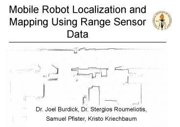
Mobile Robot Localization and Mapping Using Range
Sensor Data
Dr. Joel Burdick, Dr. Stergios Roumeliotis,
Samuel Pfister, Kristo Kriechbaum
2
Motivation
- Goal Improved Localization
- The absolute position error of a robot
accumulates due to - - Wheel slippage
- - Sensor drift
- - Sensor error
- Without correction the error growth is unbounded
- Accurate knowledge of absolute position is
necessary for effective navigation and accurate
mapping
- Goal Efficient Map Representation
- By abstracting raw sensor data into
representative features we - - require less storage space
- - reduce the computation complexity for many
mapping and localization algorithms - The data representation must not filter out
excessive useful data
3
Testbed Equipment
Mobile Robot - On board Pentium III PC
SICK Laser Range Scanner - 8 meter range / 1 mm
resolution - 180 degree field-of-view
Laser Scanner
Robot
Range Measurements
4
Goal Improved Localization
Scan Matching Align two range scans taken at
different poses to calculate an improved
displacement estimate.
Method - Discard outliers - Correspond closest
points across scans - Use iterative Maximum
Likelihood algorithm to calculate an optimal
displacement estimate
5
Weighted Approach
Explicit models of uncertainty noise sources
are developed for each scan point taking into
account - Sensor noise errors - Point
correspondence uncertainty
Improvements vs. Unweighted Method
- More accurate displacement estimate - More
realistic covariance estimate - Increased
robustness to initial conditions - Improved
convergence properties
6
Weighted Formulation
Goal Estimate displacement (pij ,?ij )
7
Maximum Likelihood Estimation
- Position displacement estimate obtained in
closed form
- Orientation estimate found using 1-D numerical
optimization, - or series expansion approximation methods
8
Localization Results
Weighted vs. Unweighted matching of two poses
512 trials with different initial displacements
within /- 15 degrees of actual angular
displacement /- 150 mm of actual spatial
displacement
- Increased robustness to inaccurate initial
displacement guesses - Fewer iterations for
convergence
9
Localization Results
- Displacement estimate errors at end of path
- Odometry 950mm
- Unweighted 490mm
- Weighted 120mm
- More accurate covariance estimate - Improved
knowledge of measurement uncertainty - Better
fusion with other sensors
10
Goal Efficient Mapping
Line Fitting - Given a group of range
measurements, each with a unique uncertainty,
determine the set of optimally fit lines as well
as the uncertainty of those lines.
Method - Group roughly collinear points using
Hough Transform - Calculate optimal line fit
using Maximum Likelihood framework with each
point weighted according to its individual
uncertainty - Calculate uncertainty of line fit -
Merge similar lines across data scans for further
map simplification
11
Line Fitting Results
Fig. A Fig. B Fig. C
Map built from laser range scans taken from 10
poses in a hallway
Fig. A Raw Points with associated
uncertainties - 7200 raw range points Fig. B
Fit lines with associated uncertainties - 114
fit lines Fig. C Final line map after line
merging - 46 fit lines
Final data compression 98.7
12
Line Fitting Results
Raw Range Data Points Taken in Lab (10 Poses,
7200 Points)
13
Line Fitting Results
141 Lines Fit
14
Line Fitting Results
74 Lines After Merging (97.9 Compression)
15
Future Work
- Transition to CCD camera as primary sensor -
Extend theory to include non-planar features -
Extract features invariant to small changes in
robot displacement - Identify a metric to
measure which features maximally distinguish
between locations - Establish a general
framework for automatic feature selection -
Merge multiple sensors for optimal localization
and mapping
Recommended
