UD WATER RESOURCE AGENCY: MAPS OF THE CHRISTINA BASIN - PowerPoint PPT Presentation
UD WATER RESOURCE AGENCY: MAPS OF THE CHRISTINA BASIN
UD WATER RESOURCE AGENCY: MAPS OF THE CHRISTINA BASIN ... These four major streams drain a 565 square mile area and provide more than 100 million gallons ... – PowerPoint PPT presentation
Title: UD WATER RESOURCE AGENCY: MAPS OF THE CHRISTINA BASIN
1
UD WATER RESOURCE AGENCY MAPS OF THE CHRISTINA
BASIN ELEMENTS OF A WATER QUALITY MANAGEMENT
STRATEGY BASE MAPS The Water Resource Agency
of the Institute for Public Administration hosts
the Christina River Basin Web Site which serves
as an excellent companion source for data and
information concerning the Christina Basin and
its subwatersheds. Watershed education and
public outreach components include an overview of
the Christina Watershed, over 400 categorized
environmental links, tips for watershed
preservation and restoration, GIS mapping,
geographic techniques, pictures, text, and video.
Surf the Web to http//www.wr.udel.edu/cb/ind
ex.html
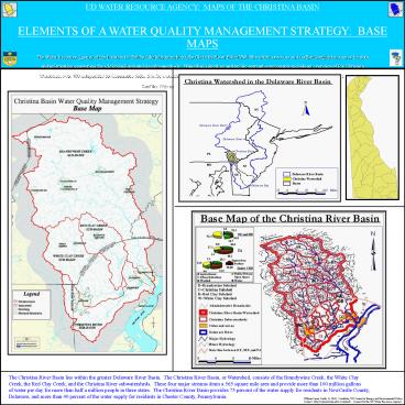
The Christina River Basin lies within the greater
Delaware River Basin. The Christina River Basin,
or Watershed, consists of the Brandywine Creek,
the White Clay Creek, the Red Clay Creek, and
the Christina River subwatersheds. These four
major streams drain a 565 square mile area and
provide more than 100 million gallons of water
per day for more than half a million people in
three states. The Christina River Basin provides
75 percent of the water supply for residents in
NewCastle County, Delaware, and more than 40
percent of the water supply for residents in
Chester County, Pennsylvania.
PowerShow.com is a leading presentation sharing website. It has millions of presentations already uploaded and available with 1,000s more being uploaded by its users every day. Whatever your area of interest, here you’ll be able to find and view presentations you’ll love and possibly download. And, best of all, it is completely free and easy to use.
You might even have a presentation you’d like to share with others. If so, just upload it to PowerShow.com. We’ll convert it to an HTML5 slideshow that includes all the media types you’ve already added: audio, video, music, pictures, animations and transition effects. Then you can share it with your target audience as well as PowerShow.com’s millions of monthly visitors. And, again, it’s all free.
About the Developers
PowerShow.com is brought to you by CrystalGraphics, the award-winning developer and market-leading publisher of rich-media enhancement products for presentations. Our product offerings include millions of PowerPoint templates, diagrams, animated 3D characters and more.


