Land Use and Land Cover - PowerPoint PPT Presentation
1 / 1
Title:
Land Use and Land Cover
Description:
Land use/Land cover change refers to shifts in the way people use the land (e.g. ... Katie Holmes, Watershed Program Director April Haight ... – PowerPoint PPT presentation
Number of Views:250
Avg rating:3.0/5.0
Title: Land Use and Land Cover
1
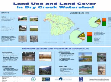
Land Use and Land Cover in Dry Creek Watershed
DEFINITIONS Land use
refers to the ways in which people use
the land (e.g., timbering, farming,
urbanization) Land cover
refers to the actual type of
feature on the land surface (e.g., forest,
pasture, buildings) Land use/Land cover change
refers to shifts in the way people use the land
(e.g., agriculture ? development) and/or
alterations in surface features (e.g., crops ?
buildings)
LAND USE AND LAND COVER
Development
Farming
Pasture
Building
1959
2004
HOW DOES LAND USE AND LAND COVER AFFECT
STREAMFLOW AND WATER QUALITY?
AGRICULTURAL LAND
DEVELOPED LAND
- INCREASED WATER POLLUTION
nutrients, pesticides and animal waste may wash
directly into streams and down into groundwater - INCREASED EROSION poor
management practices can lead to increased soil
loss
1) INCREASED FLOODING paved surfaces
and rooftops prevent water from entering the
soil 2) INCREASED WATER POLLUTION a) water
runoff picks up pollutants and washes them into
streams b) waste water may be released directly
into streams
BARREN LAND
FORESTED LAND
- INCREASED FLOODING lack of
vegetation may cause more water runoff - INCREASED EROSION soil and
hillsides are less stable and may be more prone
to erosion
- REDUCED FLOODING trees and leaf
litter absorb rainfall and water is released
slowly into streams - REDUCED EROSION trees help
stabilize hillsides and minimize soil lost by
erosion
Contacts Katie Holmes, Watershed Program
Director April Haight Kentucky Waterways
Alliance MSUs Center for Environmental
Education 222 Bakery Square LC 101A,
IRAPP Louisville, KY 40206 Morehead, KY
40351 (502) 589-8008 (606) 783-2455
This project is funded in part by a grant from
the U.S. EnvironmentalProtection Agency under
319(h) of the Clean Water Act through the
KentuckyDivision of Water to the Kentucky
Waterways Alliance (Grant C9994861-04).


