
Airborne suborbital science: Platforms and sensors PowerPoint PPT Presentation
Title: Airborne suborbital science: Platforms and sensors
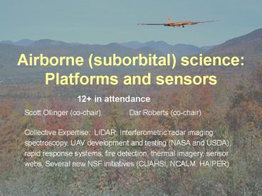
1
Airborne (suborbital) science Platforms and
sensors
12 in attendance Scott Ollinger (co-chair)
Dar Roberts (co-chair) Collective Expertise
LIDAR, Interferometric radar imaging
spectroscopy, UAV development and testing (NASA
and USDA), rapid response systems, fire
detection, thermal imagery, sensor webs, Several
new NSF initiatives (CUAHSI, NCALM, HAIPER)
2
- 1. What are the Terrestrial Ecology,
Biodiversity, and Applied Sciences Communitys
current and future needs for suborbital
observations? - Important contributions of aircraft remote
sensing - Sensor test bed (Provides a platform for sensor
testing and algorithm development - Unique sensors (HF imaging spectrometers, small
foot print LIDAR, LVIS, FLIR, FLEX, P-band SAR,
ATLAS) - Control over timing of data acquisition
(critical) - Improved cloud avoidance (data acquisition under
or around clouds) - Multiple times of day (e.g. target specific tidal
stage, sun angle or plant stress level) - Rapid deployment following disturbance (fires,
floods, insect outbreaks) - Extended periods of data collection
- Multiple sensor altitude - Variable (Scalable)
spatial resolution (lt1m to 20 m) - High Informational Resolution (Spectral,
polarimetric and vertical) - Fine spectral resolution (Imaging Spectrometers)
- Discrimination of species, chemistry and
physiological function. - Multi-frequency, fully polarimetric radar
(Penetration depth, soil moisture flood status,
vegetation structure). Frequency allocation and
band width issues limit capacity in space. - Control over Sun-Earth-Sensor geometry (timing,
flight trajectory, BDRF) - Multisensor integration Many sensor combinations
possible at multiple scales - Data quality/Sensor evolution - Opportunities for
repeat calibration, repair and upgrade. - Cost/Development cycle Aircraft missions can
be quick and cost effective as compared to
satellite missions.
3
- 1b. Limitations/Challenges with Aircraft Data
- Limited spatial temporal coverage
- Difficult Georectification
- Intractability to many users
- Perception (sometimes real unavoidable) of data
being difficult to access and work with. - Perception (sometimes real, but avoidable) of
aircraft remote sensing being a hard community to
break into. - No (or limited) distribution of standard data
products, restricts use by those lacking specific
skills.
4
- 2. Recognizing that the NASA Suborbital Science
program is evolving and that repeated attempts to
secure new funds for new airborne sensors have
failed, how should our community respond, adjust
and adapt? - What should we do???
- We should know how many non-NASA sensors (i.e.
University, private etc.) exist along with
availability/quality? - Education Airborne program can be taken for
granted. Need to inform/remind scientists,
management, congress, etc. of the value of the
airborne program. - Need for a review article on the contributions of
aircraft remote sensing to ecological research.
POSSIBLE JOURNALS BIOSCIENCES, FRONTIERS in
ECOLOGY, ECOLOGICAL APPLICATIONS - Improve dissemination and use of aircraft data
- Should NASA encourage development of data
products from airborne sensors? - Should there be an aircraft data DAAC or
equivalent? - Should NASA have specific calls for suborbital
science product development? - Interest in aircraft RS is growing in other
agencies while resources at NASA remain flat.
Provide feedback to program managers (at NASA and
other agencies) where synergy exists with
initiatives by other agencies
5
- 3. What are the Terrestrial Ecology,
Biodiversity, and Applied Sciences needs for
unpiloted aerial vehicles (UAVs)? - UAVs are appropriate for tasks that are Dull,
Dirty or Dangerous - Long duration, high altitude, plume dispersal
fires, very low altitude - Long duration eddy flux
- Fire dynamics
- Phytoplankton blooms
- Natural hazards requiring long duration, repeat
passes - UAV Attributes
- Cost
- Small UAVs can be cost effective and many are
available - Large UAVs are generally very expensive
(cost/flight hour/pound payload UAVs 10x more
than existing piloted aircraft. - Medium-sized UAVs are presently lacking, but may
be forthcoming - Higher risk of crash
- Cannot fly over commercial airspace
- What UAVs are available? See
- http//uav.wff.nasa.gov/
- http//suborbital.nasa.gov/
- http//nirops.fs.fed.us/UASdemo/
- Payloads from 20 - 3000 kg
6
Tentative Paper Outline
- Title The unique role of aircraft remote
sensing in ecological research - Ecological Needs for Remote Sensing (broadly)
- Specific contributions of airborne sensors
- Types of ecological measurements
- Niche of Airborne Sensors relative to Spaceborne
sensors - Historical Role of Airborne Sensors
- Case studies
- Future Directions
Recommended
