
Using Drifting Icebergs to Study Climate Change: The IceTrek Project PowerPoint PPT Presentation
1 / 36
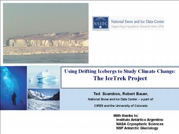
Title: Using Drifting Icebergs to Study Climate Change: The IceTrek Project
1
Using Drifting Icebergs to Study Climate Change
The IceTrek Project
Ted Scambos, Robert Bauer, National Snow and Ice
Data Center -- a part of CIRES and the
University of Colorado
With thanks to Instituto Antártico Argentino
NASA Cryospheric Sciences NSF Antarctic
Glaciology
2
Ice Shelves the gatekeepers of ice sheet mass
balance
Ice Shelves and (tabular) Icebergs -- kindred
spirits in their reaction to climate change
Icebergs -- What can we do from
satellites? What can we do from the
surface? What can an AMIGOS do for us?
3
The Larsen B Breakup, 2002
melt ponds draining
4
Water-driven ice shelf fracturing (e.g.
Weertman, 1973)
The key pre-requisites are pre-existing
crevassses, e.g. from glacier stresses or
grounding line flexure these may be partially
healed low intra-shelf compressive
stresses a surface reservoir of water to
maintain brim-full condition as fracture
extends downward
To have ponds, firn must be impermeable
5
North-drifting icebergs are natural experiments
of shelf evolution under conditions of climate
change MacAyeal, 2003
Icebergs near S. Georgia Island
A43B
Images from Space Station hand-held
camera (article appeared in Earth Observer,
April 2004)
--note moat.
A43B
melt pond
22 Jan 2004
looking nadir
looking southwest
6
A43B ponding and breakup
7
(No Transcript)
8
MODIS image evidence of calving styles
melt ponds on surface, rapid, numerous
calvings, km to sub-resolution, occurs in mid-
to late- summer analogous to Larsen A, Larsen B
disintegration
Three styles of iceberg calving - first
Iceberg Disintegration
MODIS images A43B
MODIS images A38A
9
MODIS image evidence of calving styles
fractures into two or few large pieces,
often along pre-existing rifts major change
in berg shape in several caseswhen thickness
reaches 125 meters
Three styles of iceberg calving - second
Berg rift calving
10
MODIS image evidence of calving styles
slow decrease in area, edge-parallel
calvings, little change in berg shape pace
increases north of sea ice edge
Three styles of iceberg calving - third
Berg Edge-wasting
11
Floating ice plates bend at their margins
Reeh (1968)
--Sergienko used a similar model to
calculate the effect for icebergs
but we were in for a bit of a surprise
12
Modeling of ICESat iceberg profiles
They bend differently in warmer
(non-ice-covered) water
Berm
Rampart
13
ICESat the vertical dimension
Two ways of bending berm, and rampart
why? think cork and bench
14
Enough remote sensing -- We needed to go there
full frontal sensing
15
AMIGOSberg calving, 2003
Field visit opportunity A22A iceberg Planned for
Feb-March 2006 (AMIGOSberg an extra site)
A22A calving, 1986
16
SLIDE SHOW!
17
Tempanito
AMIGOSberg
A22A Iceberg
18
ICEBERGS 101 Surface Fractures and Benches
19
A52 iceberg, near Elephant Island (RV L M Gould
photos)
Cavernous erosion Waterline melting
North of the sea ice edge (warmer water)
Waterfalls
Thanks to Kenneth Smith, Bruce Robison for these
pictures
20
Automated Met-Ice-Geo Observing Station (AMIGOS)
Field team Ted Scambos Pedro Skvarca Jonathan
Thom Ronald Ross Robert Bauer Juan Carlos
Objectives of the study Rate of surface
densification? Rate of basal melting?
Weather/tidal/wind events assoc. with
calvings? Melt ponds? Drainage? Rapid
fine-scale calvings?
November 10, 2005
A22A iceberg
Thick (350 meters)
Former Flow Direction
site
Measurements Automated Weather Station
w/ ARGOS trans. Firn Temperature String to
16m Digital Camera _at_ 6m w/ Iridium
trans. Ping radio-echo-sounder
(Humphrey) Flag line for topographic profile
GPS and GPR survey of berg
Thin (80m)
Thick (330 meters)
site
60 by 40 km
21
Caletamiento Global in the ice face
(push mound)
Berm pattern
Flat waterline
AMIGOSberg Iceberg
Sea ice present, no bench observed.
At the berg edge, AMIGOSberg
22
AMIGOS Automated Met-Ice-Geophys. Observing
Stations GPS Camera flag lines
accum/ablate surface events Weather
data Ice melt and thickness
23
Flag Line from tower camera A topographic
snapshot of the berg edge AMIGOSberg 2.2 km, 2
lines A22A 1.2 km, 1 line
Observing edge-wasting rates berm to
rampart transitions
24
August 10 2006
25
September 19 2006
26
October 10 2006
27
November 02, 2006
28
November 19, 2006
29
November 21 2006
30
December 17, 2006
31
GPS first 76 hours after installation
GPS, March 5 - May 6
A22A
Ant. Peninsula
GPS from AMIGOSberg unit cycloidal motion
1 cycle/day total 5km/day Tidally-dominated
but, with a net drift.
AMIGOSberg
32
Iceberg Motion dominated by tides then drift
first 50 days
phasing and direction of motion in synch with
tides offset from zero represents drift
rate/direction differences between GPS/model
rotation, model apparently A22A was never
stuck during this period Iceberg base is
washed at lower rate than ice shelves?
GPS on iceberg Tide Model Padman
East-West motion A22A
North-South motion A22A
33
Radio-Echo Depth Sounder
A22A Tower
Trying to resolve the compaction/ basal melt
issue Compare ICESat freeboard
to radar-derived thickness
34
A22A firn temperature profile
A22A pit density profile
autumn cooling
drained snow?
Summer warm wave
Summer, coarse, corn snow and melt layers
Preserved cold from Ronne area
35
The road ahead AMIGOS data to be reduced this
spring pictures, flag changes, satellite
images, melt ponds, fractures Radar data
processing to extract signal, A22A Further
investigation of backscatter evolution Develop
next generation of AMIGOS for Larsen B
36
The End
Marambio Station, looking southeast - Iceberg
Alley
Thanks to - NASA (remote sensing grants) NSF
(SGER grant for iceberg visit) IAA
(Getting there was half the fun)
Recommended
