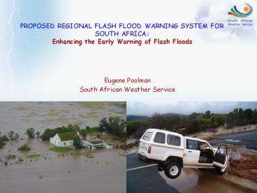
PROPOSED REGIONAL FLASH FLOOD WARNING SYSTEM FOR SOUTH AFRICA: - PowerPoint PPT Presentation
1 / 36
Title: PROPOSED REGIONAL FLASH FLOOD WARNING SYSTEM FOR SOUTH AFRICA:
1
PROPOSED REGIONAL FLASH FLOOD WARNING SYSTEM FOR
SOUTH AFRICA Enhancing the Early Warning of
Flash Floods
Eugene Poolman South African Weather Service
2
OUTLINE OF PRESENTATION
- Southern Africa region of extremes
- Flash flood early warning system in South Africa
- Way forward
3
SOUTHERN AFRICA REGION OF EXTREMES
- Most important natural disasters in Southern
Africa - Droughts,
- Floods,
- Windstorms,
- Epidemics
4
Source Global Archive Map of Extreme Flood
Events since 1985 to 2002 (Dartmouth Flood
Observatory)
Flood fatalities Southern Africa in the Global
context
5
Flooding events between 1985 and 2002
6
(No Transcript)
7
Impact Of Disaster Risk In Southern Africa
- Disaster risk
- hazard x vulnerability
- coping capacity
- Of the 14 SADC countries, 9 are Least Developing
Countries (of 49 globally) - - Increased vulnerability
- - Reduced coping capacity Increased Disaster Risk
- Weather Services aim to reduce the RISK through
early warning of flooding
8
(No Transcript)
9
(No Transcript)
10
(No Transcript)
11
(No Transcript)
12
(No Transcript)
13
FLASH FLOOD EWS IN SOUTH AFRICA
14
Early Warning through increased lead-time
Tools
Observations
NWP
GCM
GCM
- -Satellite
- Radar
- Synops
- Raob
- Regional
- Local
- Mesoscale
- Ensembles MOS
- Medium range models
- Ensembles
- MOS
-Ensembles -MOS
-Ensembles -MOS
-GCM Ensembles -MOS
Forecast Uncertainty
3-Month Season
Month
14 Days
7 Days
Outlook -Rainfall temperature anomalies
- Guidance
- -Potential hazardous weather events
- Rain and temperature tendencies
2 Days
Advisories -Severe weather events -Daily Weather
elements
0 2 Hours
Warnings -Severe weather -Daily weather elements
Products
Detail Warnings -Severe weather
15
Meteosat 8 (MSG)
- 12 Channels
- 15 minutes
- Specialized products
16
Radar Network
17
Tropical Cyclone Eline January 2000
Numerical Weather Prediction
- Now upgrading to
- 12km regional model
- 5 km mesoscale in selected areas
5 km
15 km
18
Ensemble Prediction
19
(No Transcript)
20
SA Weather Early Warning System
21
Warning and Advisory Coordination and
Dissemination
- Current warning for flash floods
- Areas of expected heavy rain with potential
of flash flooding
NDMC, Media, DWAF
NFC
MDMC
RFO
PDMC
RFO
PDMC
MDMC
PDMC
RFO
RFO
PDMC
MDMC
MDMC
22
Disaster Management lessons from the
Montagu-floods of March 2003
- The need for EWS integrated into DRM, improve
warning dissemination prior and during weather
event - Poor communication of warnings to communities at
risk - Use rainfall hydro data at time of flood to
determine areas affected
23
Case study April 2005 Bredasdorp Floods
- In April 2005 a severe weather system caused
widespread flash flood damage on the Cape South
Coast
24
According to News24.com
- Torrential rain lashed the region on Sunday
night, causing millions of Rands damage. - In Bredasdorp between 600 to 800 houses were
damaged, and 3 000 people affected. - In Mitchells Plain, Bellville, Durbanville and
Khayelitsha heavy rains, a strong wind and
hailstorms created havoc - In the Joe Slovo informal settlement, hundreds of
people were also affected by the downpour. - ..
25
Radar Imagery
26
Forecasting Ensemble and NWP Guidance
Eta model 24 hour forecast
27
- Forecasting Advisories and Warnings to
Disaster Management (SMS and direct
communications) - 8/4 (Friday) Advisory Widespread showers
expected Sunday along south coast and adjacent
interior with possible heavy falls in places E of
Still Bay - 10/4 (Sunday) Warning Heavy falls likely today
(Sunday), Overberg, Breede River valley, Ruens,
Little Karoo, South Coast persisting in east
tomorrow morning Monday - Update1 Warnings as issued earlier, heavy fall
will last longer along the south coast areas and
improve during tomorrow from the west. - Update 2 Please keep communication channels
constantly open as in past. - Update 3 Warnings as issued earlier, heavy falls
will last longer and improve during tomorrow
(Mon) from the west - Gale force south easterly winds (35knots/65km/h)
expected in places Between T/Bay and C/Agulhas
today and Mon Morning - There seems to be a well developed weather
systems to NW of CT. If this moves across (from
eve) we might have substantial falls in CT
28
(No Transcript)
29
Challenges to the Early Warning Systemfor Flash
Flood Warnings
- Lack of FF decision support system prior to event
- Need to use rainfall hydro data at time of
flood to determine areas affected - Communication of warnings to communities at risk
differs - Developed regions vs
- Developing regions
- Needed increased lead-time to overcome
communication problem to rural communities - Rather issue a warning and be wrong, but do not
miss the event!
30
WAY FORWARDAn Integrated Flash Flood
Forecasting System
- Discussions between meteorologists, hydrologists
(Prof Geoff Pegram) and disaster managers - It was clear that flash flood warnings had little
hydrological basis - Proposed solution similar to the CAFFG
- Development a mammoth task
- Discussions with NOAA very positive
31
Combine QPE, QPF with hydrological model to issue
FF guidance and warnings to Disaster Management
and communities
32
How might we get Soil Moisture?Mapping
Brightness Temperature(Prof Geoff Pegram)
Related Research Activities
33
Soil Moisture Liebenbergsvlei ground
temperatureat 15 minute intervals on May 30 2005
from MSG
34
Combining Gauge, radar and satellite
rainfall21-22 June 2005(SAWS UKZN)
Kriged Rain Gauge Field
Radar Rain Estimate
Meteosat 8 (MSG) Rain Estimate
35
Merged Sat/Radar/Gauge Rainfall Field
36
The envisaged development of the FFF system
- Team to include meteorologists, hydrologists and
disaster managers - Develop FFF system over quaternary basins
- Hydrological information available
- QPE from rain gauges, radar, MSG
- QPF from nowcasting techniques, NWP
- Integrate with Disaster Management Centers
- Dissemination of warnings and info to DM
structures - Inform communities at risk, awareness raising
- Involve other countries where possible to develop
a Southern African regional system


