
Interactive Mapping Web Sites at the Local and State Level PowerPoint PPT Presentation
1 / 26
Title: Interactive Mapping Web Sites at the Local and State Level
1
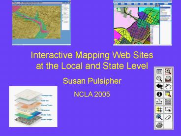
Interactive Mapping Web Sites at the Local and
State Level Susan Pulsipher NCLA 2005
2
Two interactive mapping web sites
3
Purpose of talk
- Explain what an interactive mapping web site is
(alternative phrase Internet mapping) - Explain what you can use these sites for.
- Answer questions
- Locate places
- Explain the tools used on these sites
- Explain what GIS is
4
- LAYERS
- North Carolina outline
- NC cities and towns
- NC counties outline
5
Layers on a map
- Signed bicycle route
- Greenway
- Road, street
- Limited access highway
- Parks
- Fire Stations
- Lakes
- Streams
- County boundaries
6
Kinds of questions
- Which school district is this house in?
- Is this house in a floodplain?
- What is the zoning in this part of town?
- What kinds of crime occur in this neighborhood?
- On a day trip to the beach what access do I have
to the beach? - What kinds of businesses are located in this part
of town?
7
(No Transcript)
8
(No Transcript)
9
(No Transcript)
10
(No Transcript)
11
(No Transcript)
12
(No Transcript)
13
(No Transcript)
14
(No Transcript)
15
Demonstrations
- NC FloodPlain Mapping
- Truck crashes from Highway Safety Research
Center - Charlotte-Mecklenburg Police Department
- Alexander County
16
Disclaimers
Johnston County
Charlotte- Mecklenburg Police Department
17
What is a Geographic Information System (GIS?)
- Hardware
- Software
- Data
- Trained personnel
- Used in many businesses
- Combine with GPS, handheld devices, remote
sensing imagery
Geo-referenced data Tabular data
18
Data layers
- Census records
- Property records
- Crime incident records
- Soil data
- Land use data
From What is ArcGIS 9.1 by ESRI Press, p.8
19
Vector data
Feature classes - point feature class for
schools - line feature class for roads -
polygon feature class for lakes
20
Spatial references
- Geo-referenced data
- X, Y coordinates
- Base layers
- Geocoded data
- on address or zipcode or census tract or county
- Tabular data
21
Johnston county zip codes voting districts
22
More city sites
23
What is NC OneMap?
- Collection of data on North Carolina
- Data provided by local governments
- Data can be manipulated
- Data can be downloaded
24
Summary
- What is an interactive mapping web site?
- How many out there?
- Read Disclaimers
- Read Help screens
- how to construct queries
- Remember information comes from databases
25
Handout
- Sites shown in talk
- Selected other NC sites
- Links to lists of NC sites
- Some federal sites
- Site handout
26
Contact Information
Susan Pulsipher Davis Memorial Library Methodist
College 5400 Ramsey Street Fayetteville, NC
28311 Phone (910) 630-7122 Email
sue_at_methodist.edu
Recommended
