Reading Maps PowerPoint PPT Presentation
Title: Reading Maps
1
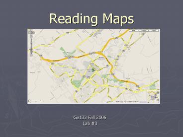
Reading Maps
- Ge133 Fall 2006
- Lab 3
2
Map Types
- Road Maps
- Topographic Maps
- Geologic Maps
- Political Maps
- Ski Slope Maps
- Relief Maps
- Hybrid
3
Road Maps
4
Topographic Maps
- Quadrangles Represents a section of the Earths
surface bounded by lines of latitude and by lines
of longitude - Compass Bearings Azimuth or Directional
- Scales Graphic, Representative Fraction , and
Verbal Scale - Contour Lines Map elevation changes
- Index Contour Starting point for interpretation
- Contour Interval Elevation difference between
lines
5
(No Transcript)
6
Fundamental Definitions
- Topography The general configuration of the
land surface - Altitude The elevation of a point with respect
to an accepted datum (usually mean sea level).
Altitude numbers are always brown. - Relief The difference in elevation (altitude)
between two points. - Contour Lines Continuous lines drawn through a
series of points all of which have the same
elevation. - Bench Mark Generally abbreviated B.M., is a
single point of known elevation from which any
future surveys may begin.
7
Interpreting Contours
- All points on one contour line are of the same
elevation. - Contour lines never intersect.
- A vertical cliff is represented by coincident
contours. - Contour lines point upstream.
- Uniformly space contours represent uniform slope
- Contours spaced far apart indicate a gentle slope
- Contours spaced closely indicate a steep slope
8
Coordinate Systems
- Latitude and Longitude
- Latitude Angular distance of a point on the
Earths surface north or south of the equator,
the equator being 0 and the north and south
poles at 90 - Longitude Angular distance of a meridian of a
given place and the prime meridian, has a max of
180 from the prime meridian. - UTM (Universal Transverse Mercator)
- The projection used on so many world maps is a
cylindrical projection, meaning the globe is
encircled by an imaginary cylinder touching at
the equator, and the earth is projected onto the
cylinder
PowerShow.com is a leading presentation sharing website. It has millions of presentations already uploaded and available with 1,000s more being uploaded by its users every day. Whatever your area of interest, here you’ll be able to find and view presentations you’ll love and possibly download. And, best of all, it is completely free and easy to use.
You might even have a presentation you’d like to share with others. If so, just upload it to PowerShow.com. We’ll convert it to an HTML5 slideshow that includes all the media types you’ve already added: audio, video, music, pictures, animations and transition effects. Then you can share it with your target audience as well as PowerShow.com’s millions of monthly visitors. And, again, it’s all free.
About the Developers
PowerShow.com is brought to you by CrystalGraphics, the award-winning developer and market-leading publisher of rich-media enhancement products for presentations. Our product offerings include millions of PowerPoint templates, diagrams, animated 3D characters and more.

