Educational Module PowerPoint PPT Presentation
Title: Educational Module
1
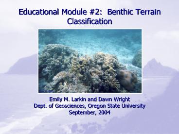
Educational Module 2 Benthic Terrain
Classification
- Emily M. Larkin and Dawn Wright
- Dept. of Geosciences, Oregon State University
- September, 2004
2
Objectives
- On completion of the project, you should be able
to - Do a slope analysis.
- Use Raster Calculator to do simple analyses.
- Use Grid to process a short command sequence that
is given to you. - Define Slope, Bathymetric Position Index,
benthic, standard deviation and benthic zones.
3
Benthic Terrain Classification
- Benthic of or pertaining to the seafloor.
(e.g. A benthic animal lives on the seafloor.) - Bathymetry can be classified into different zones
based on what type of terrain it is.
4
Slope
- Slope is steepness of the landscape
- Percent Slope Rise / Run 100
- Degree Slope the measure of the slope angle
5
Bathymetric Position Index (BPI)
- BPI finds out where a pixel is in relationship to
its neighbors. - Raster calculator compares the position of a
pixel to those around it.
6
Bathymetric Position Index
- BPI is calculated at a user-defined scale.
- The resolution of the grid the outer radius in
the BPI equation - Fine-scale BPIlooks at small features (e.g small
crests on a large slope) - Broad-scale BPIlooks at large features (e.g. the
large slope)
7
Benthic Zones
- Divide bathymetry into 4 zones flats, slopes,
crests and depressions - Benthic zones have been linked to biodiversity
(Karlson et al. 2004) - Based on
- Slopegreater or less than 5
- Broad-scale BPIless than or greater than 1
standard deviation from the mean - WARNINGWhen you get to this part of the lesson,
you must type everything correctly! Go slow and
double-check.
8
Module 2
- Bathymetry from Pago Pago Harbor
- Slope Analysis
- BPI
- Benthic Zone Classification
9
Error Correction--
- Note On Page 12, Step 1 should read
- Add ppg5m84_neg. In the Spatial Analyst
- Step 1aMake sure the ppg5m84_neg grid is showing
PowerShow.com is a leading presentation sharing website. It has millions of presentations already uploaded and available with 1,000s more being uploaded by its users every day. Whatever your area of interest, here you’ll be able to find and view presentations you’ll love and possibly download. And, best of all, it is completely free and easy to use.
You might even have a presentation you’d like to share with others. If so, just upload it to PowerShow.com. We’ll convert it to an HTML5 slideshow that includes all the media types you’ve already added: audio, video, music, pictures, animations and transition effects. Then you can share it with your target audience as well as PowerShow.com’s millions of monthly visitors. And, again, it’s all free.
About the Developers
PowerShow.com is brought to you by CrystalGraphics, the award-winning developer and market-leading publisher of rich-media enhancement products for presentations. Our product offerings include millions of PowerPoint templates, diagrams, animated 3D characters and more.

