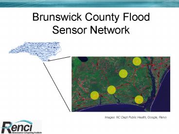
Brunswick County Flood Sensor Network PowerPoint PPT Presentation
Title: Brunswick County Flood Sensor Network
1
Brunswick County Flood Sensor Network
Images NC Dept Public Health, Google, Renci
2
Flood Sensor Data Flow
- Measurements acquired by SunSPOTS from Aquarod,
HOBO, sonar, radar - Measurements transmitted by Spots to Spot gateway
(Zigbee) - Spot gateway to base station (USB)
- Base station to cellular gateway (802.11, 900Mhz)
- Cellular and Trunked UHF to RENCI SensorBus.
3
NC EONS
Environmental ObservationNetwork System for
North Carolina
- 14 Institutions in North Carolina
- 18 x 18 feet (5.5M x 5.5M) platform
- 15 feet (4.5M) above Mean Sea Level
- 4 Kilowatt hours total power per day
Image Don Stanfield, NCSU
4
NC EONS Instruments
- Meteorological Station
- Sonic Wind Profiler
- Pair of bottom-mounted ADCPs
- CTD
- Bottom Boundary Layer tripod
- Dissolved gasses, chlorophyll, salinity, pH
- Automated refrigerated sampler
- Florescence probe
- Gas Chromatograph
- Turbidity
- Fish Acoustic Measurement
Image Rick Luettich, UNC-IMS
PowerShow.com is a leading presentation sharing website. It has millions of presentations already uploaded and available with 1,000s more being uploaded by its users every day. Whatever your area of interest, here you’ll be able to find and view presentations you’ll love and possibly download. And, best of all, it is completely free and easy to use.
You might even have a presentation you’d like to share with others. If so, just upload it to PowerShow.com. We’ll convert it to an HTML5 slideshow that includes all the media types you’ve already added: audio, video, music, pictures, animations and transition effects. Then you can share it with your target audience as well as PowerShow.com’s millions of monthly visitors. And, again, it’s all free.
About the Developers
PowerShow.com is brought to you by CrystalGraphics, the award-winning developer and market-leading publisher of rich-media enhancement products for presentations. Our product offerings include millions of PowerPoint templates, diagrams, animated 3D characters and more.

