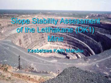
Slope Stability Assessment of the Letlhakane DK1 Mine - PowerPoint PPT Presentation
1 / 10
Title:
Slope Stability Assessment of the Letlhakane DK1 Mine
Description:
Current Life of Mine 12 years as an open pit at current production levels ... during the Cretaceous period (90 million years ago) ... – PowerPoint PPT presentation
Number of Views:1059
Avg rating:3.0/5.0
Title: Slope Stability Assessment of the Letlhakane DK1 Mine
1
Slope Stability Assessment of the Letlhakane
(DK1) Mine
- Keabetswe Keith Makuku
2
Project AIMS
- Assess and Evaluate the Stability of the Ultimate
slopes - Propose Remediation measures where applicable
3
Letlhakane Mine Information
- Location Southern Africa, Central Botswana, 200
km west of Francistown and 50 km east of Orapa - Establishment - 1977
- Current Life of Mine 12 years as an open pit at
current production levels - Ownership - Debswana
- Mining Method Open Pit
- Employees Orapa and Letlhakane 3200
- Production during 2002 Ore treated 3.6 million
tons
Diamonds recovered 1.03 million
carats Recovered Grade
25.7 carats per 100 tons Total
Waste stripped 15.25 million tons
www.debswana.bw
4
Geology and Topography
- Kalahari Sands and Calcrete - 10 meters
- Stomberg Basalts (135 meters massive 10-15 m
thick flows with - near horizontal top and base. Localised worm
like calcite amygdales) - Ntane Sandstones - 120 meters thick, hard-medium
grained, crossbedded - and Interbedded by fine, weak red mudstone
lenses) - Kimberlite (Diamond Ore body) - Intruded into
the Karoo sequence - during the Cretaceous period (90 million years
ago) - Flat topography- area lies at an altitude of
1000 m.a.m.s.l and - undulates gently with no significant
physiographic features
5
LETLHAKANE MINE GEOLOGY SECTION THROUGH D/K1
6
Work Done
- Geological Mapping
- Point Loads
- Scan-line survey
- Geotechnical Core logging
- Weathering Exercise
- Groundwater seepage Mapping
- Density Measurements
- Triaxial Test
7
Data Analysis
- MRMR, RMR,Q-system
- Rock DATA (rock strength parameters)
- DIPS (preliminary assessment-stereonet)
- Swedge (deterministic and probabilistic)
WEDGE POTENTIAL
TOPPLING POTENTIAL
8
Remediation
- Dentition
Sub-horizontal Drainage
(Concrete of higher strength parameters)
9
- Dewatering Boreholes
- Sub-horizontal dewatering holes
(Weathering effect only effective towards the
day-lighting zone of the rock unit)
10
References
- www.debswana.bw
- Rock Slope Engineering E Hoek J Bray
- Detecting Problems with Mine Slope Stability.
- Jami M Girad and Ed Mo turgh
- An Investigation of the Main Failure Planes at
Letlhakane mine (2001) - P.H.G.M. Dirks
- Engineering rock mass classifications,
- Wiley-Interscience, New York (1989) Z.T
Bieniawski


