Supercell storms - PowerPoint PPT Presentation
1 / 65
Title: Supercell storms
1
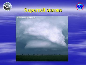
Supercell storms
2
Wind Speed Shearas wind speed shear
INCREASES,storm organization INCREASES
3
Updraft in weak wind SPEED shear
Courtesy David Floyd
4
Updraft in strong wind SPEED shear
Courtesy David Floyd
5
Wind Speed ShearWeak shear
Strong shear
6
Wind Speed ShearEffects on updrafts
Strong wind speed shear destroys weak updrafts.
Strong wind speed shear helps intense updrafts
last longer.
7
Helicity
40 knots
10 knots
8
The mesocyclone
Mesocyclone - A rotating thunderstorm updraft.
Called MESO for short.
9
Wind Directional Shearas wind directional shear
INCREASES,storm organization INCREASES
10
Supercells rotate
11
In Summarythe severity of thunderstorm machine
depends on
Intensitywhich is determined by buoyancy,
especially early on. Greater buoyancy
(instability) means stronger updrafts. Organizati
on and Duration which are determined by wind
speed and directional shear. Strong wind
speed shear causes updraft to tilt, allowing
the updraft to last longer, because rain and
hail, which cause the downdraft, fall away
from the updraft. Strong wind directional
shear causes the storm to rotate, which can
translate into tornado development.
12
Mesocyclone
A mesocyclone is a rotating updraft in a
thunderstorm. Thunderstorms with deep and
persistent mesocyclones are known as supercells.
8K ft AGL
Storm-Relative Velocity Data
13
TVS
TVS Tornado Vortex Signature A small but
strong rotation signature suggesting that a
tornado MAY be occurring.
2K ft AGL
Storm-Relative Velocity Data
14
Look for these features
Wall Cloud
Rear Flank Downdraft
15
Wall Clouds
A lowering of the rain-free base. Usually slope
toward the rain area. Look for PERSISTENT
rotation. A rotating wall cloud often precedes
tornado development !!!!
16
Wall cloud persistent, rapid rotation
17
Updrafts - Downdrafts
Ordinary tilted Cell
Supercell
18
Rear Flank Downdraft
19
Rear Flank Downdraft
20
Rear Flank Downdraft
Courtesy Jon Davies
21
Rear Flank Downdraft (RFD)
Inflow air could be recycled and becomes part of
the Rear Flank Downdraft.
22
Rear Flank Downdraft (RFD)
The amount of moisture in the inflow may be
linked to the air temperature in the RFD.
23
Rear Flank Downdraft (RFD)
When the difference between the Temperature and
Dew point of the low-level inflow air is less
than 20F the RFD will likely be warm.
24
Rear Flank Downdraft (RFD)
The warmer the air in the RFD, the more likely it
will be unstable (buoyant) and be able rise into
a developing tornado. Cold RFD air will flow out
near ground level and can kill tornado
development.
25
RFD radar view
RFD Flow
26
RFD radar view
Tornado Genesis Failure
RFD air is too cool and can not be lifted. RFD
air is too cool and it plows through the
circulation.
27
Warm RFD
Courtesy Steve Piltz
28
Warm RFD
Formation of the clear slot often precedes
tornadogenesis. Indicator of a Rear Flank
Downdraft. Updraft base may resemble a
horseshoe. Higher humidity RFDs favor tornado
formation.
29
Lamar 8/28/02
30
Lamar 8/28/02
31
Classic Supercell
32
HP supercell
33
Low Precipitation (LP)Supercell
Barebones look at updraft with few accessory
clouds. Storm prefers hail over rain
production. Caution! Downdraft may contain very
large hail which appears visually translucent.
34
Low Precipitation (LP)Supercell
35
Falcon LP supercell
Courtesy Greg Stumpf
36
Supercell in the SLV
37
Supercell in the SLV
38
Supercell in the SLV
39
Supercell in the San Juan Mountains
40
Supercell in the San Juan Mountains
41
Supercell in the San Juan Mountains
42
Non-mesocyclone tornadosform along wind shift
lines
43
4
1
2
5
3
44
(No Transcript)
45
Non-mesocyclone tornadosnorthern SLV
46
Microbursts
courtesy Roger Hill
Microbursts are a small area (less than 2 ½ miles
across) of rapidly descending, precipitation
cooled air under a shower or a thunderstorm The
leading edge of these winds usually can be seen
as a rain foot or dust foot
47
Microbursts
Courtesy Bill Bunting
48
Microbursts
Courtesy Bill Bunting
49
Microbursts
Courtesy Bill Bunting
Courtesy Bill Bunting
50
Microbursts
51
Microburst damage
52
Microburst (RFD)
53
MicroburstSouthern Costilla county - Summer 2002
Courtesy Phil Hysell
Courtesy Jan Gautreaux
54
Microburst damageCrowley county, June, 2001
55
Microburst damageCrowley county, June, 2001
56
Microburst damagesoutheast El Paso county,
August 18, 2002
57
Microburst damagesoutheast El Paso county,
August 18, 2002
58
Microburst damagesoutheast El Paso county,
August 18, 2002
59
Right moving storms
Average Winds Aloft
Strong Low-Level Winds
Strong inflow into a storm can affect both the
direction and speed of the storms track.
60
Dont be fooled !!!
- The thunderstorm base evolves rapidly and is
complex!! - Try not to make snap judgments ...
watch a specific area for a minute or two before
deciding. - Think - Does feature make sense?
What else could it be? Wall cloud vs scud
cloud. Rain shaft vs tornado. Smoke plume vs
tornado. Organized rotation vs transient cloud
swirls. - Take care when mobile. Dont get
stuck on gravel or dirt roads with no escape
route from the threatening weather.
61
Large, slow rotating F1
Courtesy Al Pietrycha
62
Lamar F3 tornado
Courtesy Jim Faull
63
Lamar 5/29/01
64
Lamar 5/29/01
65
Not The End
- Just the beginning
- Continue to review material that you didnt grasp
fully the first or second time through. If you
have questionsemail the WCM at Pueblo for
clarification. - pubnws_at_noaa.gov
- You may also take the spotter quiz by emailing
the Warning Coordination Meteorologist.


